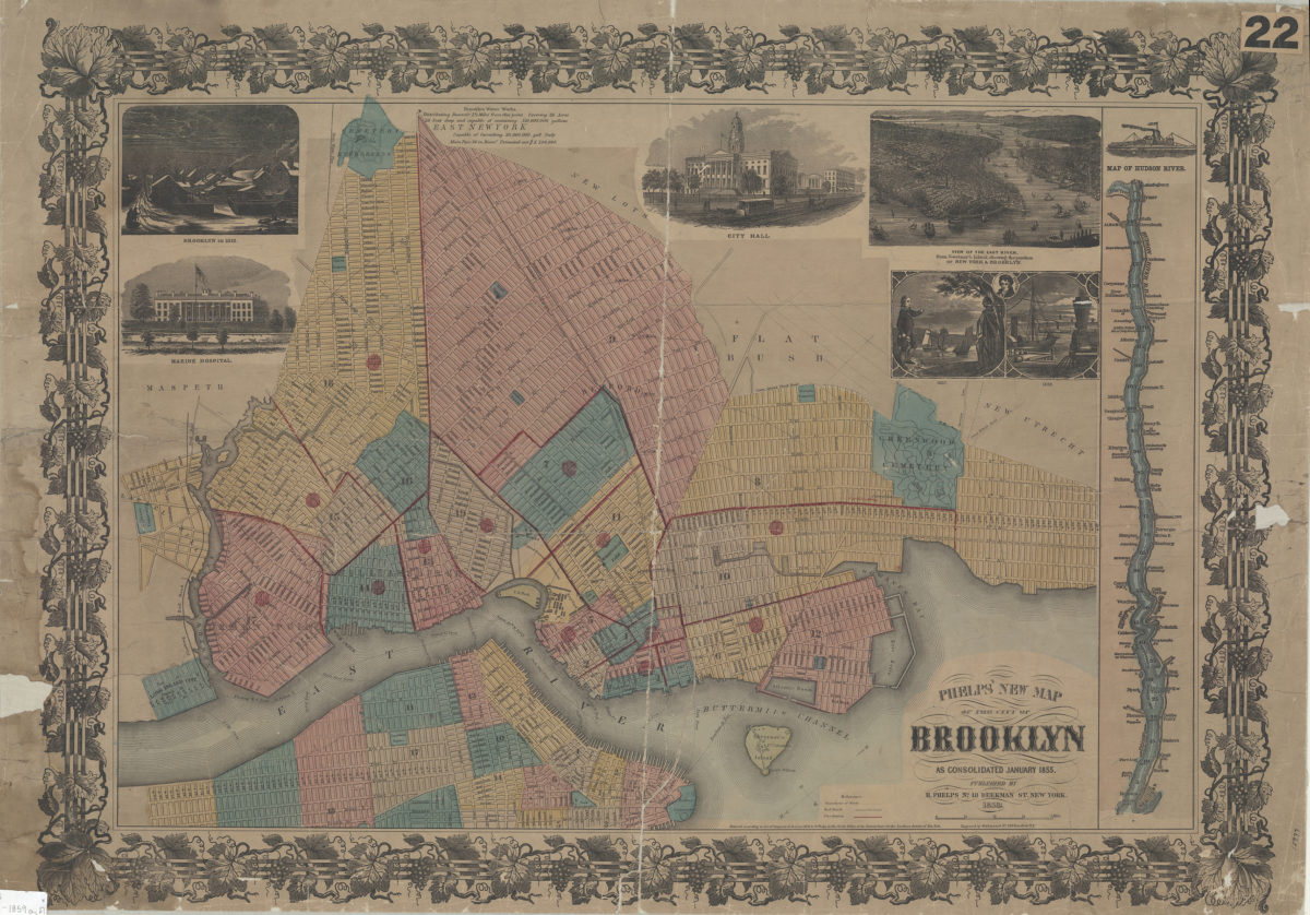
Phelps’ new map of the city of Brooklyn: as consolidated January 1855 1859; [ca. 1858]
Covers the city of Brooklyn north from 60th St. to Green Point and east to the Cemetery of the Evergreens. Minimally details portions of New Utrecht, Flatbush, and New Lots. Also covers Governor’s Island and portions of southern Queens and Lower Manhattan. Shows wards, ferry lines, railroads, fire districts, and distances from City Hall (modernly known as Borough Hall). Relief shown pictorially. Oriented with north to the lower left. “Entered according to Act of Congress in the year 1858, by H. Phelps in the Clerks Office of the District Court for the Southern district of New York.” Includes key, decorative border, inset map of the Hudson River, text, titled ill., and pictorial view of the East River from Governor’s Island, showing the position of New York and Brooklyn. Titled ill: Brooklyn in 1812 — Marine Hospital — City Hall — Fulton 1807, 1858.
Map area shown
Genre
MapRelation
Full catalog recordSize
58 × 82 cmDownload
Low Resolution Image
Creator
Phelps, Humphrey,Publisher
Brooklyn Historical SocietyCitation
Phelps’ new map of the city of Brooklyn: as consolidated January 1855; 1859; [ca. 1858], Map Collection, B A-1859a.Fl; Brooklyn Historical Society.Scale
Scale [ca. 1:22,380]