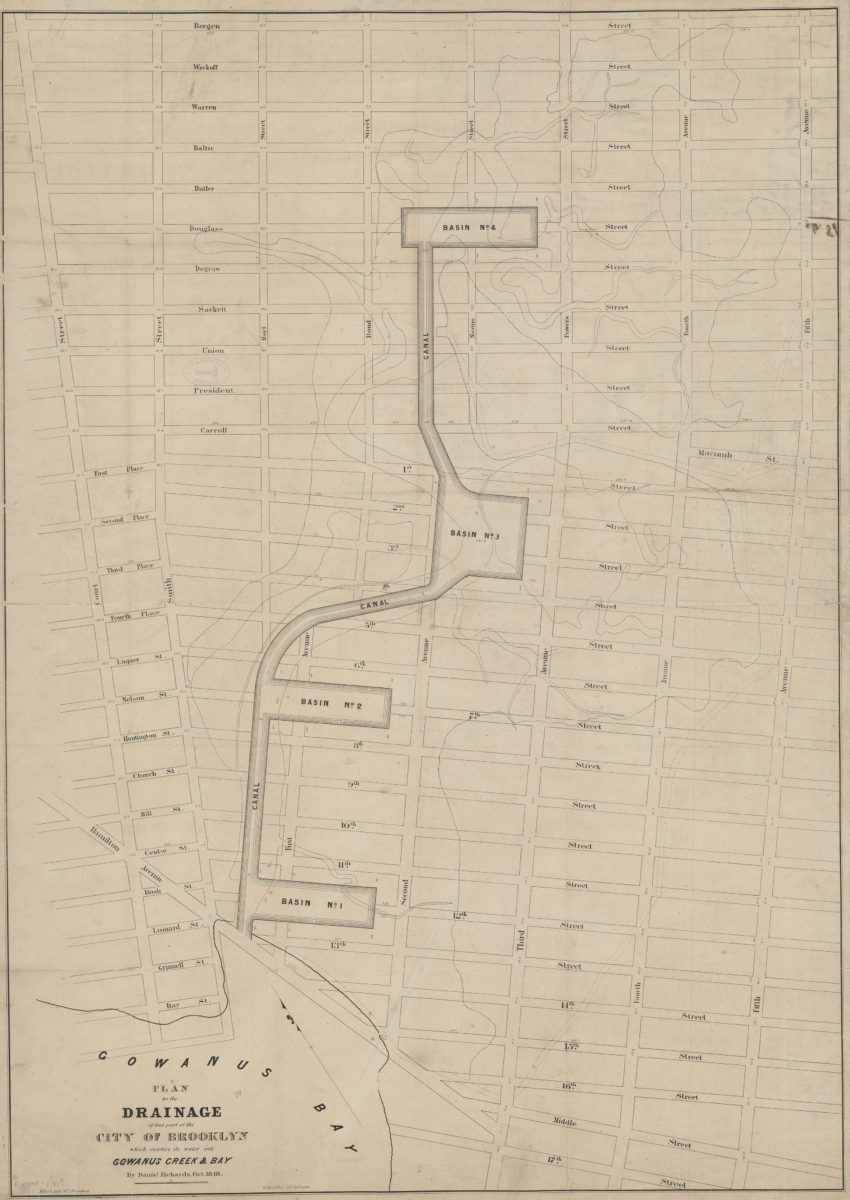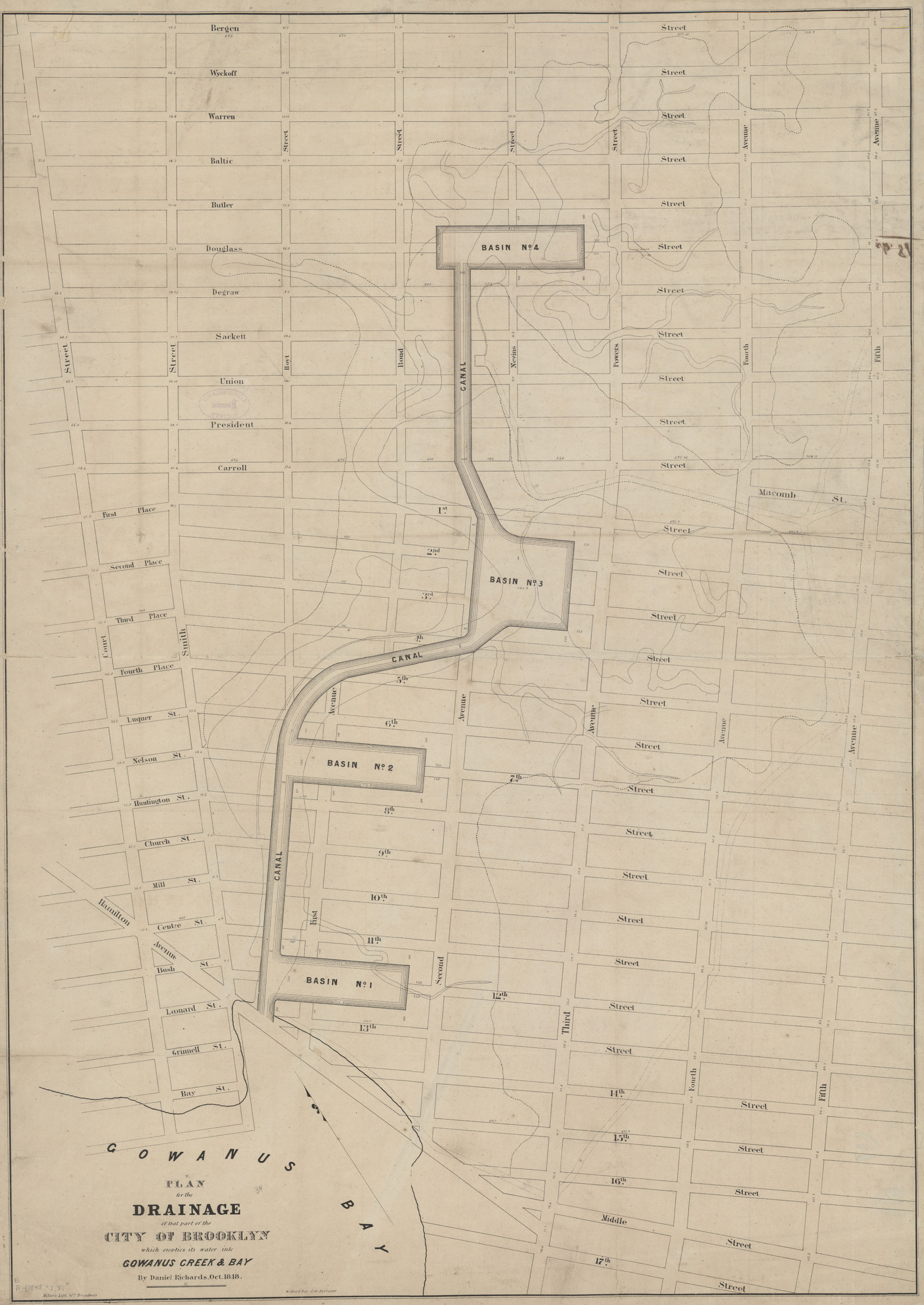
Plan for the drainage of that part of the city of Brooklyn which empties its water into Gowanus Creek & Bay: by Daniel Richards, Oct. 1848 ; Willard Day, city surveyor [1848]
Map No. B A-[1848?]a.Fl
Covers area bounded by 17th St., 5th Ave., Bergen Ave., Court St., and Hamilton Ave. Also shows basins, streams, the Gowanus Canal, and surrounding streets. Oriented with north to the upper left.
Map area shown
Genre
Public utility mapsRelation
Full catalog recordSize
96 × 68 cmDownload
Low Resolution Image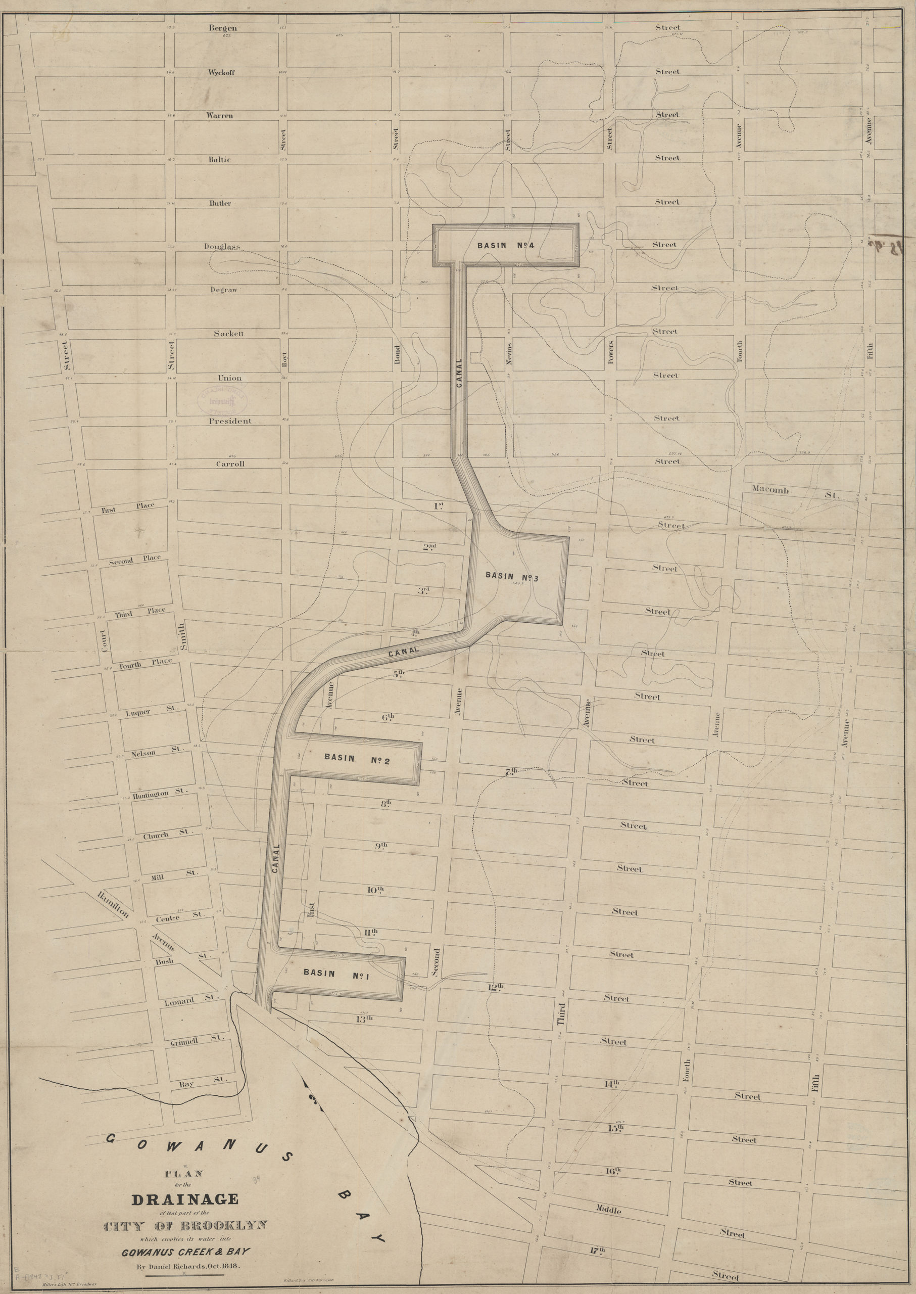
Creator
Richards, Daniel,Publisher
Brooklyn Historical SocietyCitation
Plan for the drainage of that part of the city of Brooklyn which empties its water into Gowanus Creek & Bay: by Daniel Richards, Oct. 1848 ; Willard Day, city surveyor; [1848], Map Collection, B A-[1848?]a.Fl; Brooklyn Historical Society.Scale
Scale not givenLoading zoom image...