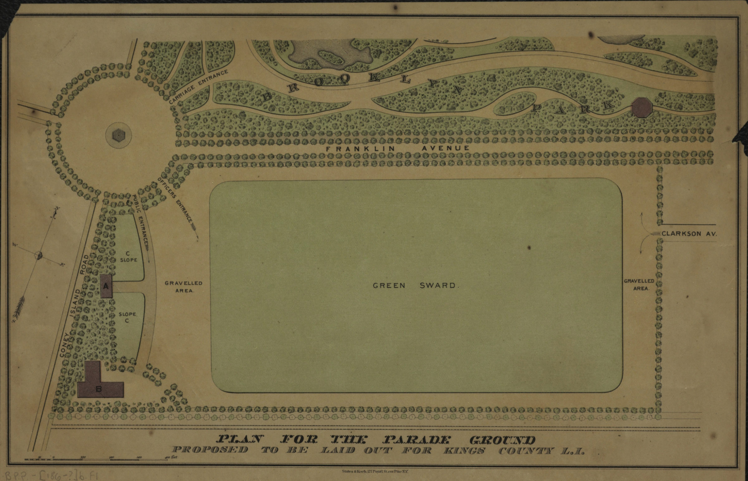
Plan for the Parade Ground: proposed to be laid out for Kings Co., L.I. [186?]
Map No. B PP-[186-?]b.Fl
Shows the Parade Ground south of Prospect Park, including the following features: entrances, landscaping, and the “Green Sward” (used for military training drills). Also covers surrounding streets, including Franklin Ave., Clarkson Ave., and Coney Island Road. Relief shown pictorially. Oriented with north to the upper right. BHS copy affixed to mat frame.
Map area shown
Genre
Thematic mapsRelation
Full catalog recordSize
19 × 31 cmDownload
Low Resolution Image
Creator
States & Koch,Publisher
Brooklyn Historical SocietyCitation
Plan for the Parade Ground: proposed to be laid out for Kings Co., L.I.; [186?], Map Collection, B PP-[186-?]b.Fl; Brooklyn Historical Society.Scale
Scale [ca. 1:2,560]Loading zoom image... 