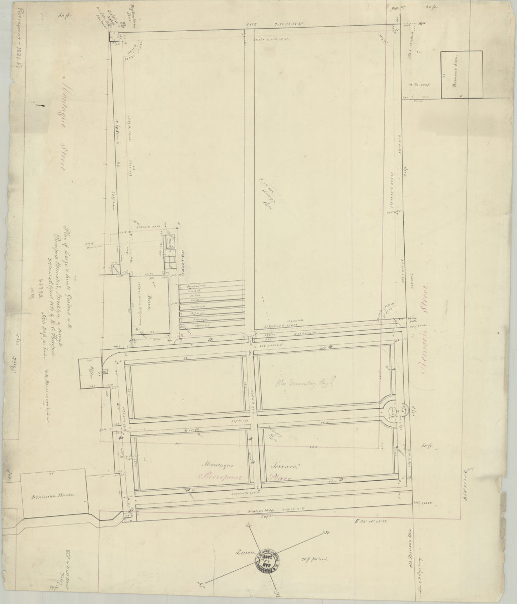
Plan of large & small gardens at the Pierrepont Homestead, Brooklyn: as surveyed … by W.C. Pierrepont March 31 & Apr. 2, 1821
Map No. Pierrepont-1821.Fl
Cadastral map covering area bounded by Montague St., Pierrepont Pl., and Remsen St. (modern-day Brooklyn Heights). Shows property (including lots, dimensions, and buildings) and “the streets as now laid out.” Oriented with north the lower right.
Subjects
Places
Map area shown
Relation
Full catalog recordSize
46 × 54 cmDownload
Low Resolution Image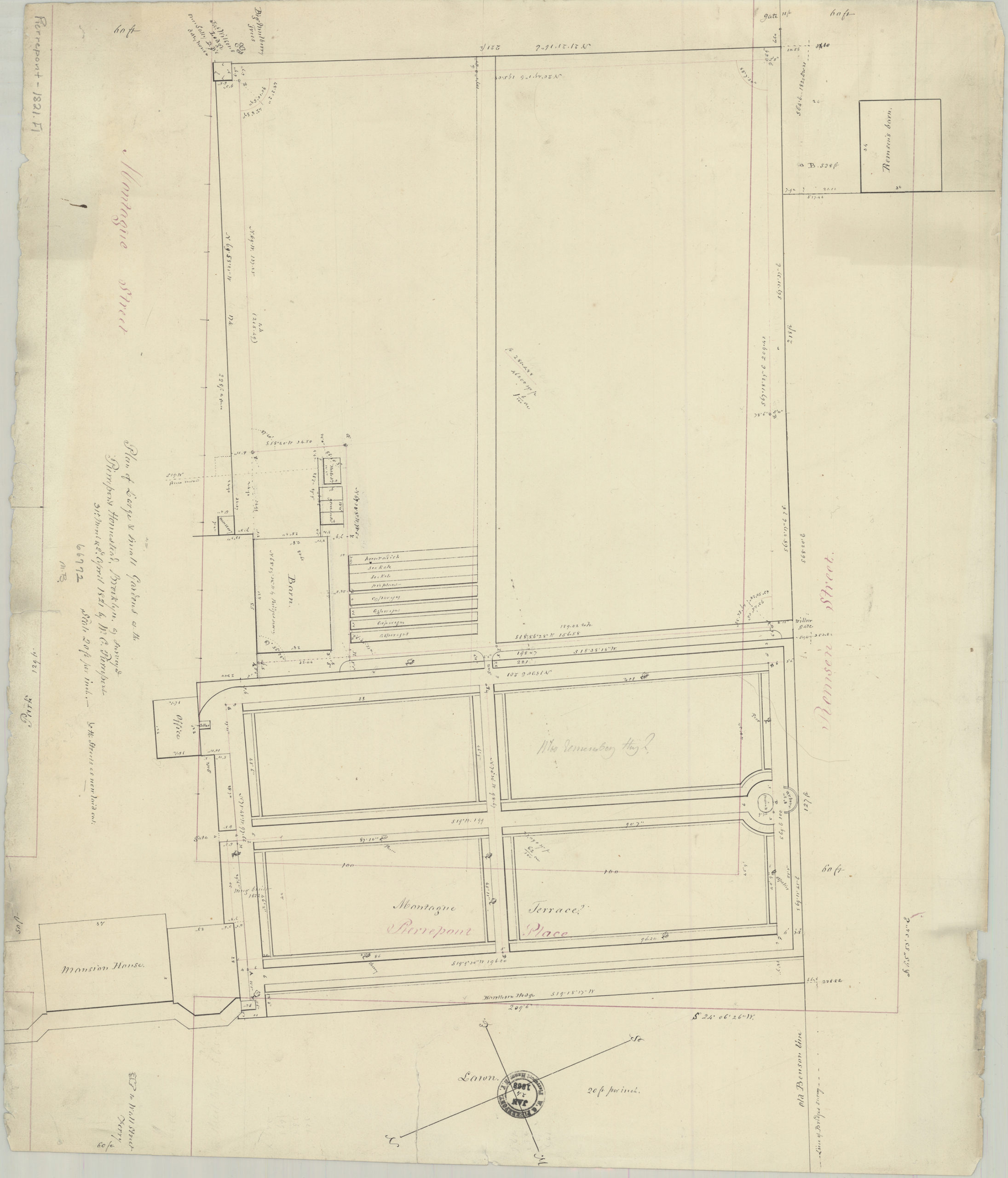
Creator
Pierrepont, W. C., Pierrepont, W. C.,Publisher
Brooklyn Historical Society, Brooklyn Historical SocietyCitation
Plan of large & small gardens at the Pierrepont Homestead, Brooklyn: as surveyed … by W.C. Pierrepont; March 31 & Apr. 2, 1821, Map Collection, Pierrepont-1821.Fl; Brooklyn Historical Society.Scale
Scale [1:240] 1 in to 20Loading zoom image...