
Plan of New York and Brooklyn [186?]
Map No. NYC-[186-?]a.Fl
Covers the entirety of Manhattan also covers Rikers Island, the Brothers Islands, Randall’s Island, Sunken Meadow, Ward’s Island, Blackwells Island, Ellis’s Island, Bedloes Island, and Governors Island as well as portions of Queens, the South Bronx, Jersey City, and Hoboken. Covers Brooklyn north from approximately Red Hook to Greenpoint and east to Evergreen Cemetery. Shows wards, ferry lines, pier lines, and bulkhead lines. Extracted from unknown atlas. Includes decorative border. “3”–Upper right corner.
Map area shown
Genre
MapRelation
Full catalog recordSize
40 × 32 cmDownload
Low Resolution Image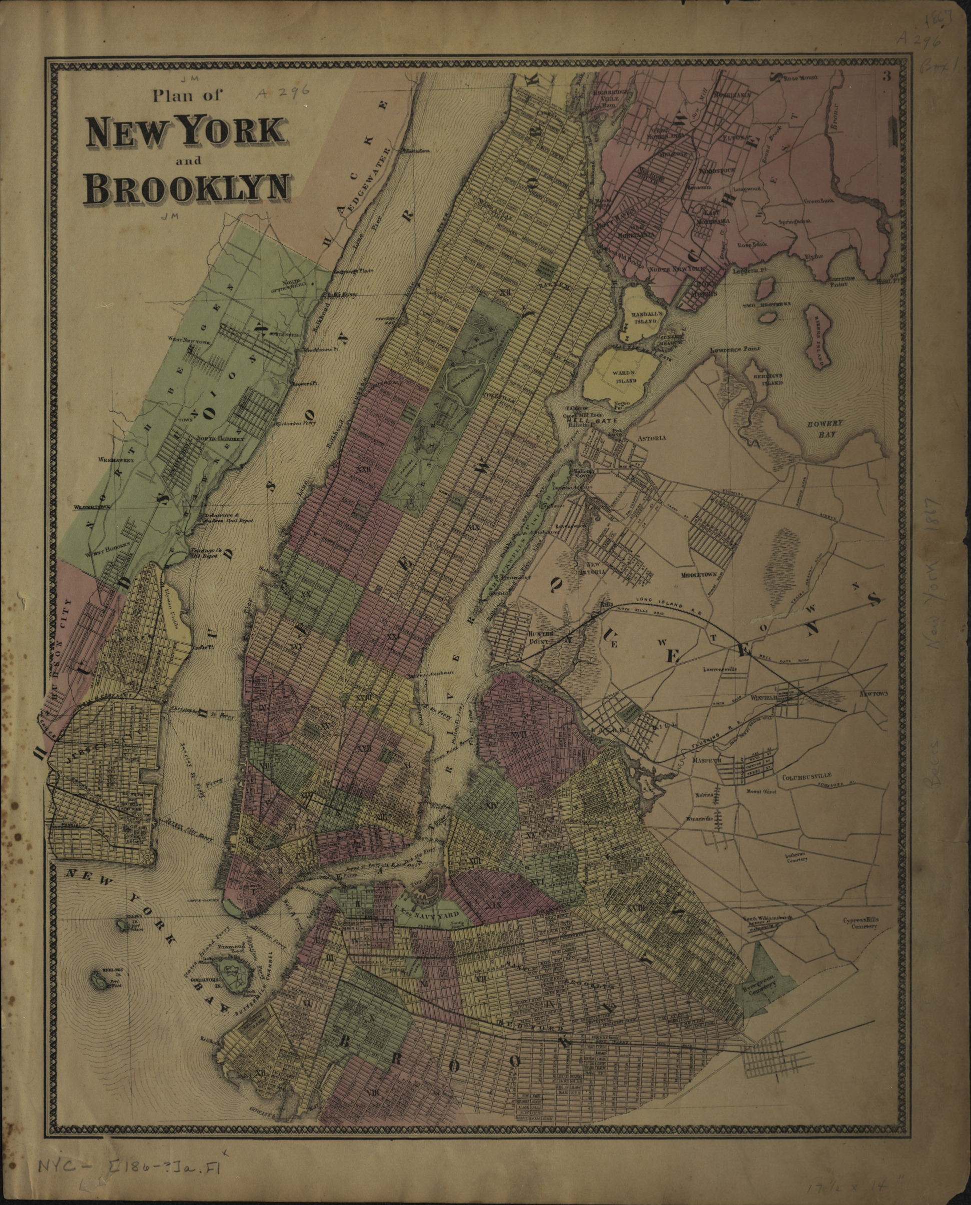
Creator
Publisher
Brooklyn Historical SocietyCitation
Plan of New York and Brooklyn; [186?], Map Collection, NYC-[186-?]a.Fl; Brooklyn Historical Society.Scale
Scale not givenLoading zoom image... 