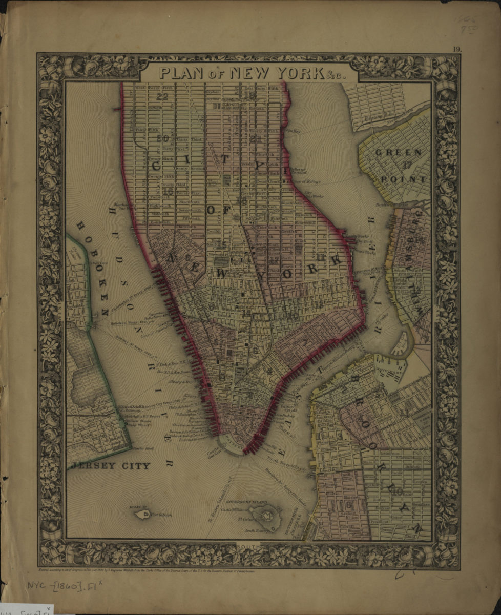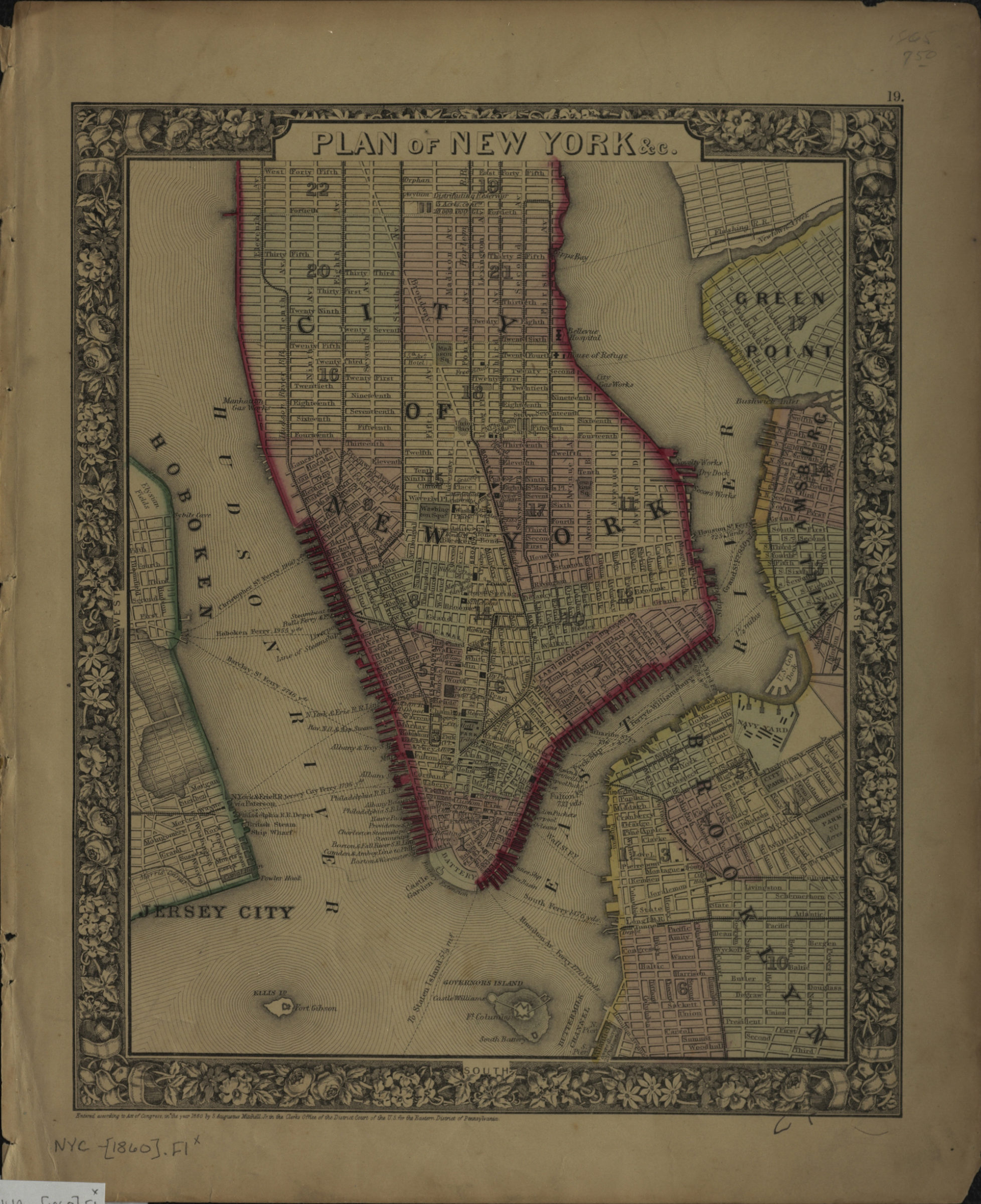
Plan of New York &c [ca. 1860]
Map No. NYC-[1860].Fl
Covers Manhattan south of 46th St., and parts of Hoboken, Jersey City, Green Point, and Williamsburg. Shows piers, ferry lines, wards, streets and railroads. “Entered according to Act of Congress in the year 1860 by S. Augustus Mitchell Jr. in the Clerk’s Office of the District Court for the Eastern District of Pennsylvania.” Map within decorative border. “19”–upper right margin.
Map area shown
Genre
MapRelation
Full catalog recordSize
39 × 31 cmDownload
Low Resolution Image
Creator
Mitchell, S. Augustus (Samuel Augustus),Publisher
Brooklyn Historical SocietyCitation
Plan of New York &c; [ca. 1860], Map Collection, NYC-[1860].Fl; Brooklyn Historical Society.Scale
Scale not givenLoading zoom image...