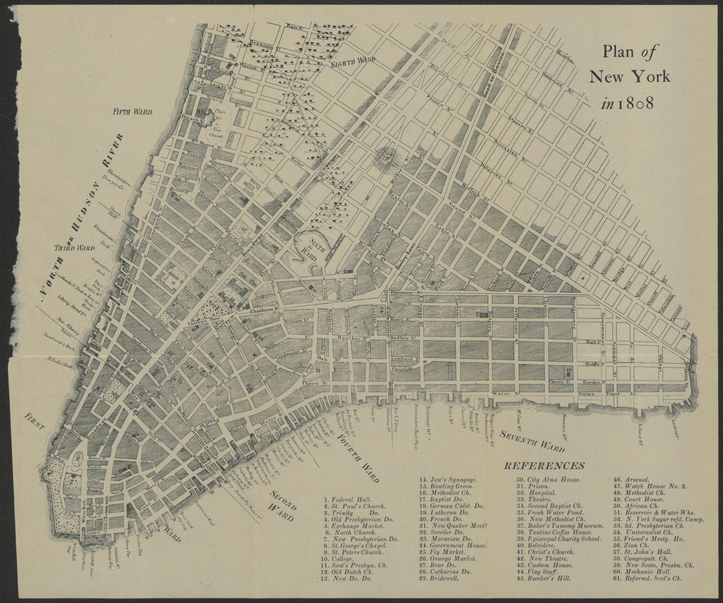
Plan of New York in 1808 [18??]
Map No. M-1808.Fl
Street map of Manhattan from the Battery to Romaine Street showing wards, street names, wharves and docks. Detached from an unidentified publication. Includes index to religious and public buildings.
Map area shown
Genre
MapRelation
Full catalog recordSize
26 × 31 cmDownload
Low Resolution Image
Creator
Publisher
Brooklyn Historical SocietyCitation
Plan of New York in 1808; [18??], Map Collection, M-1808.Fl; Brooklyn Historical Society.Scale
Scale not givenLoading zoom image... 