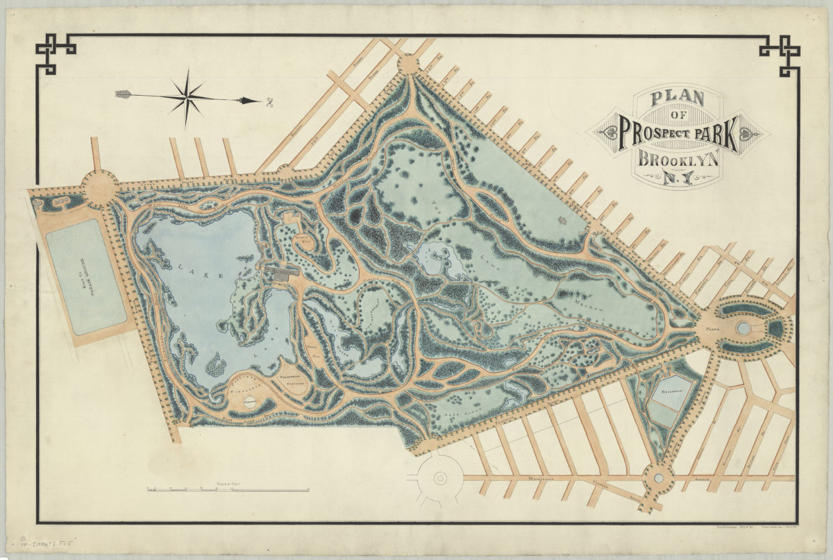
Plan of Prospect Park, Brooklyn, N.Y.: Jos. Strachan, N.Y.U. ’83 [1886]
Map No. B PP-[1886?].Fl.Folio
Also shows sorrounding streets, the Parade Ground, the Plaza, and the Reservoir. Relief shown by shading. Some trees shown pictorially. Oriented with north to the right. “Finished March 12 1886”–Lower right margin. “Plan of 1870”–Lower right margin.
Map area shown
Genre
MapRelation
Full catalog recordSize
61 × 97 cmDownload
Low Resolution Image
Creator
Strachan, Jos,Publisher
Brooklyn Historical SocietyCitation
Plan of Prospect Park, Brooklyn, N.Y.: Jos. Strachan, N.Y.U. ’83; [1886], Map Collection, B PP-[1886?].Fl.Folio; Brooklyn Historical Society.Scale
Scale [ca. 1:3,200]Loading zoom image...