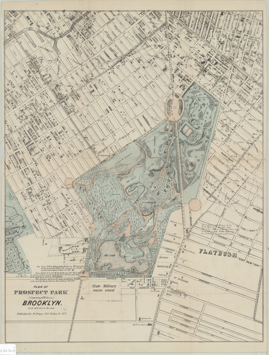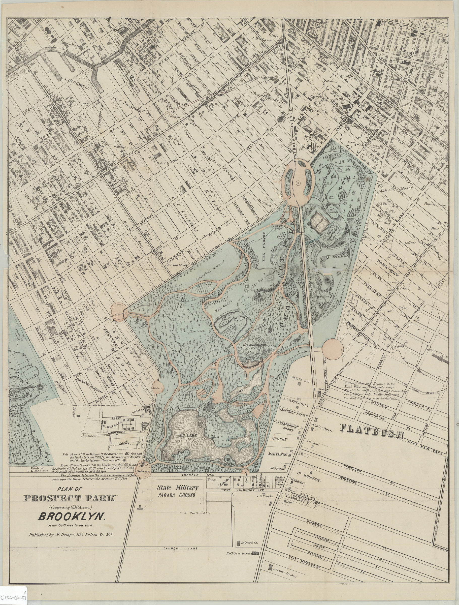
Plan of Prospect Park (comprising 630 acres), Brooklyn [186?]
Map No. B PP-[186-?]a.Fl
Also shows part of Greenwood Cemetery, the Parade Ground, the reservoir, surrounding portions of Park Slope and Prospect Heights, and names of property owners. Relief shown pictorially and by hachures. Includes notes.
Map area shown
Relation
Full catalog recordSize
58 × 45 cmDownload
Low Resolution Image
Creator
Dripps, M.,Publisher
Brooklyn Historical SocietyCitation
Plan of Prospect Park (comprising 630 acres), Brooklyn; [186?], Map Collection, B PP-[186-?]a.Fl; Brooklyn Historical Society.Scale
Scale [1:7,200] 1 in to 6Loading zoom image...