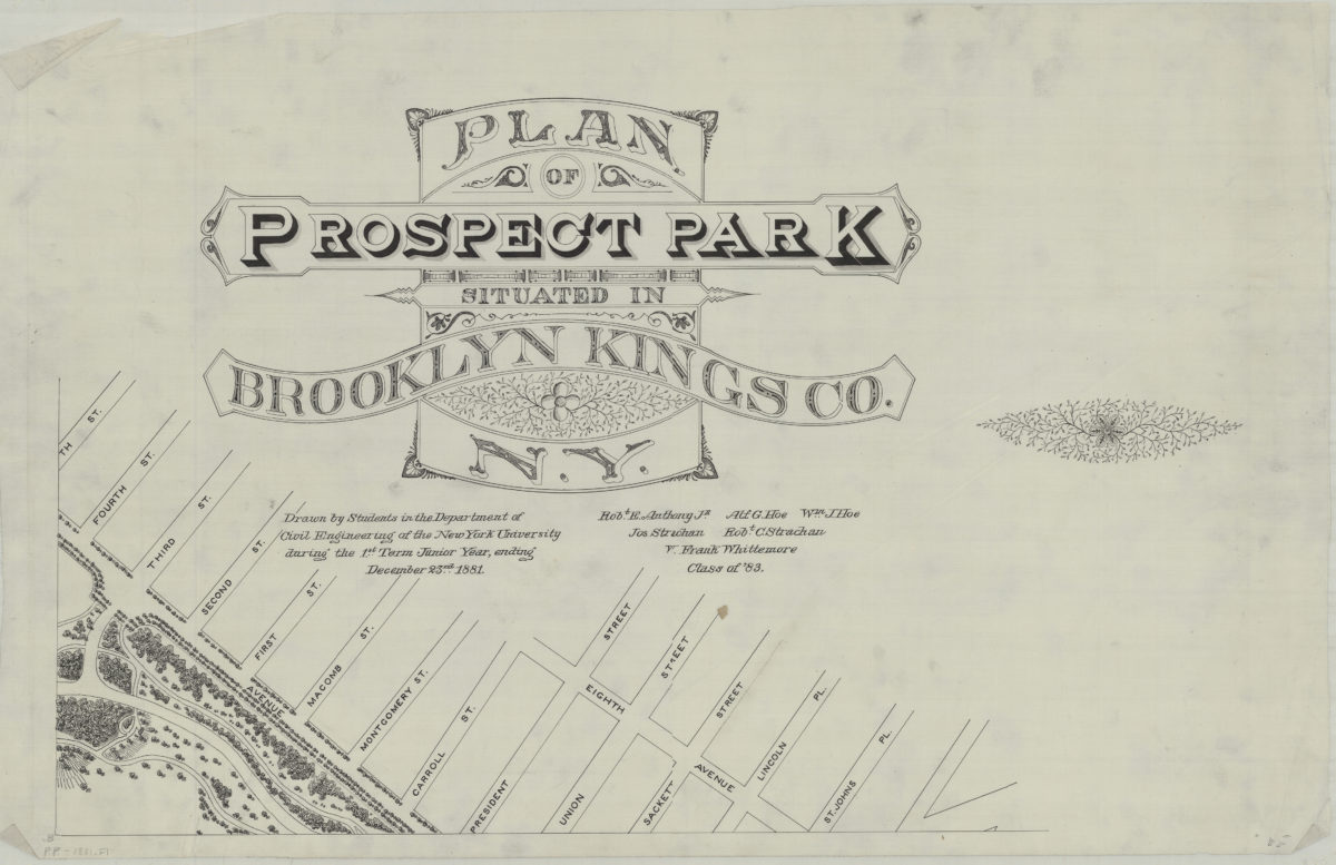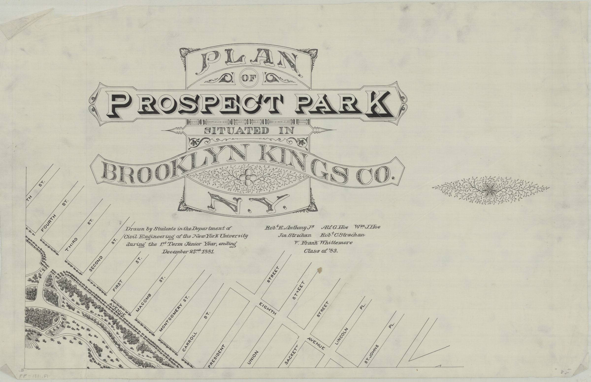

Plan of Prospect Park, situated in Brooklyn, Kings Co., N.Y.: drawn by students in the Department of Civil Engineering of the New York University during the 1st term junior year, ending December 23rd 1881 [1881]
Map No. B PP-[1881].Fl
BHS copy incomplete consists of only 1 sheet, covering west side of the park, from 5th St. to St. Johns Pl. (modern-day Park Slope). Number of sheets for complete map unknown. Includes decorative cartouche.
Subjects
Places
Map area shown
Genre
BroadsidesRelation
Full catalog recordSize
45 × 71 cmDownload
Low Resolution Image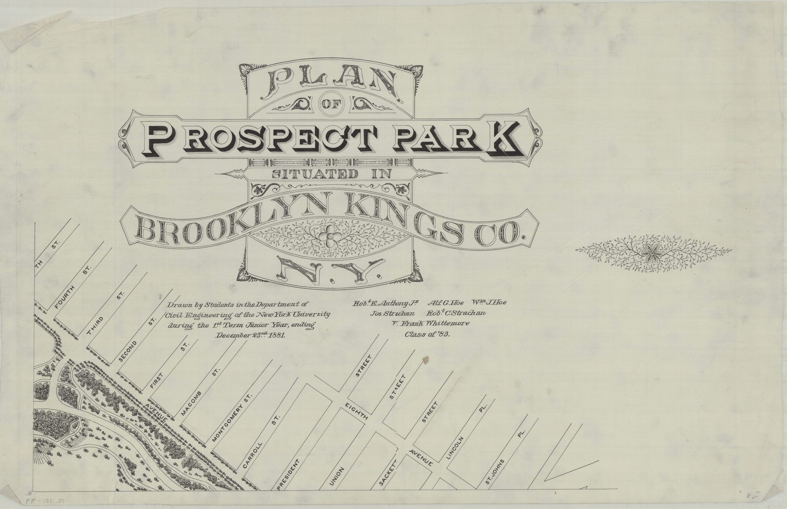
Creator
Anthony, Robt. E.; Hoe, Alf. G.; Hoe, Wm. J.; Strachan, Jos; Strachan, Robt. C.; Whittemore, W. Frank; New York University, Anthony, Robt. E.; Hoe, Alf. G.; Hoe, Wm. J.; Strachan, Jos; Strachan, Robt. C.; Whittemore, W. Frank; New York University,Publisher
Brooklyn Historical Society, Brooklyn Historical SocietyCitation
Plan of Prospect Park, situated in Brooklyn, Kings Co., N.Y.: drawn by students in the Department of Civil Engineering of the New York University during the 1st term junior year, ending December 23rd 1881; [1881], Map Collection, B PP-[1881].Fl; Brooklyn Historical Society.Scale
Scale not givenLoading zoom image...