Plan of the city of New York, 1808 [1852]
Map No. M-1808 (1852).Fl
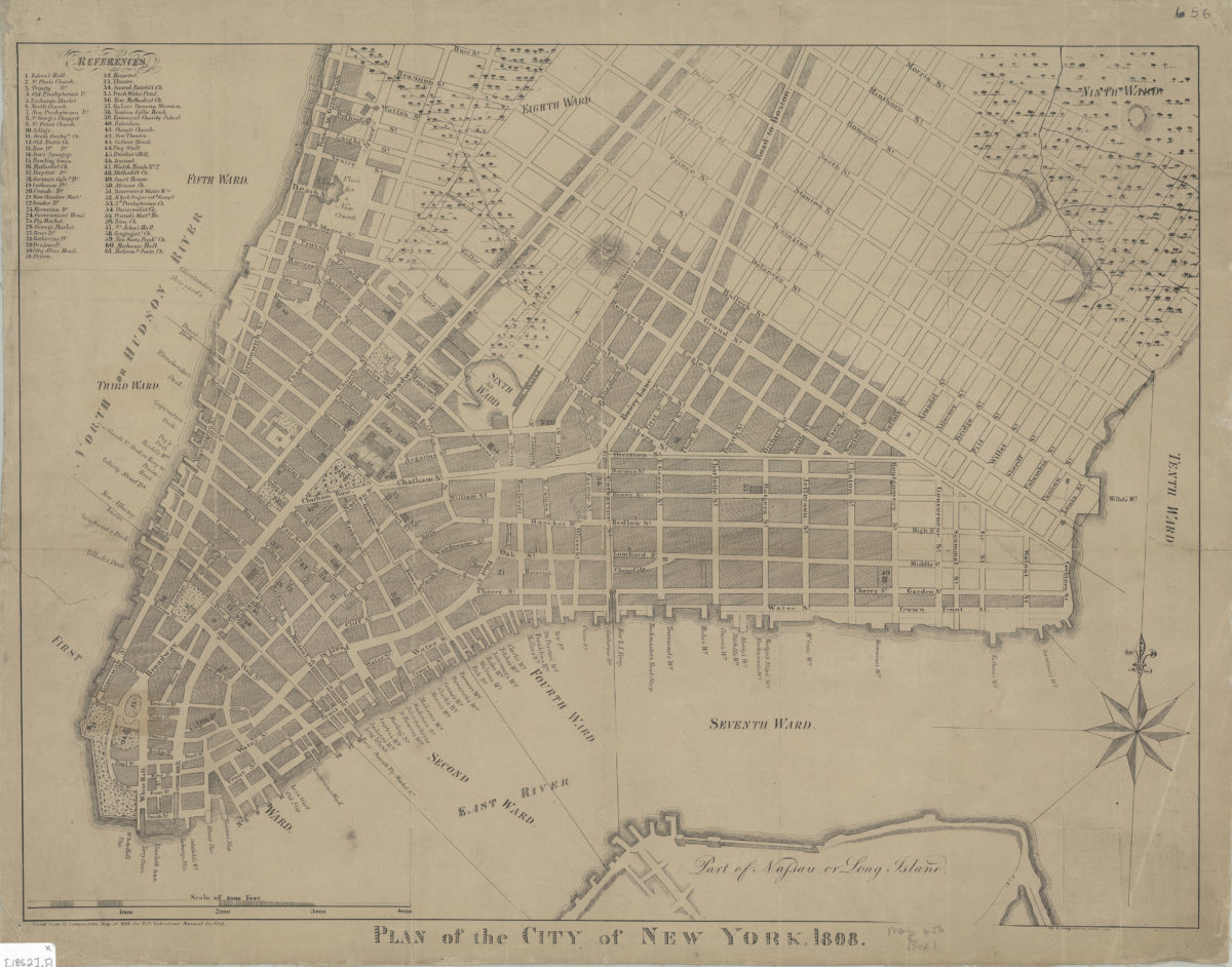
Facsimile covering Manhattan north to Morris Street. Shows wards, streets, buildings, and ferry docks. Relief shown by hachures. “Copied from D. Longworth’s Map of 1808 for D.T. Valentine’s Manual for 1852.” Includes index to points of interest. BHS copy mounted on linen.
Map area shown
Genre
MapRelation
Full catalog recordSize
38 × 50 cmDownload
Low Resolution Image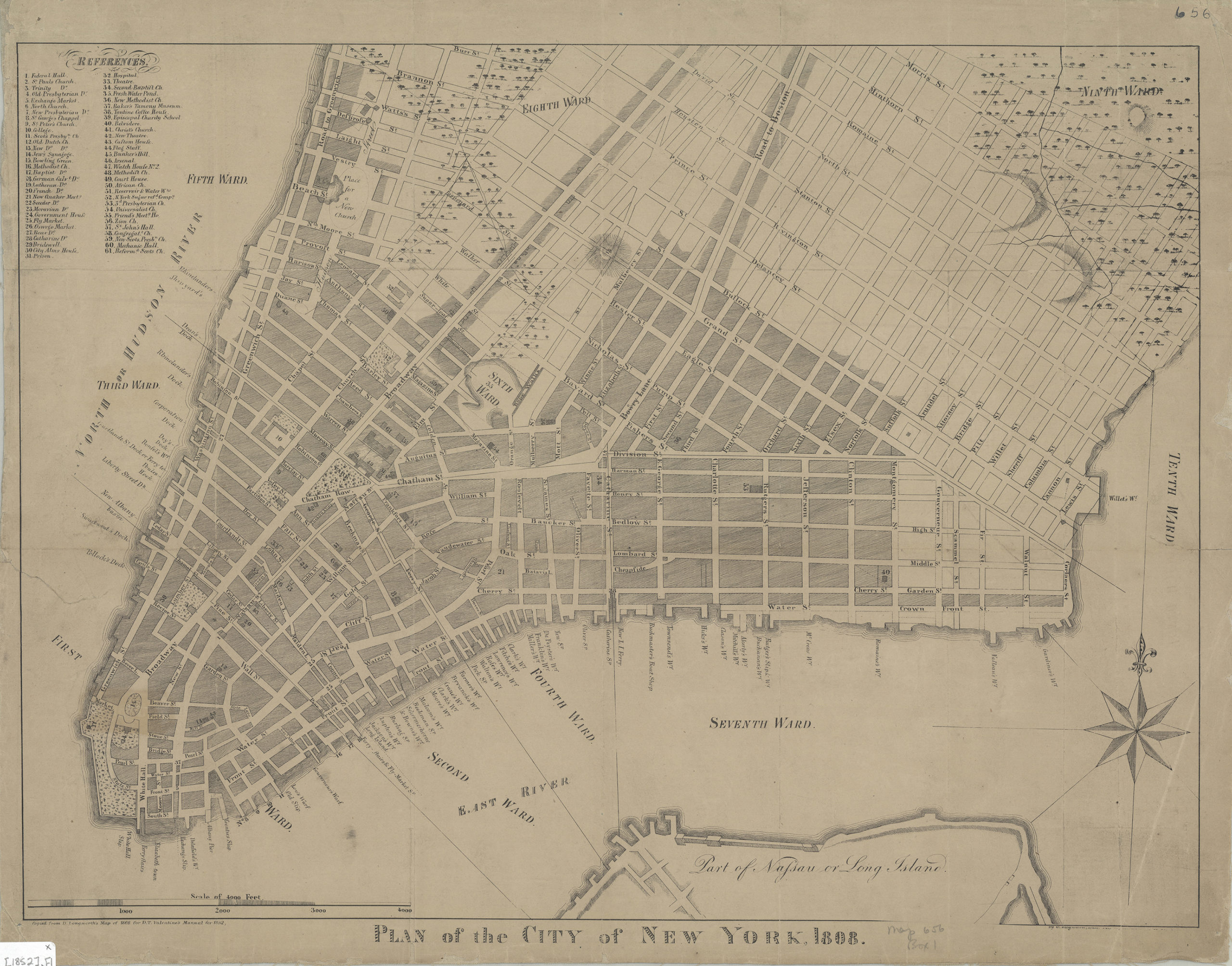
Creator
Hayward, George; Valentine, D. T.; Longworth, David,Publisher
Brooklyn Historical SocietyCitation
Plan of the city of New York, 1808; [1852], Map Collection, M-1808 (1852).Fl; Brooklyn Historical Society.Scale
Scale [ca. 1:7,700]Loading zoom image...