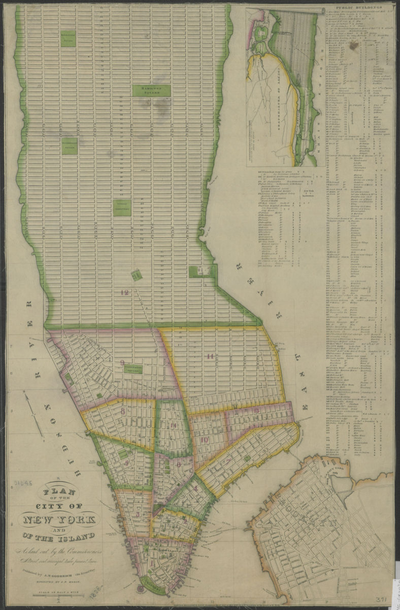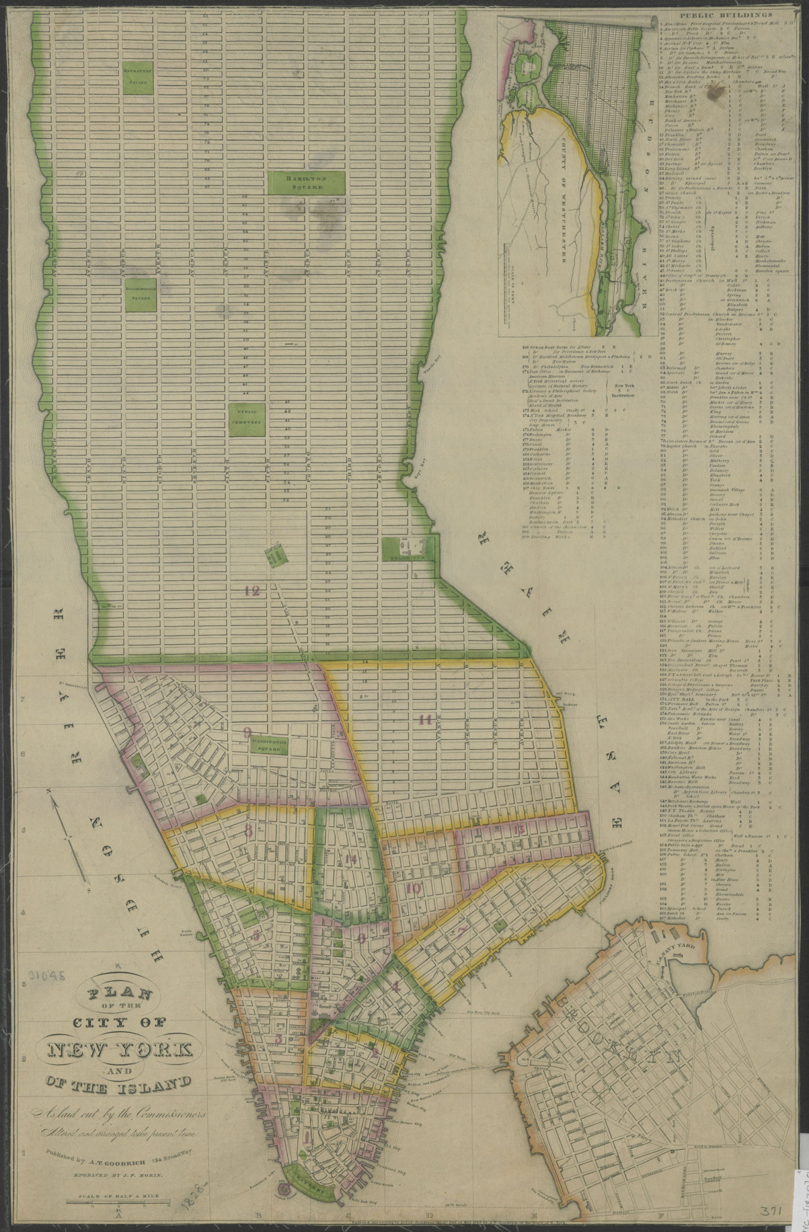
Plan of the City of New York and of the island as laid out by the Commissioners: altered and arranged to the present time: engraved by J.F. Morin 1828
Map No. NYC-[1828].Fl
Covers Manhattan, New York (N.Y.) below 90th Street. Shows some existing and proposed streets also buildings, piers. Copy 1 lacks cover, stored flat. Soiled, silked. M010802
Map area shown
Genre
MapRelation
Full catalog recordSize
61 × 39 cmDownload
Low Resolution Image
Creator
Goodrich, Andrew Thompson; Morin, J. F.,Publisher
Brooklyn Historical SocietyCitation
Plan of the City of New York and of the island as laid out by the Commissioners: altered and arranged to the present time: engraved by J.F. Morin; 1828, Map Collection, NYC-[1828].Fl; Brooklyn Historical Society.Scale
Scale [ca 1:16,000]Loading zoom image...