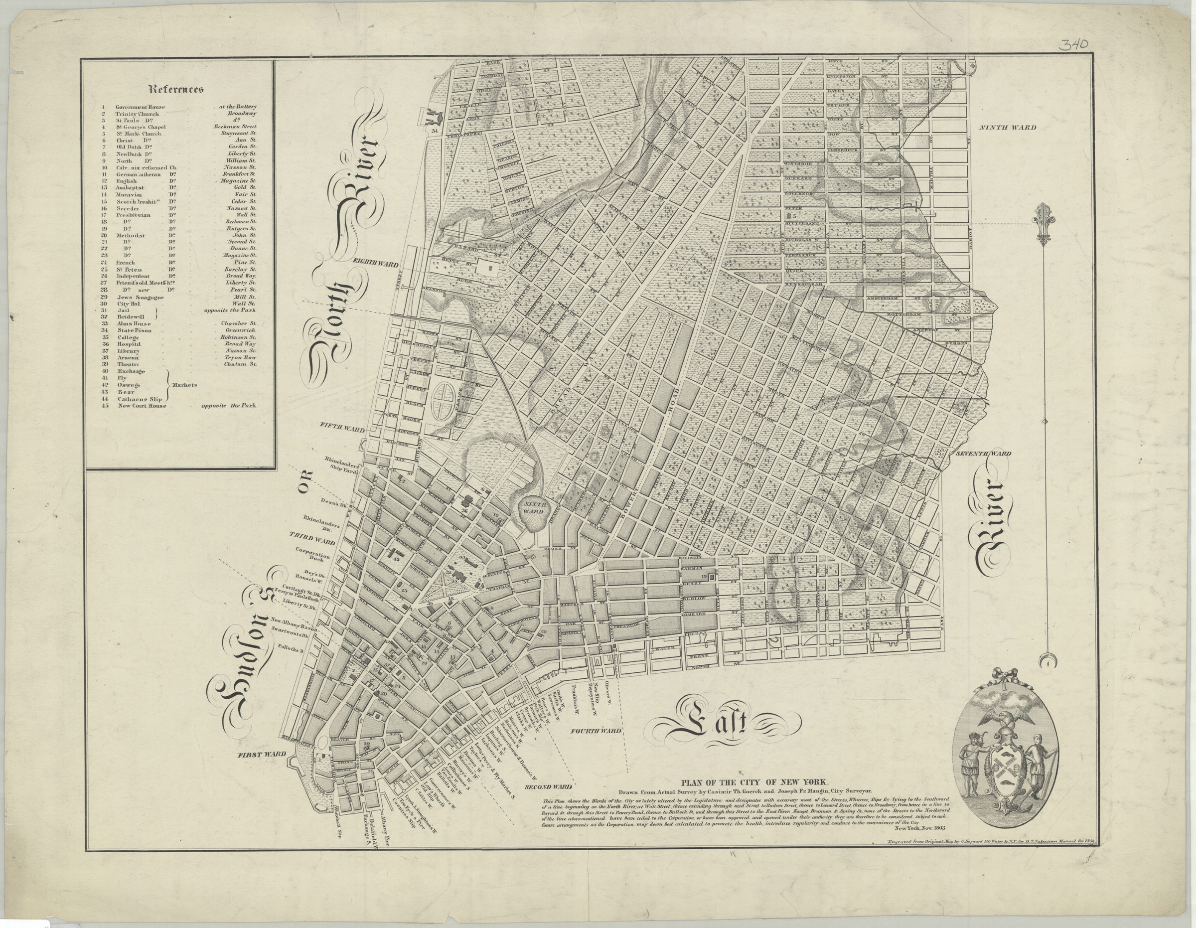
Plan of the city of New York: drawn from actual survey by Casimir Th. Goerck and Joseph Fr. Mangin, city surveyor [1856]
Map No. M-1803 (1856).Fl
Covers Manhattan north from the Battery to Dove St. Shows wards, piers, slips, and docks. Relief shown by hachures. “Engraved from Original Map by G. Hayward 120 Water St. N.Y. for D.T. Valentines Manual for 1856.” Includes text, ill., and index.
Map area shown
Genre
MapRelation
Full catalog recordSize
48 × 62 cmDownload
Low Resolution Image
Creator
Goerck, Casimir Th.,Publisher
Brooklyn Historical SocietyCitation
Plan of the city of New York: drawn from actual survey by Casimir Th. Goerck and Joseph Fr. Mangin, city surveyor; [1856], Map Collection, M-1803 (1856).Fl; Brooklyn Historical Society.Scale
Scale not givenLoading zoom image... 