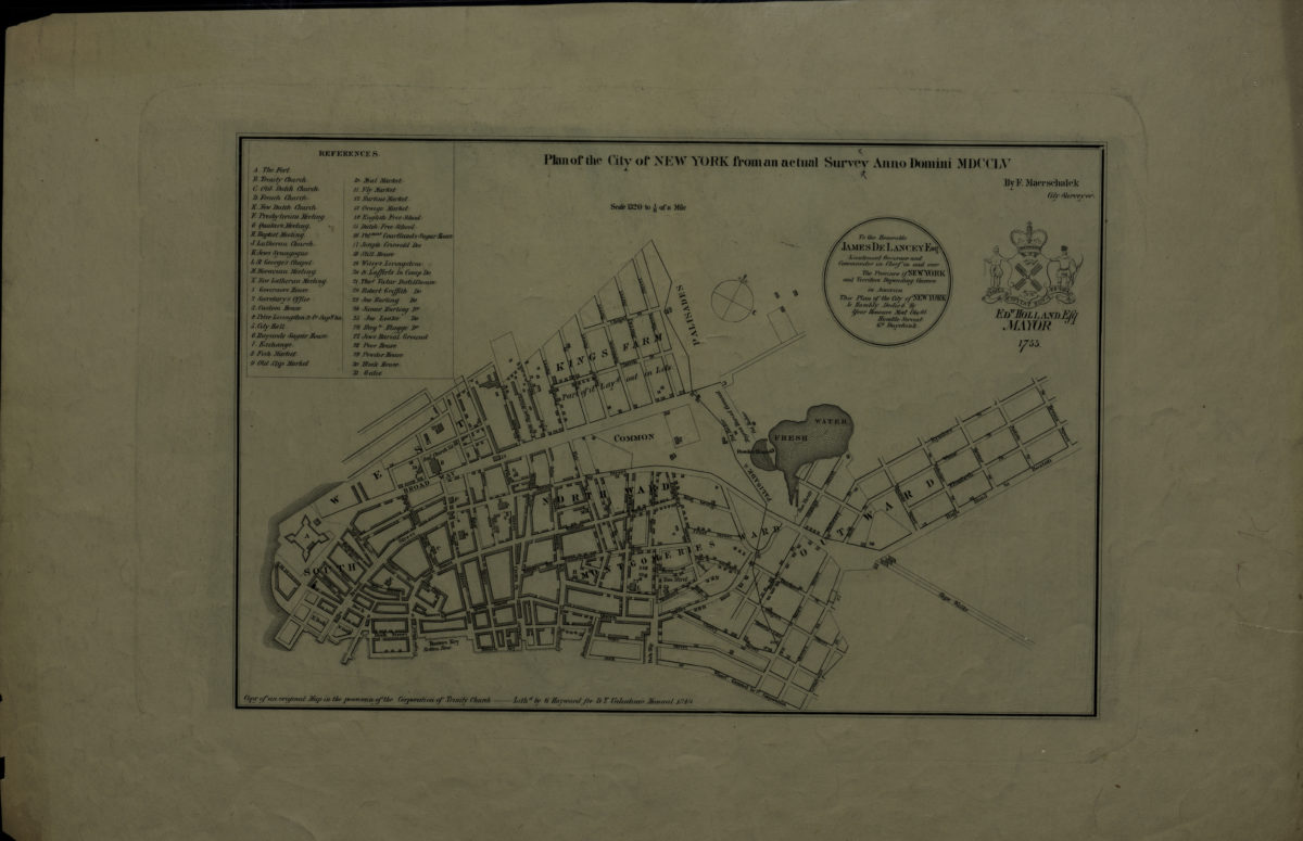
Plan of the city of New York, from an actual survey, anno domini MDCCLV: by F. Maerschalck [1849]
Map No. M-1755 (1849).Fl
Covers Manhattan north to St. Hevius St. Shows wards, churches and synagogues, markets, schools and public buildings. Oriented with north to the upper right. “Copy of an original Map in the possession of the Corporation of Trinity Church — Lithd. by G. Hayward for D.T. Valentine’s Manual 1849.” Dedication: To the Honorable JAMES DE LANCEY … This Plan of the City of NEW YORK Is Humbly Dedicd. By Your Honours Most Obedt. Humble Servent G.S. Duyckinck. “Edw. Holland Esq., Mayor.” Includes index and seal.
Map area shown
Genre
Early mapsRelation
Full catalog recordSize
26 × 39 cmDownload
Low Resolution Image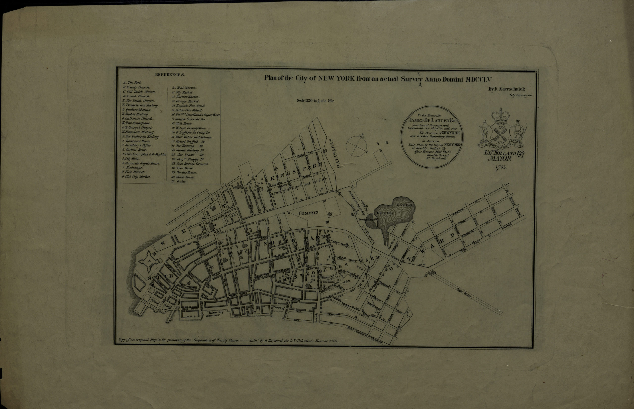
Creator
Maerschalck, Francis W.,Publisher
Brooklyn Historical SocietyCitation
Plan of the city of New York, from an actual survey, anno domini MDCCLV: by F. Maerschalck; [1849], Map Collection, M-1755 (1849).Fl; Brooklyn Historical Society.Scale
Sale in 1320 to 1/8 of aLoading zoom image...