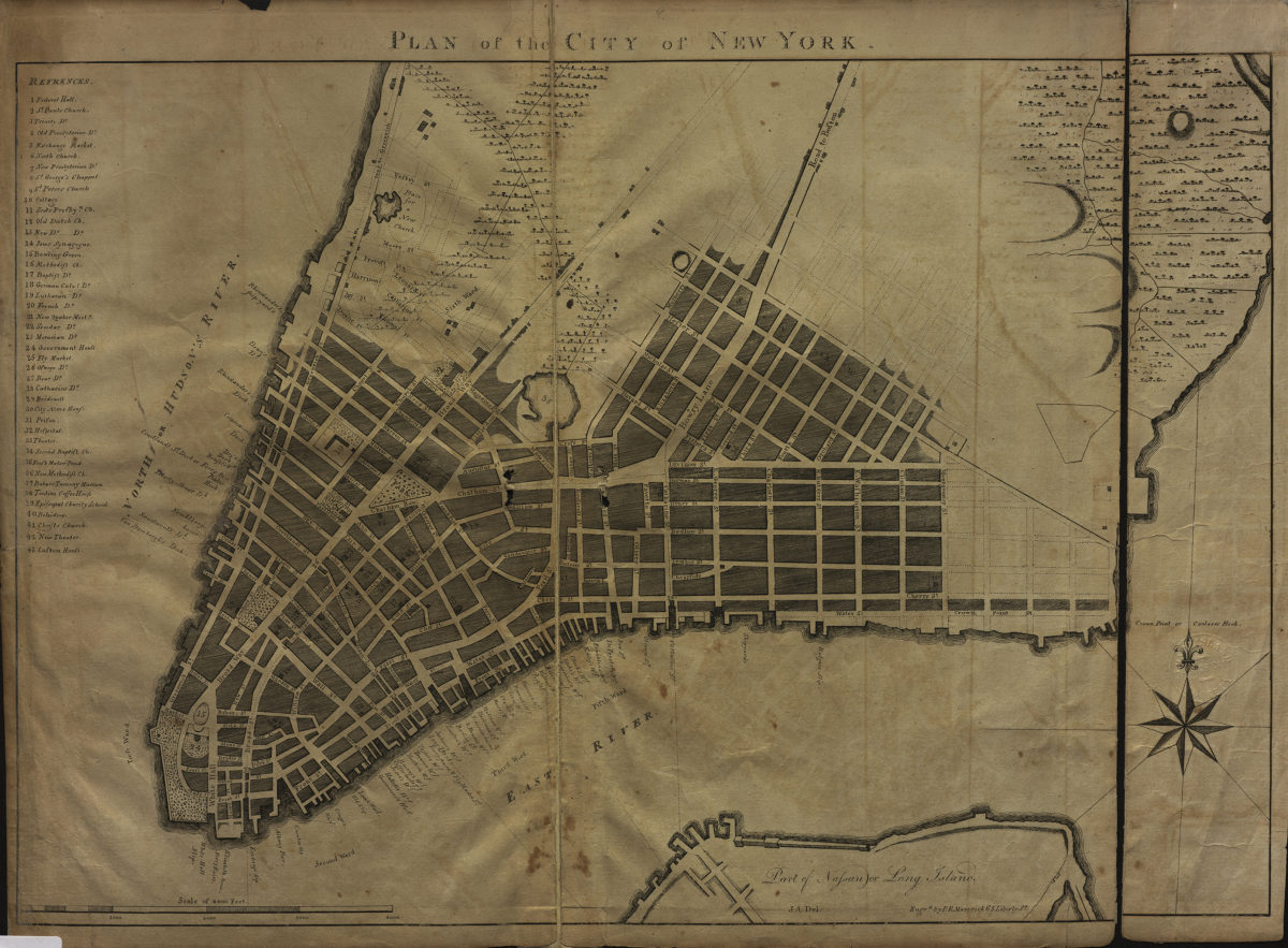
Plan of the city of New York: J.A., del [1803]
Map No. M-[1803?].Fl
Covers lower Manhattan and a portion of Brooklyn. Shows roads, wards, public structures, ship yards, wharves, slips, docks, and ferries. Relief shown by hachures. Includes index. BHS copy not mounted on linen.
Map area shown
Genre
MapRelation
Full catalog recordSize
38 × 55 cmDownload
Low Resolution Image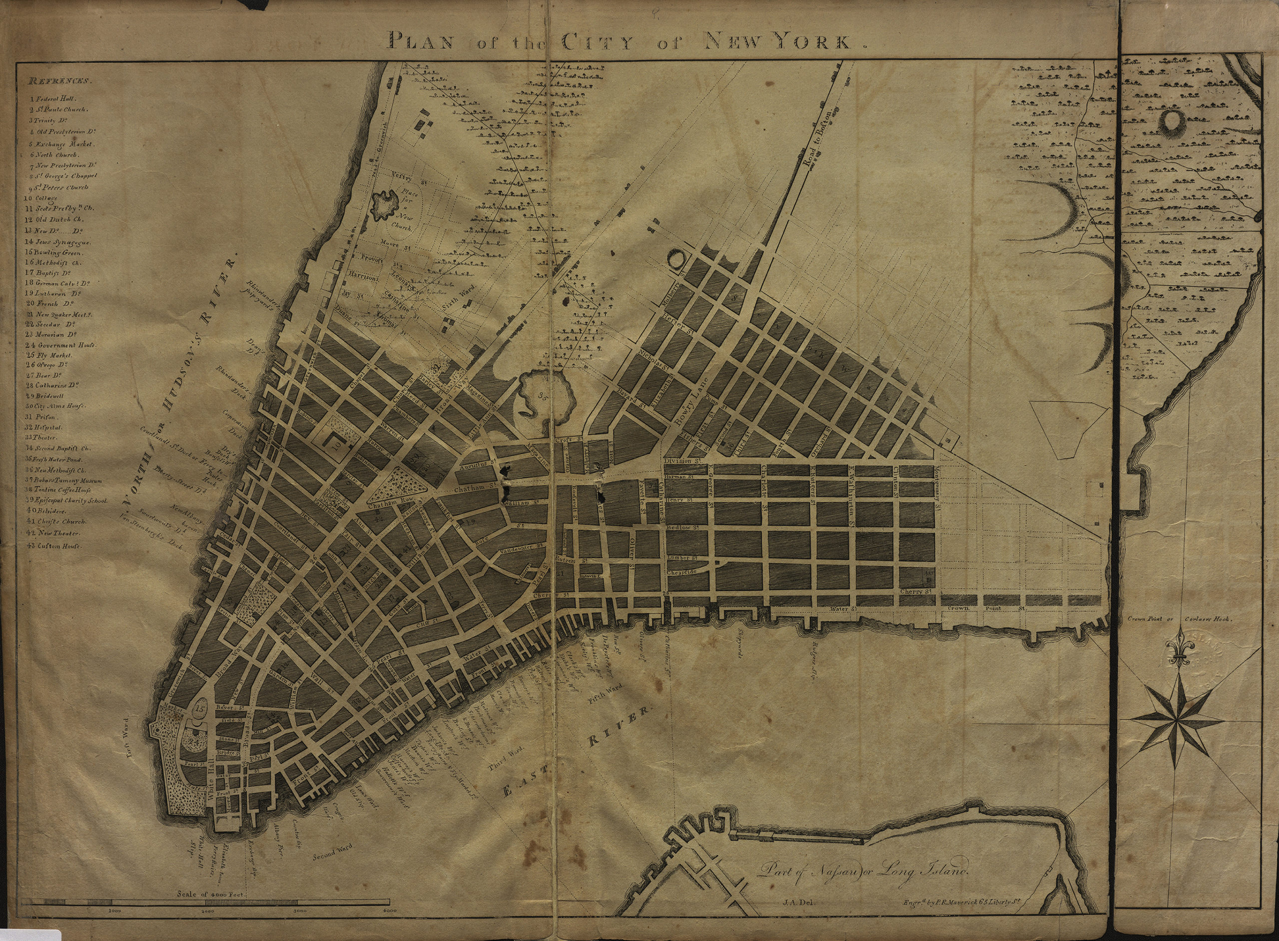
Creator
J. A.,Publisher
Brooklyn Historical SocietyCitation
Plan of the city of New York: J.A., del; [1803], Map Collection, M-[1803?].Fl; Brooklyn Historical Society.Scale
Scale [ca. 1:9,000]Loading zoom image...