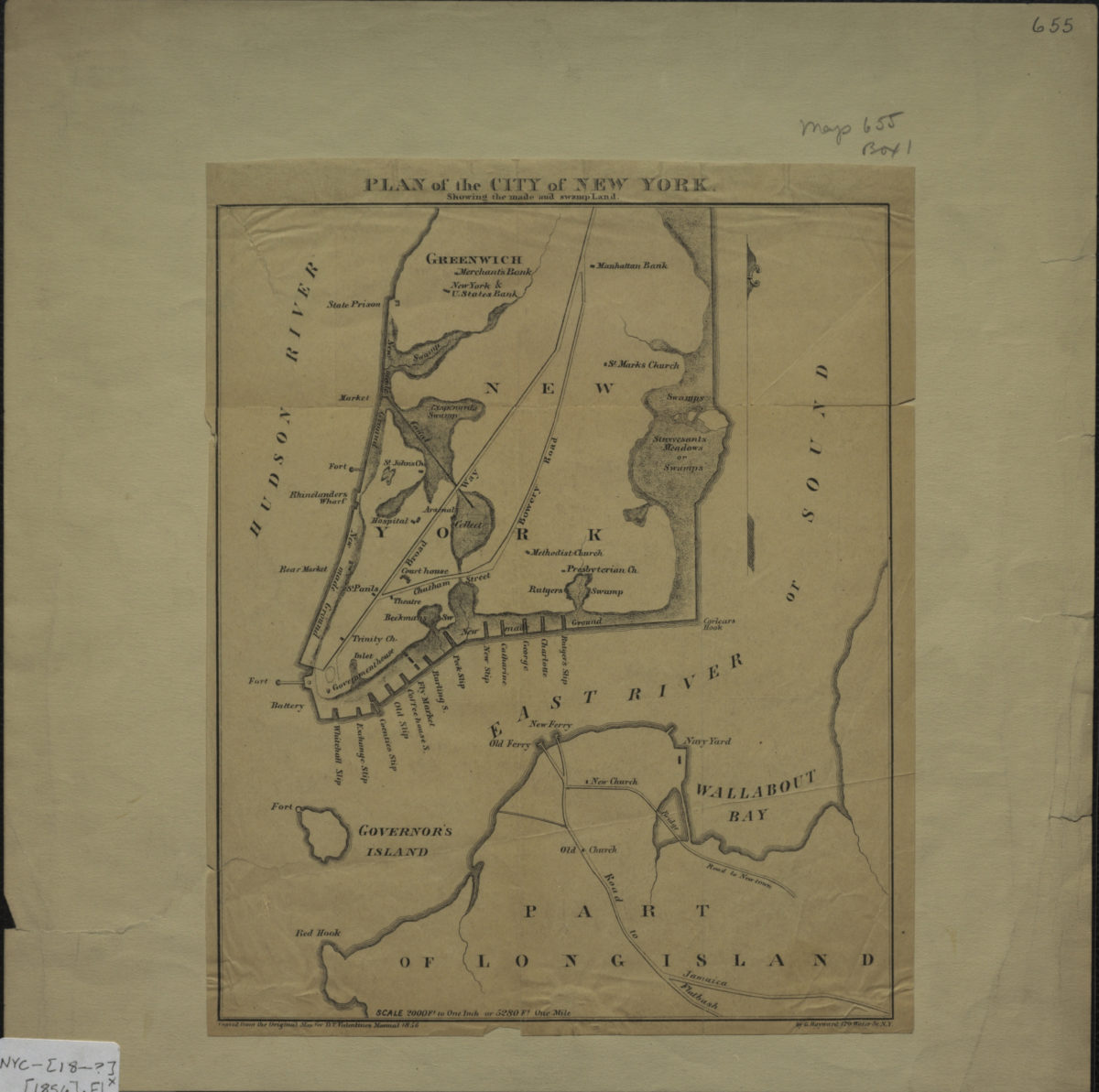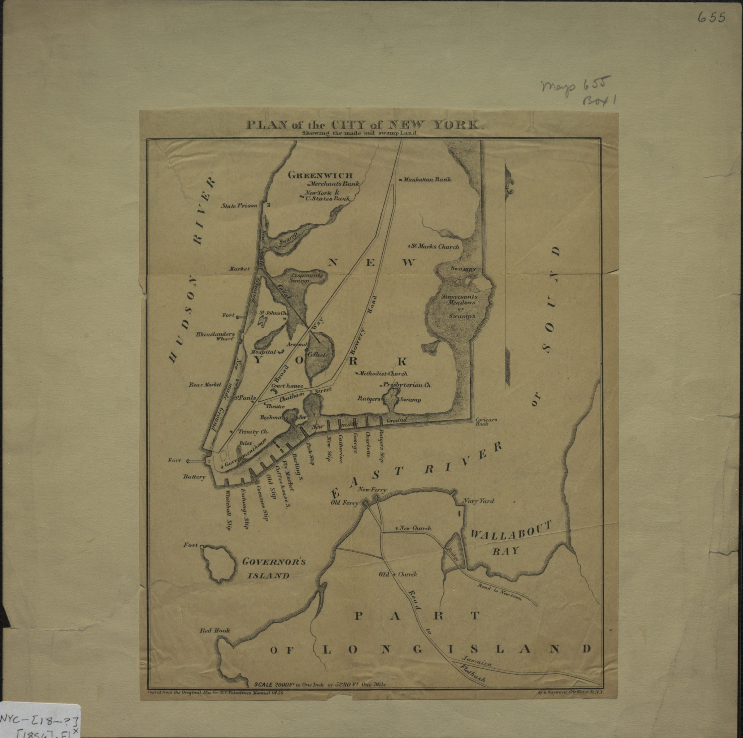
Plan of the city of New York: showing the made and swamp land: copied from the original map … by G. Hayward, 120 Water St. N.Y. [1856]
Map No. NYC-[18--?] (1856).Fl
Facsimile. Covers Manhattan north from the Battery to Greenwich Village also covers Brooklyn north from Red Hook to Wallabout Bay. Shows churches, banks, slips, ferries, markets, and hospitals. “For D.T. Valentine’s Manual, 1856.”
Map area shown
Genre
Historical mapsRelation
Full catalog recordSize
23 × 19 cmDownload
Low Resolution Image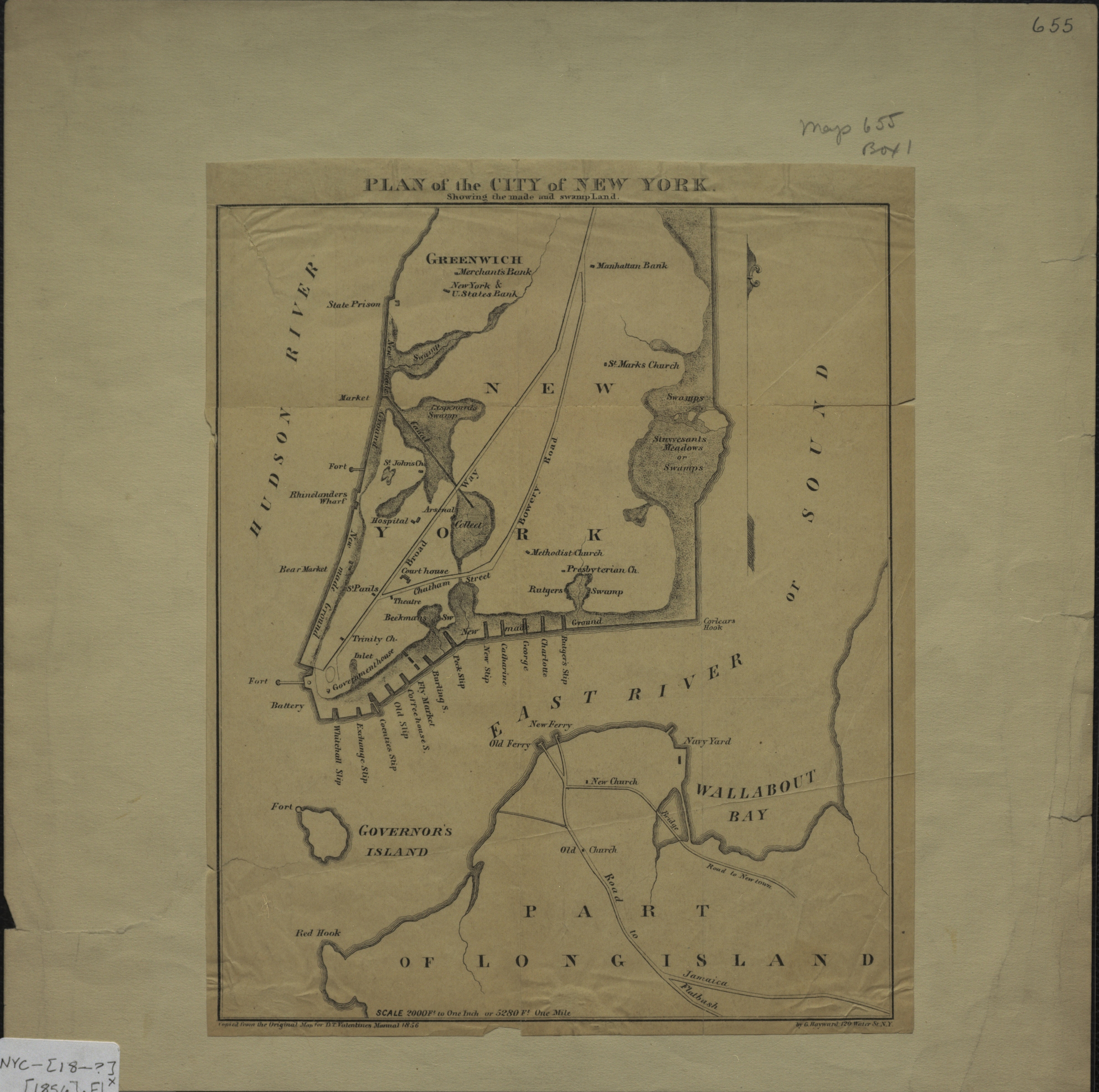
Creator
Hayward, George,Publisher
Brooklyn Historical SocietyCitation
Plan of the city of New York: showing the made and swamp land: copied from the original map … by G. Hayward, 120 Water St. N.Y.; [1856], Map Collection, NYC-[18--?] (1856).Fl; Brooklyn Historical Society.Scale
Scale [24,000] 1 in to 2,Loading zoom image...