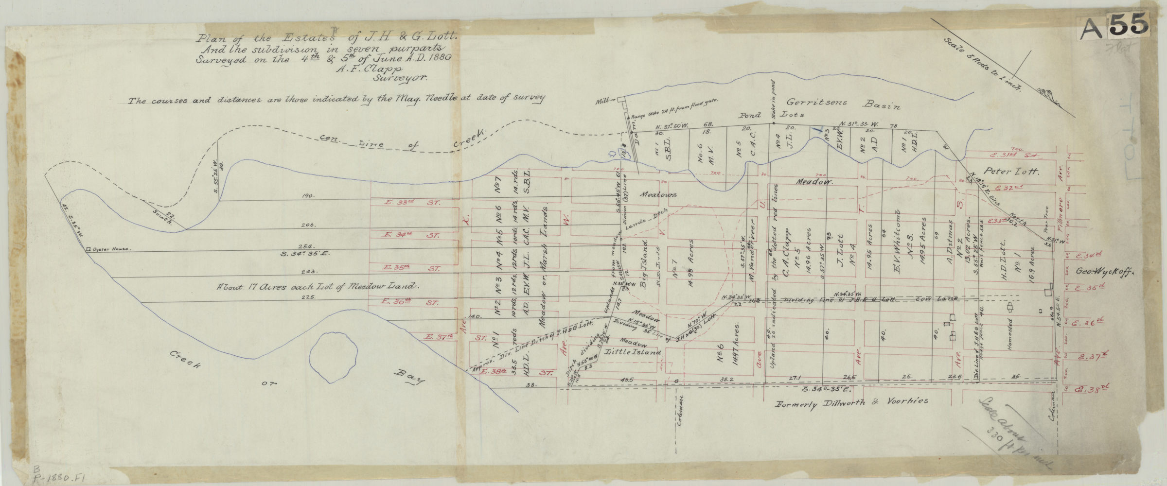
Plan of the estates of J.H. & G. Lott, and the subdivision in seven purparts: surveyed … [by] A.F. Clapp, surveyor June 4 & 5, 1880
Map No. B P-1880.Fl
Cadastral map covering area north from Ave. X to Fillmore Ave. between E. 31st St. and E. 38th St. (modern-day Marine Park). Shows property (including dimensions and buildings), and names of landowners. Oriented with north to the lower right. Includes notes.
Map area shown
Relation
Full catalog recordSize
28 × 71 cmDownload
Low Resolution Image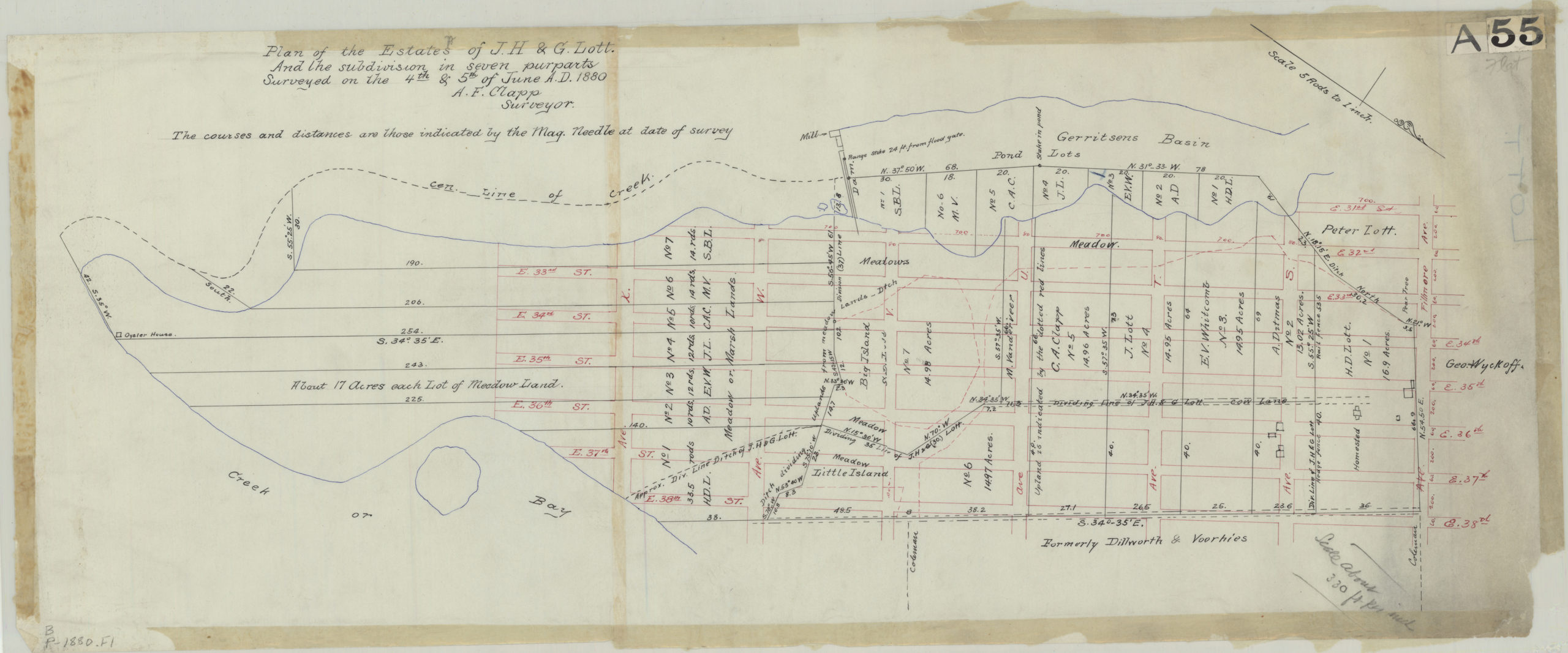
Creator
Clapp, A. F.,Publisher
Brooklyn Historical SocietyCitation
Plan of the estates of J.H. & G. Lott, and the subdivision in seven purparts: surveyed … [by] A.F. Clapp, surveyor; June 4 & 5, 1880, Map Collection, B P-1880.Fl; Brooklyn Historical Society.Scale
Scale [1:990] 1 in to 5 rLoading zoom image... 