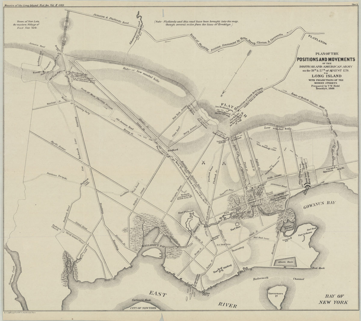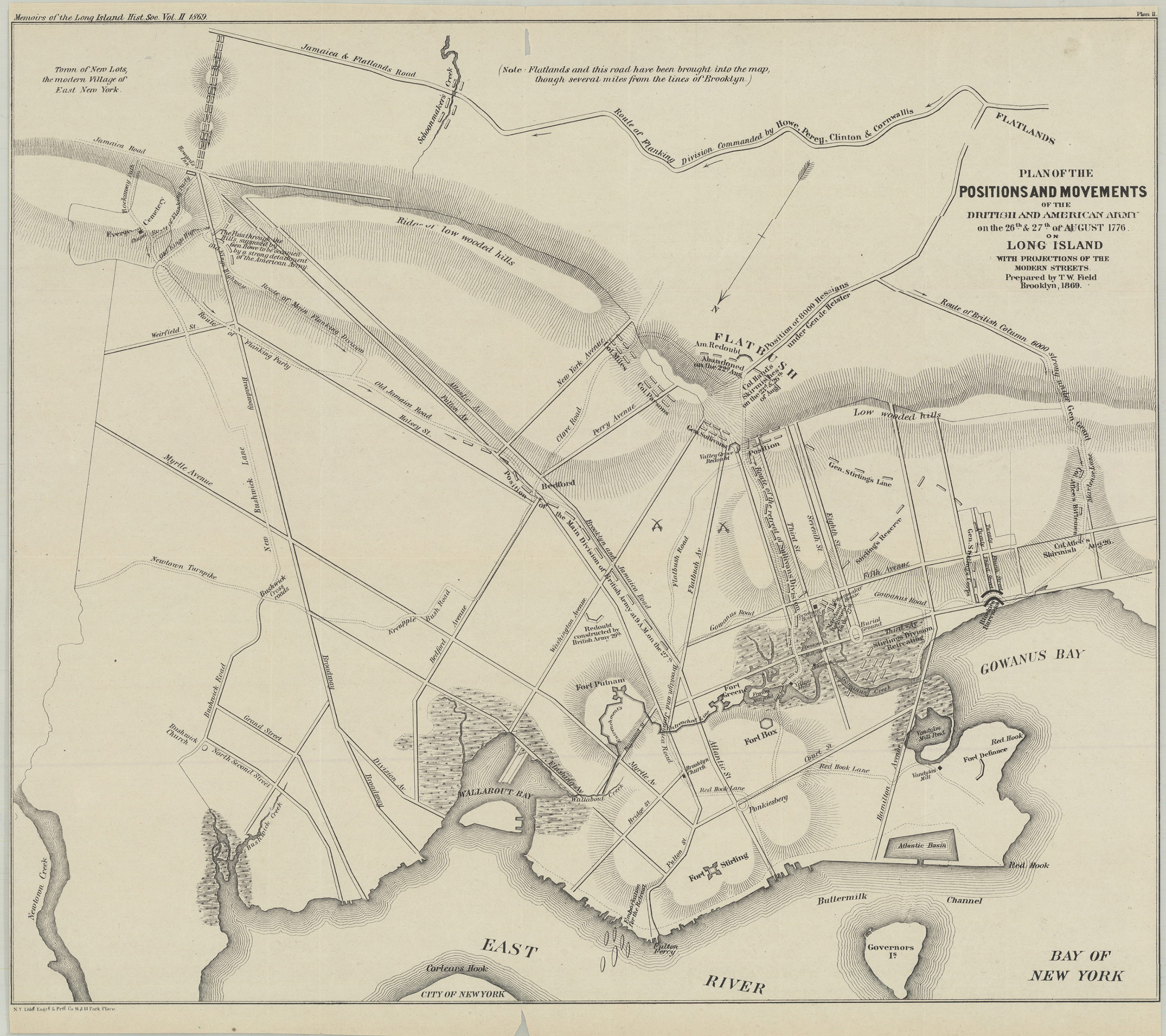
Plan of the positions and movements of the British and American army on the 26th & 27th of August 1776, on Long Island, with projects of the modern streets: prepared by T.W. Field 1869
Map No. Rev. War-1776 (1869).Fl;Rev. War-1776 (1869).Fl c.2
Covers Brooklyn south from Greenpoint to the Gowanus Bay and east to the Jamaica & Flatlands Rd. Relief shown by hachures. Extracted from: Memoirs of the Long Island Historical Society. Vol. II. Brooklyn, N.Y. : Long Island Historical Society, 1869. Oriented with north to the lower left. Includes notes. “Plan II”–Upper left margin. BHS has 2 copies.
Map area shown
Relation
Full catalog recordSize
47 × 55 cmDownload
Low Resolution Image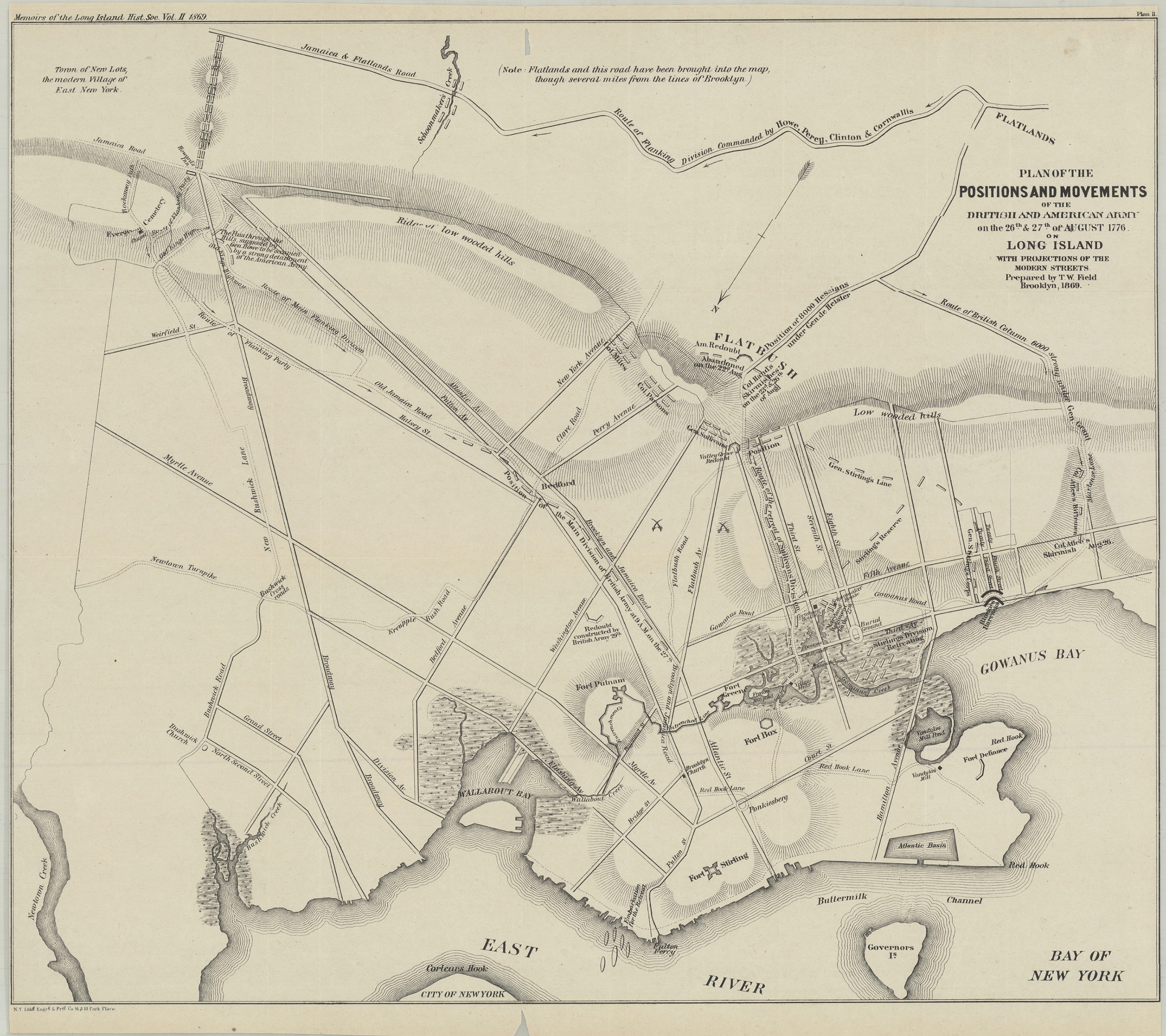
Creator
Field, T. W.,Publisher
Brooklyn Historical SocietyCitation
Plan of the positions and movements of the British and American army on the 26th & 27th of August 1776, on Long Island, with projects of the modern streets: prepared by T.W. Field; 1869, Map Collection, Rev. War-1776 (1869).Fl;Rev. War-1776 (1869).Fl c.2; Brooklyn Historical Society.Scale
Scale not givenLoading zoom image...