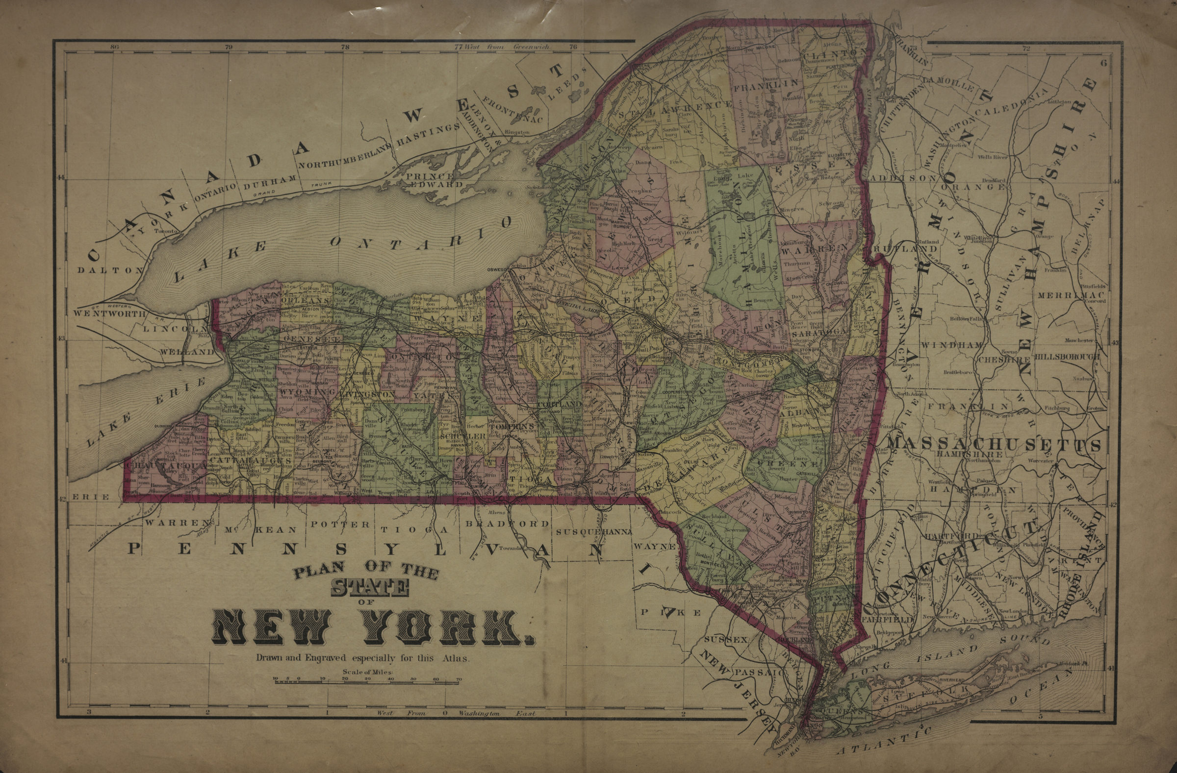
Plan of the state of New York: drawn and engraved especially for this atlas [1873]
Map No. NYS-[1873].Fl
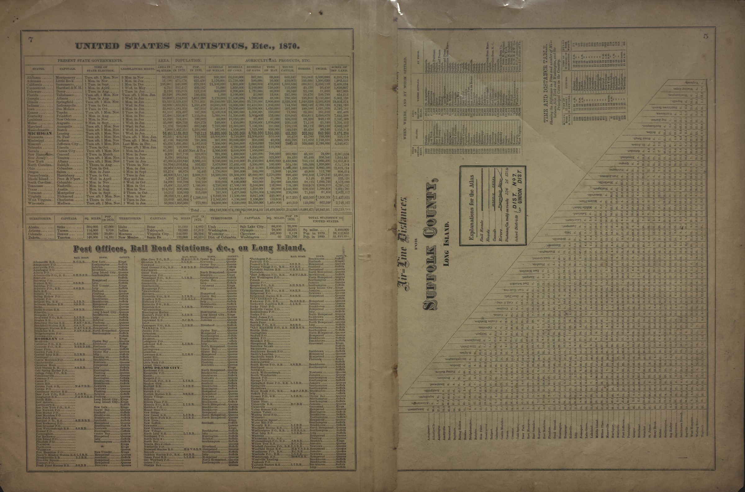
Shows counties and portions of surrounding states. Relief shown by hachures and spot heights (in feet). Extracted from: Atlas of Long Island, New York. New York : Beers, Comstock & Cline, 1873, p. 5-7. Prime meridians: Greenwich and Washington. On verso: United States statistics, etc., 1870 — Post offices, rail road stations, &c., on Long Island — Air-line distances for Suffolk County, Long Island.
Places
Map area shown
Genre
MapRelation
Full catalog recordSize
38 × 54 cmDownload
Low Resolution Image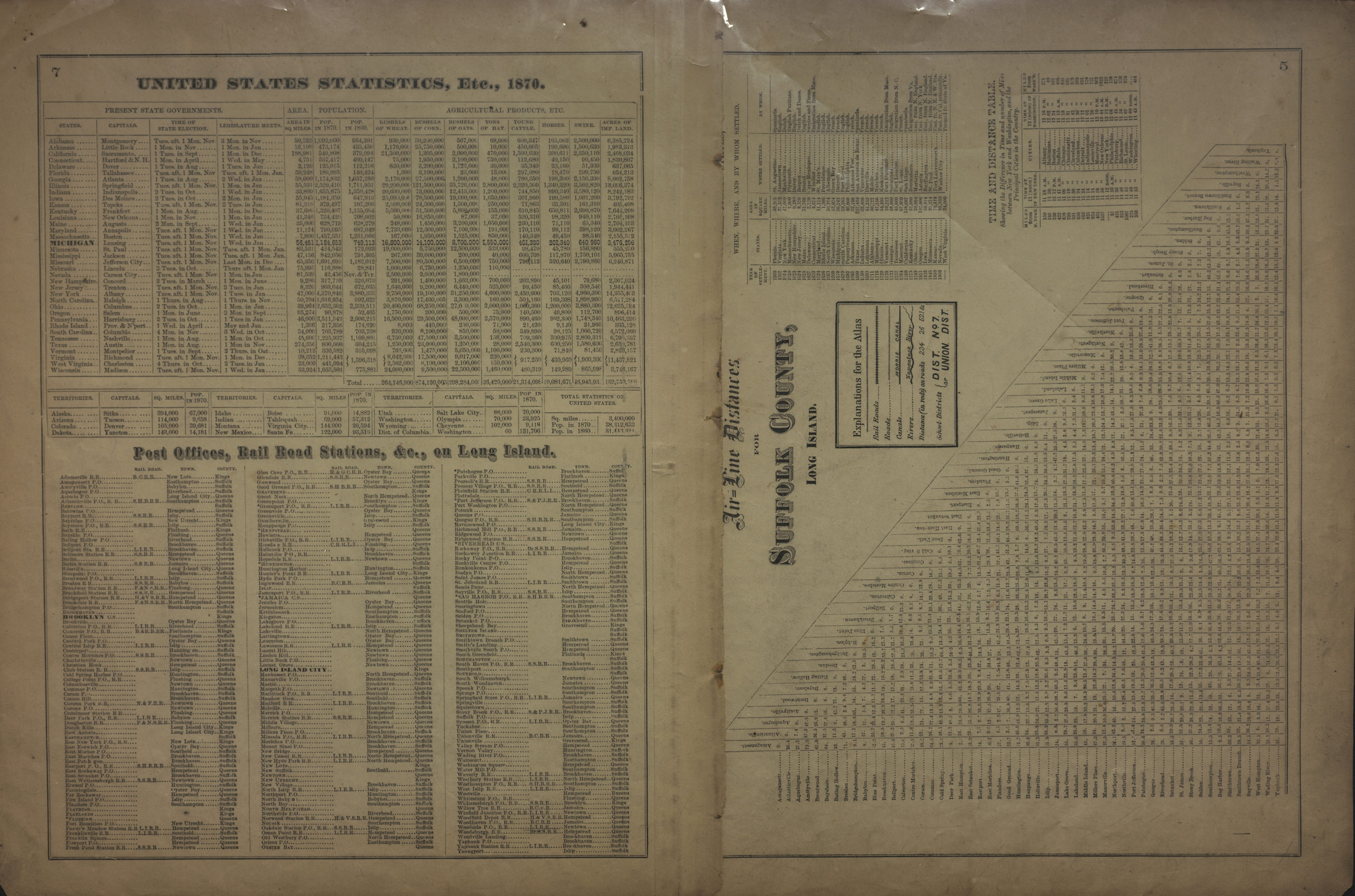
Creator
Beers, F. W.; Beers, Comstock & Cline,Publisher
Brooklyn Historical SocietyCitation
Plan of the state of New York: drawn and engraved especially for this atlas; [1873], Map Collection, NYS-[1873].Fl; Brooklyn Historical Society.Scale
Scale [ca. 1:1,391,435]Loading zoom image... 