
Plan of the village of Brooklyn and part of Long Island 1766 [1864]
Map No. B A-1776 (1864).Fl
Road map. Covers Brooklyn, New York (N.Y.) between Wallabout Bay and Red Hook, Williamsburg to Bedford. Shows buildings, cultivated land. Also shows landforms and streams. Shows relief by hachures. Date of original situation 1766. Date of this reproduction 1864. “…for H. McCloskey’s Manual 1864” NYHS copy creased, soiled, stained, cropped. Mounted verso to verso with another map, M008355. M008356 bound verso to verso with M008355
Genre
Historical mapsRelation
Full catalog recordSize
27 × 42 cmDownload
Low Resolution Image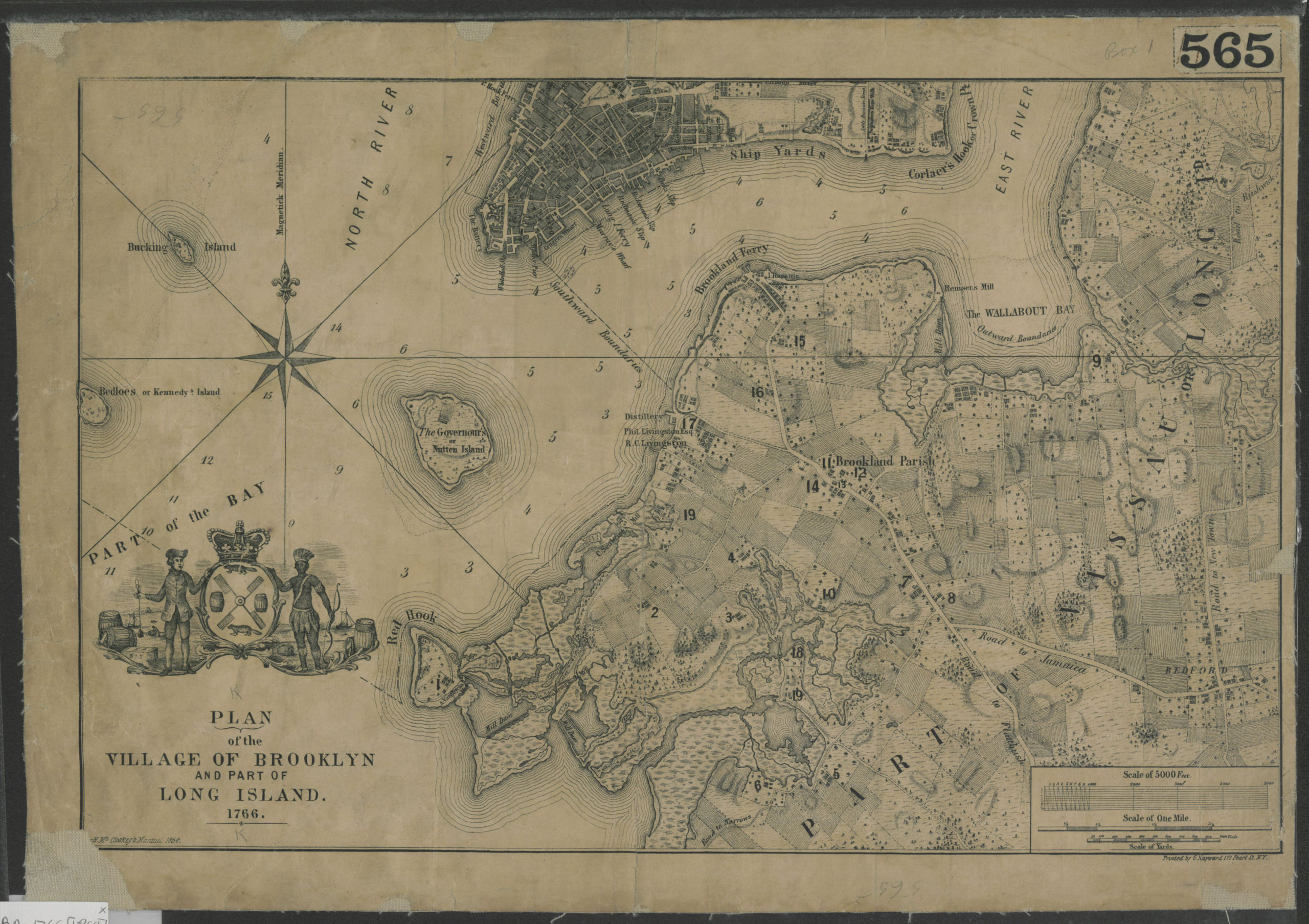
Creator
Hayward, G.; McCloskey, Henry,Publisher
Brooklyn Historical SocietyCitation
Plan of the village of Brooklyn and part of Long Island 1766; [1864], Map Collection, B A-1776 (1864).Fl; Brooklyn Historical Society.Scale
Scale [ca 1:2,200]Loading zoom image... 