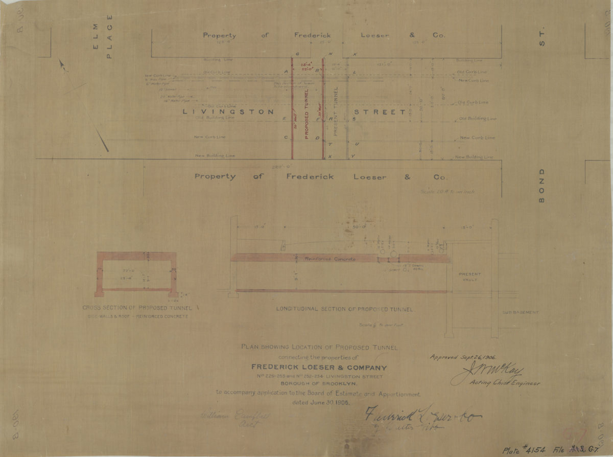
Plan showing location of proposed tunnel connecting the properties of Frederick Loeser & Company, nos. 229-255 and nos. 252-254 Livingston Street, Borough of Brooklyn:dated June 30, 1906 1906
Map No. B A-1906.Fl c.2;B A-1906.Fl
Shows location of proposed and old tunnels underneath Livingston Street between Elm Place and Bond Street. Includes cross section and longitudinal section of proposed tunnel (scale 1/8″ to 1 foot). Signed at bottom: William Campbell, Archt. “Plate # 4154, File G-7.”
Map area shown
Genre
Cadastral mapsRelation
Full catalog recordSize
46 × 62 cmDownload
Low Resolution Image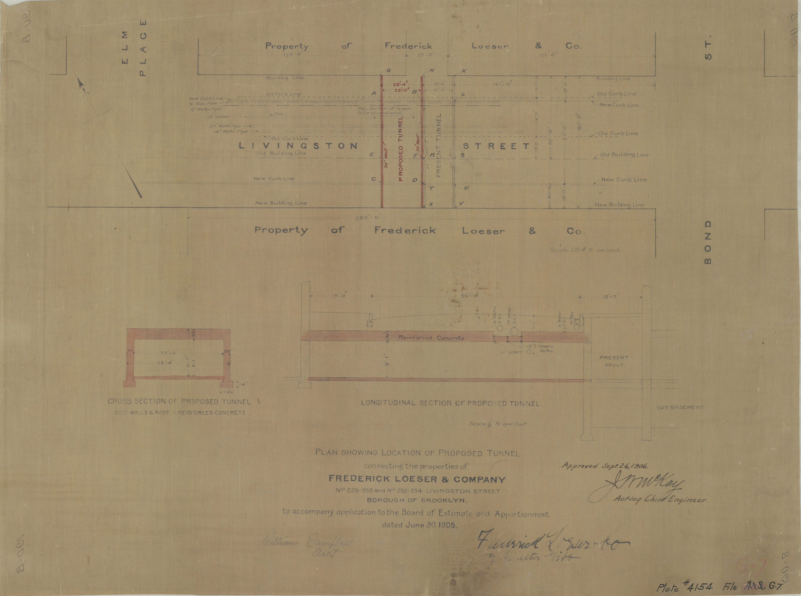
Creator
McKay, J.M,Publisher
Brooklyn Historical SocietyCitation
Plan showing location of proposed tunnel connecting the properties of Frederick Loeser & Company, nos. 229-255 and nos. 252-254 Livingston Street, Borough of Brooklyn:dated June 30, 1906; 1906, Map Collection, B A-1906.Fl c.2;B A-1906.Fl; Brooklyn Historical Society.Scale
Scale [1:610] 1 in to 20Loading zoom image...