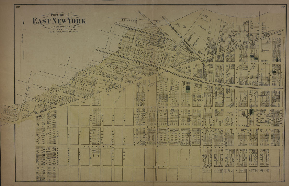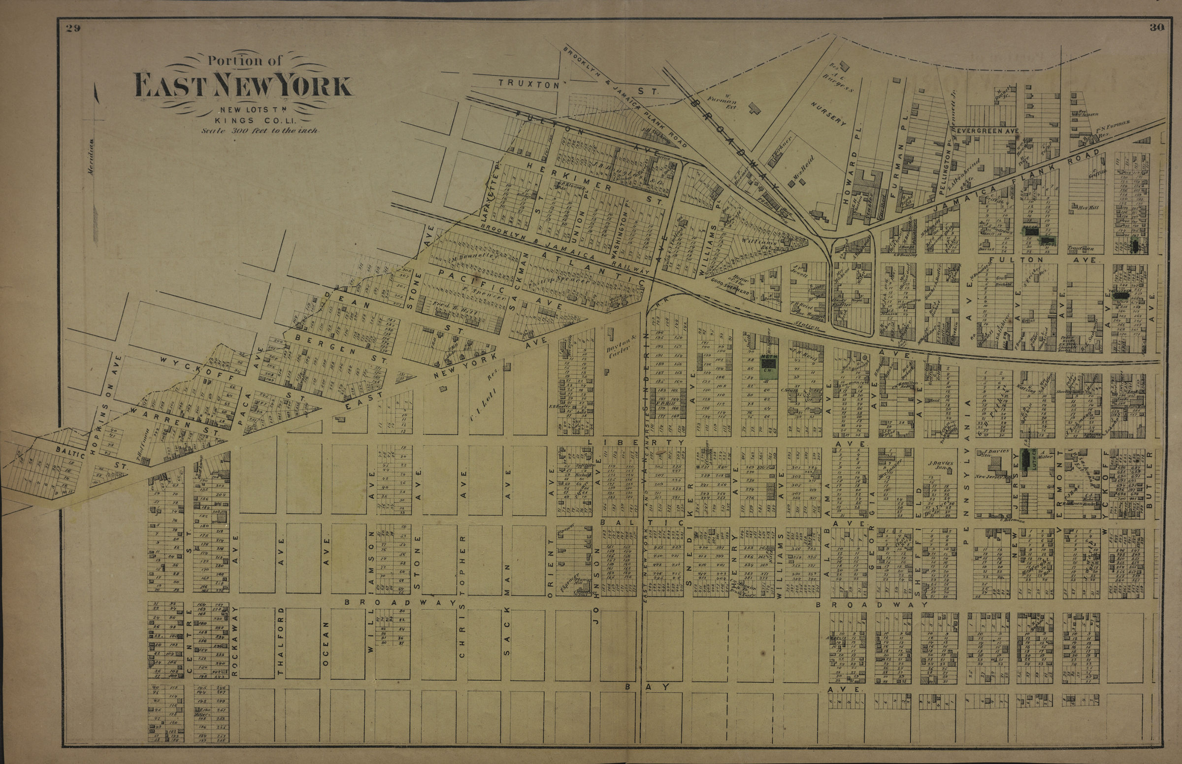
Portion of East New York, New Lots Tn., Kings Co., L.I. [1873]
Map No. B A-[1873]c.Fl
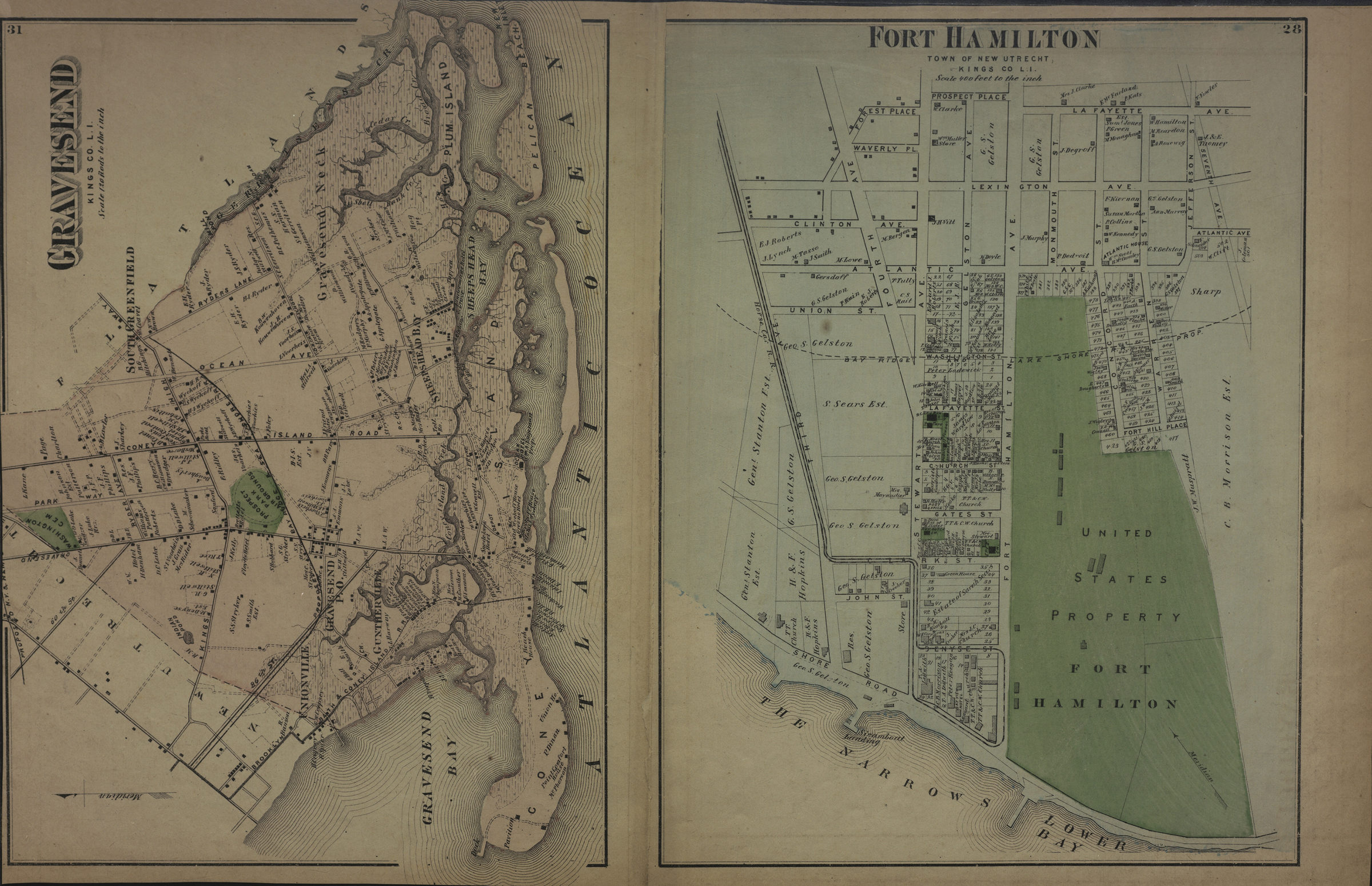
Cadastral map. Covers area north from Bay Ave. to Truxton St. and east from Hopkinson Ave. to Butler Ave. Shows property (including lot numbers and buildings), names of landowners, churches, and railroads. Extracted from: Atlas of Long Island, New York. New York : Beers, Comstock & Cline, 1873, p. 28-31. On verso: 2 ancillary maps. Ancillary maps: Gravesend, Kings Co., L.I. (Scale [1:23,760]. 120 rods to the in.) — Fort Hamilton, twn of New Utrecht, Kings Co., L.I. (Scale [1:4,800]. 400 ft. to the in.).
Subjects
Places
Map area shown
Genre
Cadastral mapsRelation
Full catalog recordSize
35 × 56 cmDownload
Low Resolution Image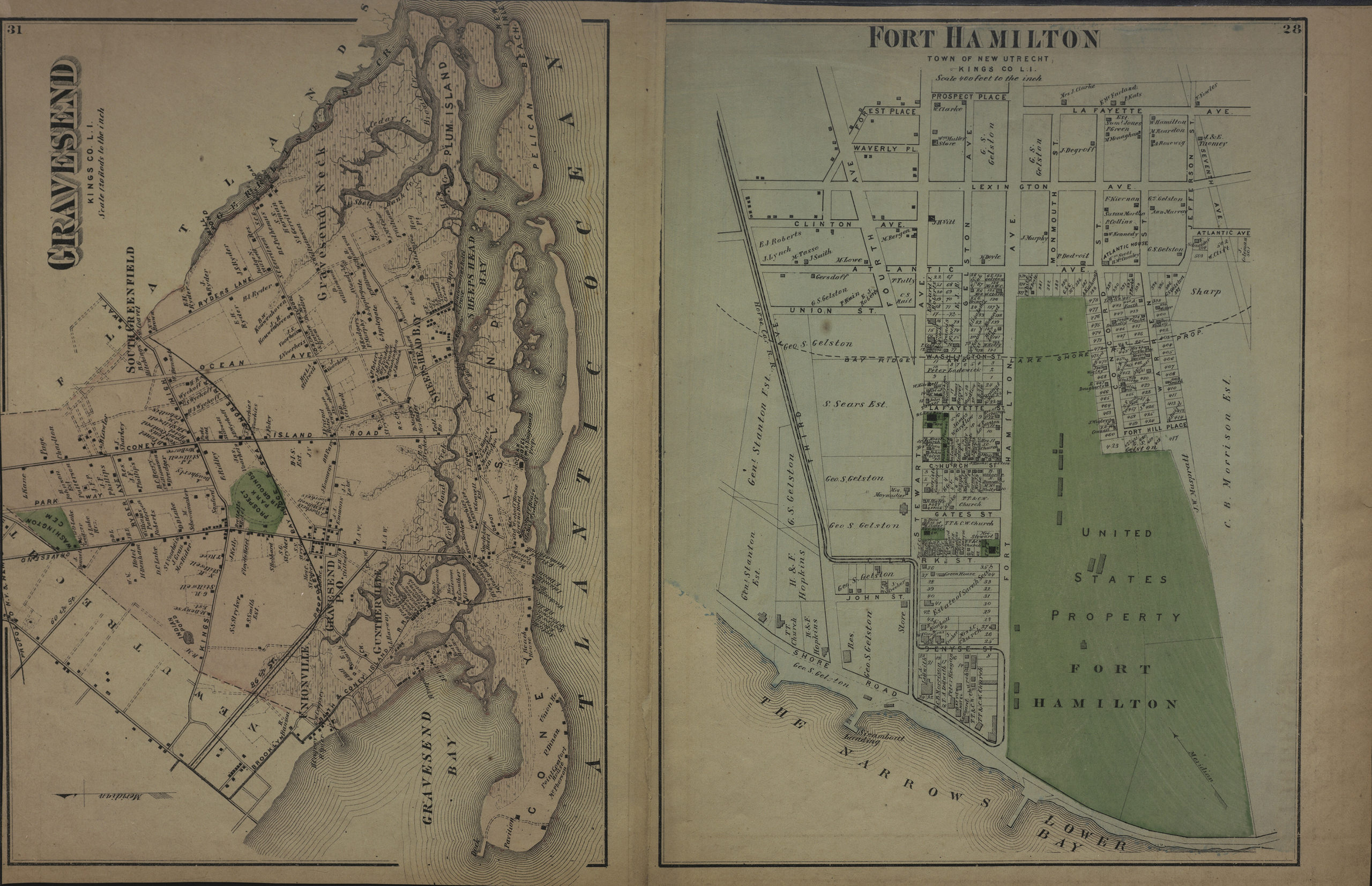
Creator
Beers, F. W.; Beers, Comstock & Cline,Publisher
Brooklyn Historical SocietyCitation
Portion of East New York, New Lots Tn., Kings Co., L.I.; [1873], Map Collection, B A-[1873]c.Fl; Brooklyn Historical Society.Scale
Scale [1:3,600] 1 in to 3Loading zoom image...