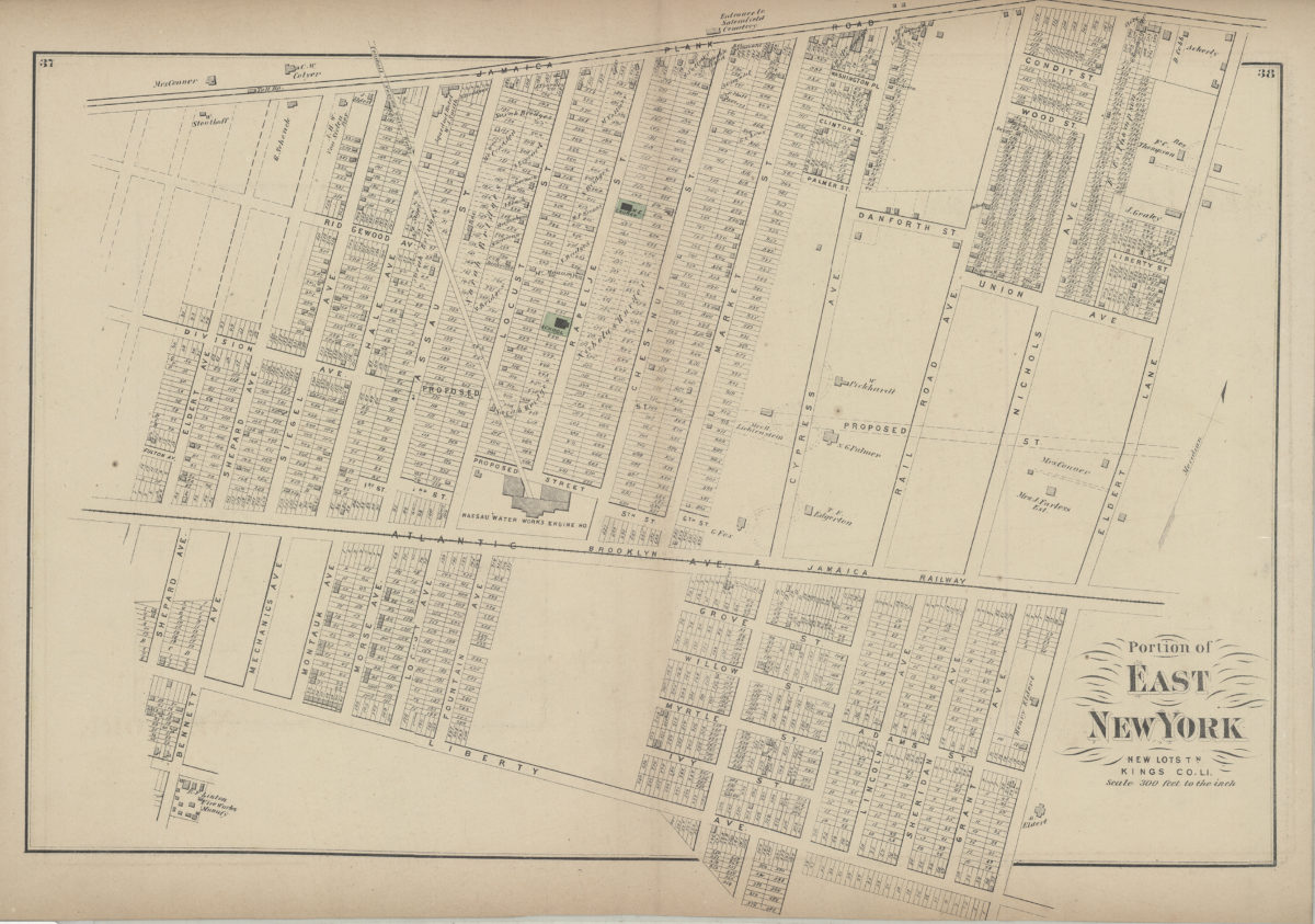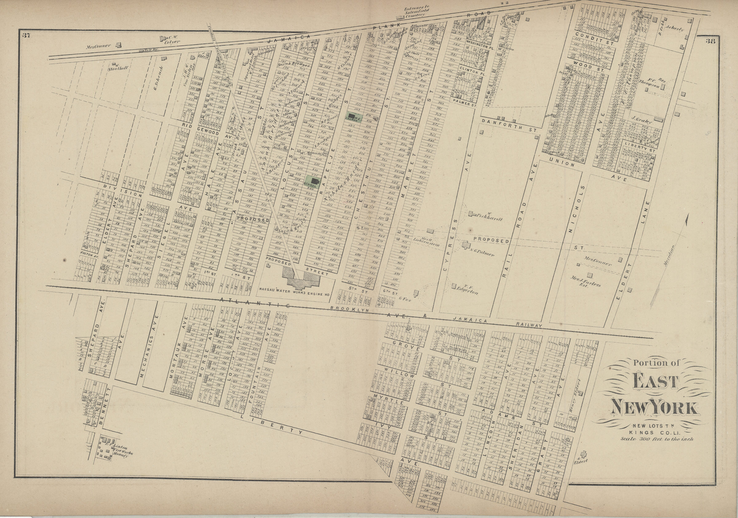

Portion of East New York, New Lots Tn., Kings Co., L.I. [1873]
Map No. B A-[1873]d.Fl
Cadastral map. Covers area north from Liberty Ave. to Jamaica Plank Rd. and east from Shepard Ave. to Eldert Ln. Shows property (including lot numbers and buildings), names of landowners, schools, churches, and the Nassau Water Works Engine House. Extracted from: Atlas of Long Island, New York. New York : Beers, Comstock & Cline, 1873, p. 36-39. On verso: 2 ancillary maps. Ancillary maps: New Lots, Kings Co. (Scale [1:23,760]. 120 rods to the in.) — Canarsie, town of Flatlands, Kings Co. (Scale [1:5,940]. 30 rods to the in.).
Subjects
Places
Map area shown
Genre
Cadastral mapsRelation
Full catalog recordSize
40 × 54 cmDownload
Low Resolution Image
Creator
Beers, F. W.; Beers, Comstock & Cline,Publisher
Brooklyn Historical SocietyCitation
Portion of East New York, New Lots Tn., Kings Co., L.I.; [1873], Map Collection, B A-[1873]d.Fl; Brooklyn Historical Society.Scale
Scale [1:3,600] 1 in to 3Loading zoom image...