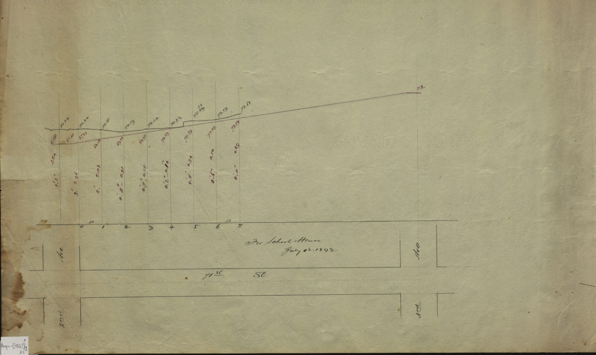
[Profile map of the grade of 71st Street between 2nd Avenue and 3rd Avenue] 1892
Map No. Bergen-[1892?]g.Fl
Grade profile of 1 block in modern-day Bay Ridge. Title devised by cataloger. Attributed to Van Brunt Bergen, based on handwriting on piece. “For school house, July 12, 1892.”
Map area shown
Relation
Full catalog recordSize
21 × 86 cmDownload
Low Resolution Image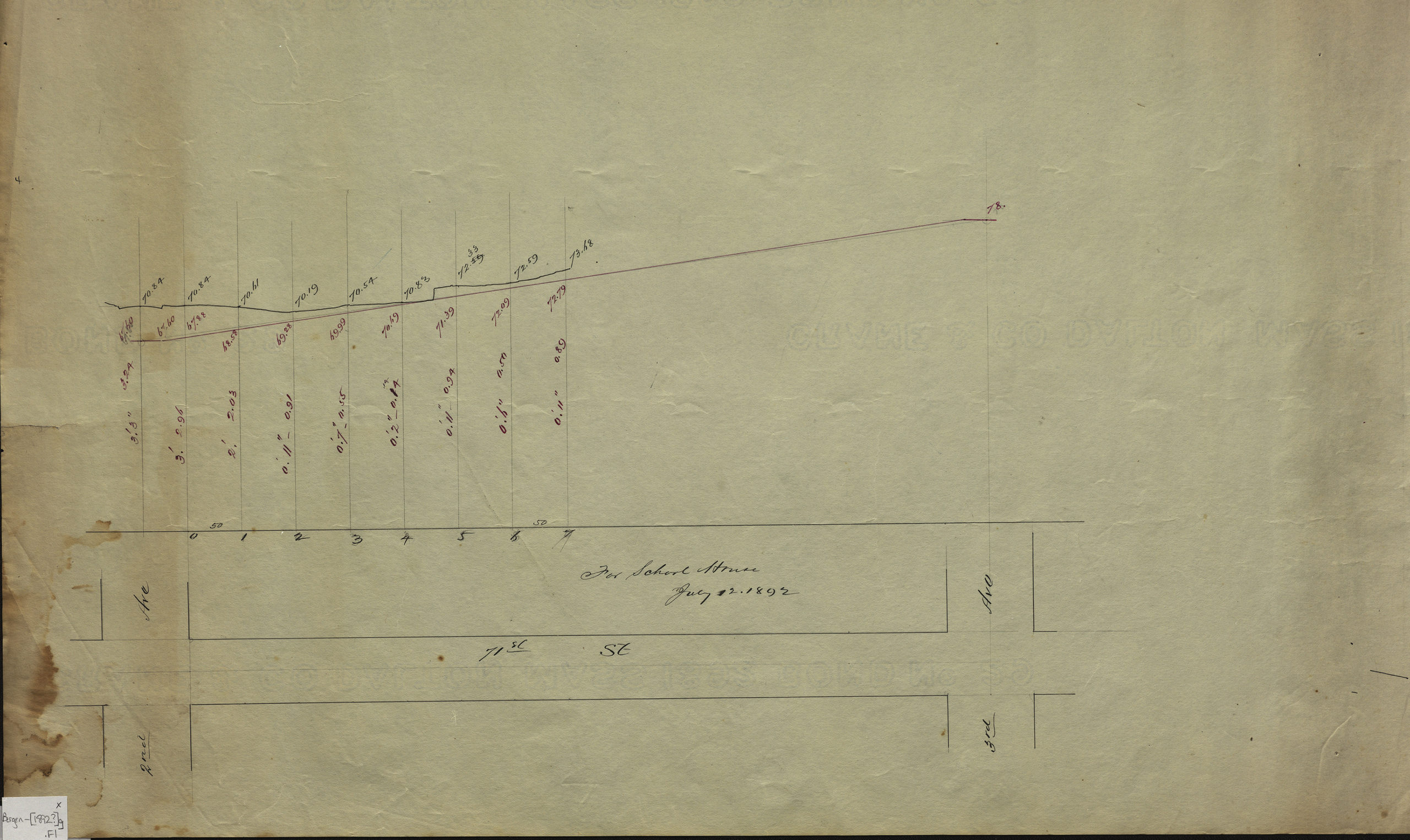
Creator
Bergen, Van Brunt,Publisher
Brooklyn Historical SocietyCitation
[Profile map of the grade of 71st Street between 2nd Avenue and 3rd Avenue]; 1892, Map Collection, Bergen-[1892?]g.Fl; Brooklyn Historical Society.Scale
Scale not givenLoading zoom image...