
[Profile map of the grade of Wakeman Place between 2nd Avenue and 3rd Avenue] [1886]
Map No. Bergen-[18--?]y.Fl
Grade profile of elevation of 1 block in modern-day Bay Ridge. Title devised by cataloger. Attributed to Van Brunt Bergen, based on handwriting on piece. Includes calculations.
Map area shown
Genre
Manuscript mapsRelation
Full catalog recordSize
32 × 58 cmDownload
Low Resolution Image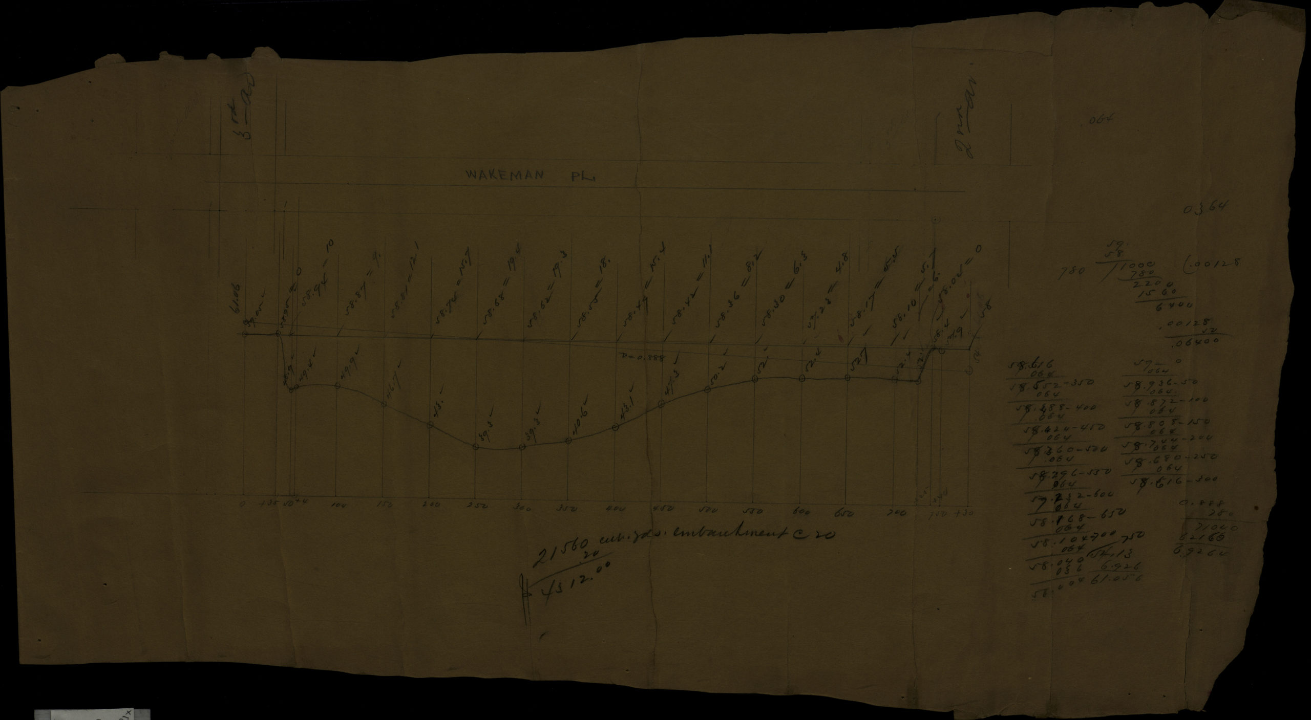
Creator
Bergen, Van Brunt,Publisher
Brooklyn Historical SocietyCitation
[Profile map of the grade of Wakeman Place between 2nd Avenue and 3rd Avenue]; [1886], Map Collection, Bergen-[18--?]y.Fl; Brooklyn Historical Society.Scale
Scale not givenLoading zoom image... 