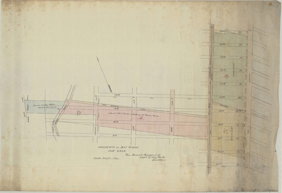
Property at Bay Ridge for sale: Van Brunt Bergen, C.E., Dept. of City Works, Brooklyn [187?]
Map No. B P-[187-?]a.Fl
Cadastral map covering area north from 83rd. St. to 73rd St. and east from New York Bay to 4th Ave. Shows property (including dimensions), and a railroad. Oriented with north to the upper left.
Map area shown
Relation
Full catalog recordSize
50 × 71 cmDownload
Low Resolution Image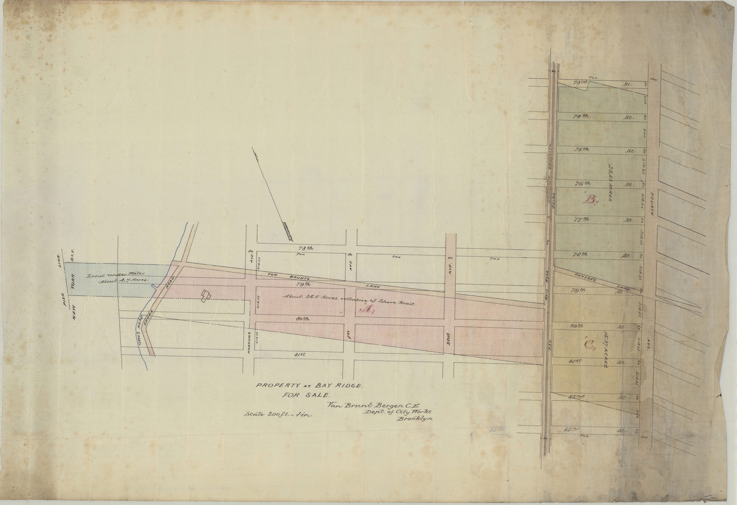
Creator
Bergen, Van Brunt,Publisher
Brooklyn Historical SocietyCitation
Property at Bay Ridge for sale: Van Brunt Bergen, C.E., Dept. of City Works, Brooklyn; [187?], Map Collection, B P-[187-?]a.Fl; Brooklyn Historical Society.Scale
Scale [1:2,400] 1 in to 2Loading zoom image...