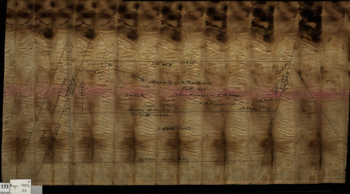
Property of D. Van Brunt, Sept. 1887, from surveys of T.G. Bergen: V. B. Bergen, C.E. Sept 1887
Map No. Bergen-1887b.Fl
Cadastral survey map covering area along Ft. Hamilton Ave. near Stewart Ave., in modern-day Bay Ridge. Shows property. Otriented with north to the upper left. Area covered identical to: Line between D. & J. Van Brunt (Bergen-[1887?]a.Fl), ), also held by BHS.
Map area shown
Relation
Full catalog recordSize
23 × 42 cmDownload
Low Resolution Image
Creator
Bergen, Van Brunt,Publisher
Brooklyn Historical SocietyCitation
Property of D. Van Brunt, Sept. 1887, from surveys of T.G. Bergen: V. B. Bergen, C.E.; Sept 1887, Map Collection, Bergen-1887b.Fl; Brooklyn Historical Society.Scale
Scale not givenLoading zoom image...