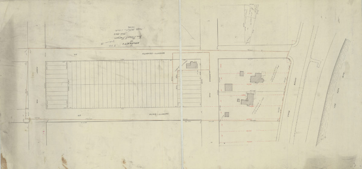
Property of Van Brunt Bergen Feb-03
Map No. B P-1903.Fl
Cadastral map covers 77th Street from the Shore Road to 1st Avenue in modern-day Bay Ridge. Shows buildings, lots (including dimensions), and names of landowners. Dissected and mounted on linen. Attributed to Van Brunt Bergen based on handwriting on piece.
Map area shown
Relation
Full catalog recordSize
41 × 84 cmDownload
Low Resolution Image
Creator
Bergen, Van Brunt,Publisher
Brooklyn Historical SocietyCitation
Property of Van Brunt Bergen; Feb-03, Map Collection, B P-1903.Fl; Brooklyn Historical Society.Scale
Scale [1:600] 1 in to 50Loading zoom image...