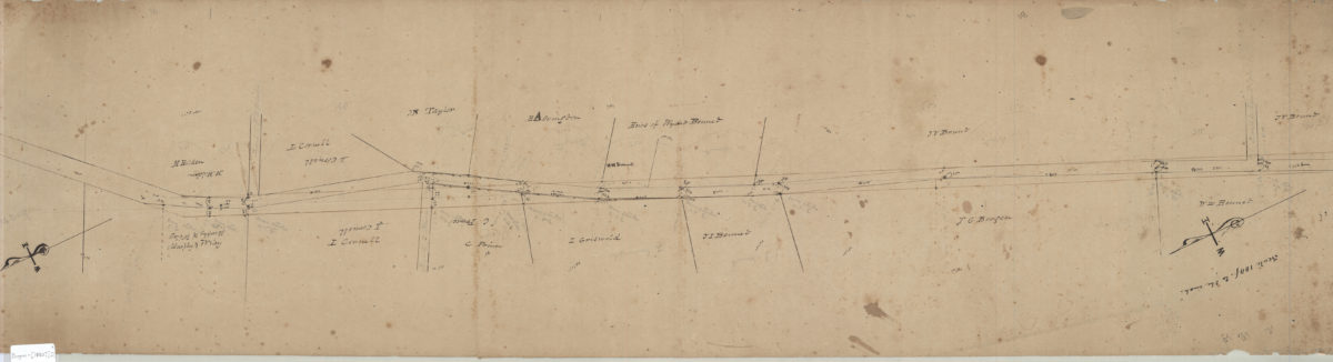
Proposed altered & widened road from 3rd Ave. to … [text illegible] Douglas, preliminary survey made about 1850 [ca. 1850]
Map No. Bergen-[1850?].Fl
Cadastral survey map likely covering modern-day Bay Ridge. Shows property and names of landowners. Verso title. Likely attributed to T.G. Bergen, based on handwriting on piece. Oriented with north to the lower left. Includes notes and calculations.
Subjects
Places
Map area shown
Relation
Full catalog recordSize
28 × 110 cmDownload
Low Resolution Image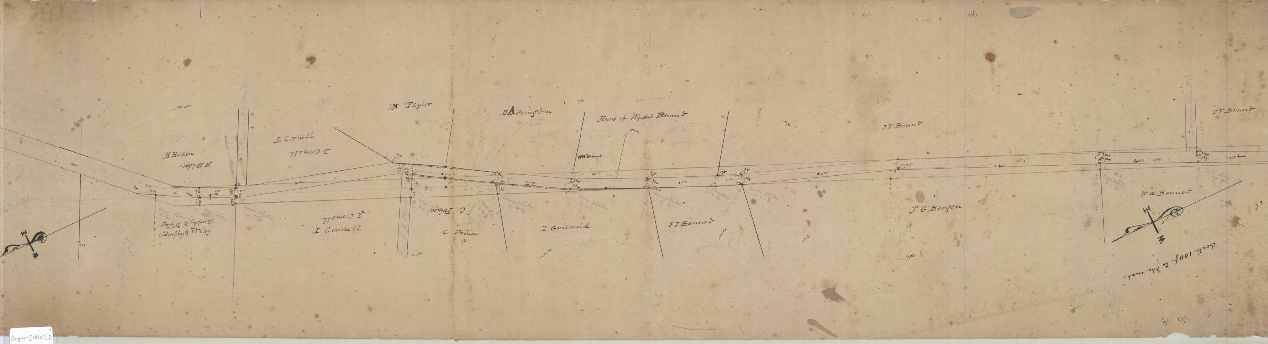
Creator
Bergen, Teunis G.,Publisher
Brooklyn Historical SocietyCitation
Proposed altered & widened road from 3rd Ave. to … [text illegible] Douglas, preliminary survey made about 1850; [ca. 1850], Map Collection, Bergen-[1850?].Fl; Brooklyn Historical Society.Scale
Scale [1:1,200] 1 in to 1Loading zoom image...