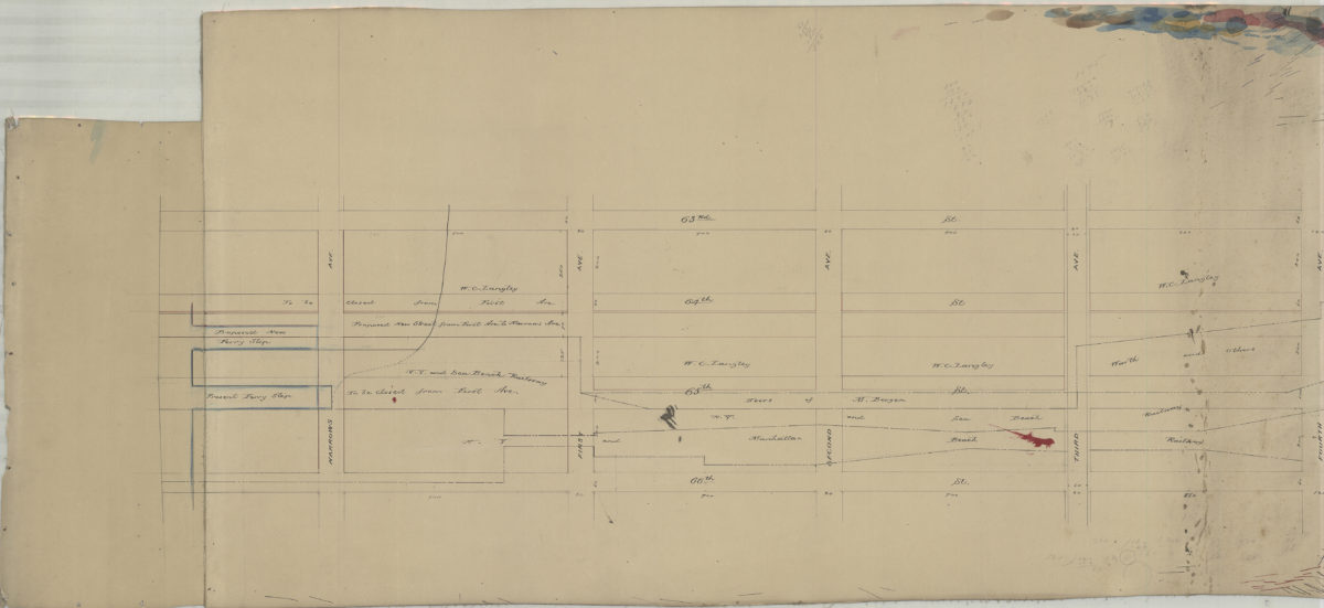
Proposed changes at … [text illegible] 65th St June 1889
Map No. Bergen-1889a.Fl
Survey map covering area north from 66th St. to 63rd St. and east from New York Bay to 4th Ave. (modern-day Sunset Park). Shows proposed streets, ferry slips, railroads, and names of landowners. Verso title. Likely attributed to Van Brunt Bergen, based on handwriting on piece. Irregularly shaped.
Map area shown
Genre
Manuscript mapsRelation
Full catalog recordSize
48 × 108 cmDownload
Low Resolution Image
Creator
Bergen, Van Brunt,Publisher
Brooklyn Historical SocietyCitation
Proposed changes at … [text illegible] 65th St; June 1889, Map Collection, Bergen-1889a.Fl; Brooklyn Historical Society.Scale
Scale not givenLoading zoom image...