Proposed Park Slope historic district [1973]
Map No. B A-[197-?].Fl
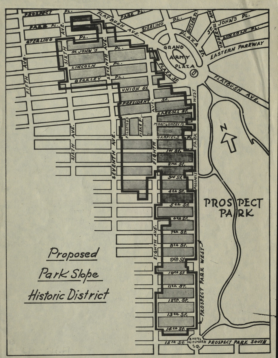
Covers proposed Park Slope Historic District from Prospect Place to 14th Street, and from Sixth Avenue to Prospect Park West. Also covers Grand Army Plaza and western portion of Prospect Park. Shows street names, with proposed historic district outlined in black and shaded in gray.
Map area shown
Genre
Zoning mapsRelation
Full catalog recordSize
28 × 22 cmDownload
Low Resolution Image
Creator
Publisher
Brooklyn Historical SocietyCitation
Proposed Park Slope historic district; [1973], Map Collection, B A-[197-?].Fl; Brooklyn Historical Society.Scale
Scale not givenLoading zoom image...