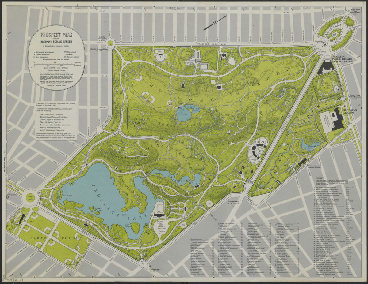
Prospect Park and the Brooklyn Botanic Garden: by George Colbert and Guenther Vollath [ca. 1972]
Map No. B PP-1972.Fl
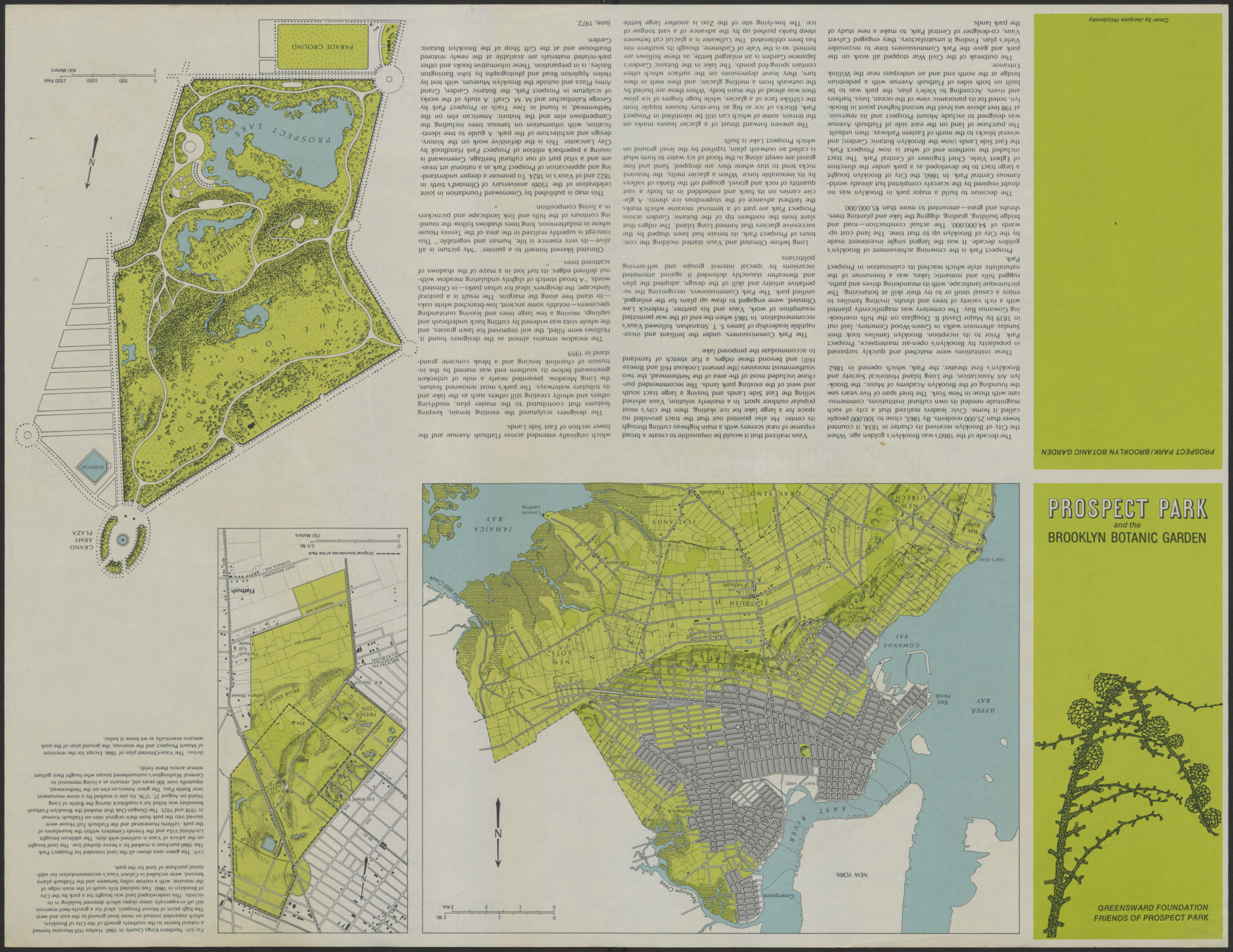
Shows monuments and statues, subway entrances, playgrounds, shelters, comfort stations, important trees, surrounding streets. Relief shown by contours and spot heights. “Reduced from Park dept. plans 1934-66. Feild checked by GC 1970-71.” “Coordinates are those of the Mossman System.” Published by Greensward Foundation, Inc. for the friends of Prospect Park. Includes index and tree list compiled by M.M. Graff. On verso: text, ill., and ancillary maps: Northern Kings County in 1860, Land intended for Prospect Park, and the Vaux-Olmsted plan of 1866.
Map area shown
Genre
Thematic mapsRelation
Full catalog recordSize
42 × 55 cmDownload
Low Resolution Image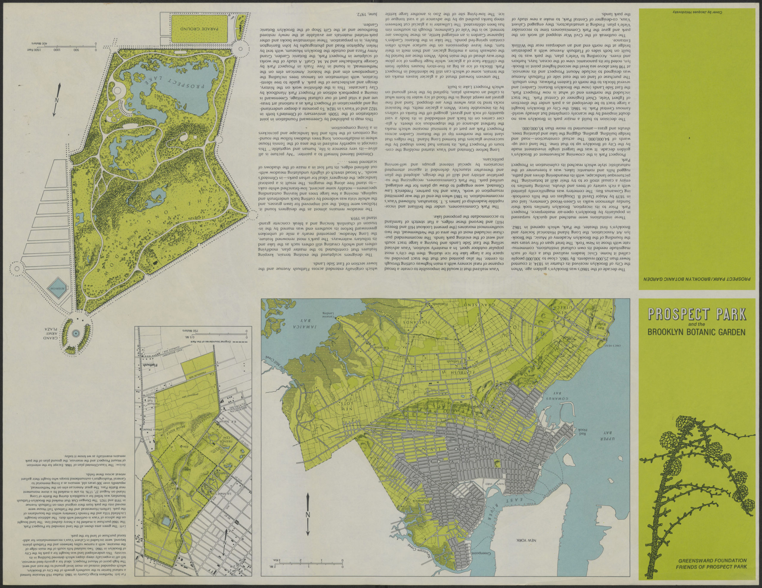
Creator
Colbert, George,Publisher
Brooklyn Historical SocietyCitation
Prospect Park and the Brooklyn Botanic Garden: by George Colbert and Guenther Vollath; [ca. 1972], Map Collection, B PP-1972.Fl; Brooklyn Historical Society.Scale
Scale [ca. 1:4,750]Loading zoom image...