Prospect Park and the Brooklyn Botanic Garden: by George Corbert and Guenter Vollath [ca. 1990]
Map No. B PP-1990.Fl c.2;B PP-1990.Fl
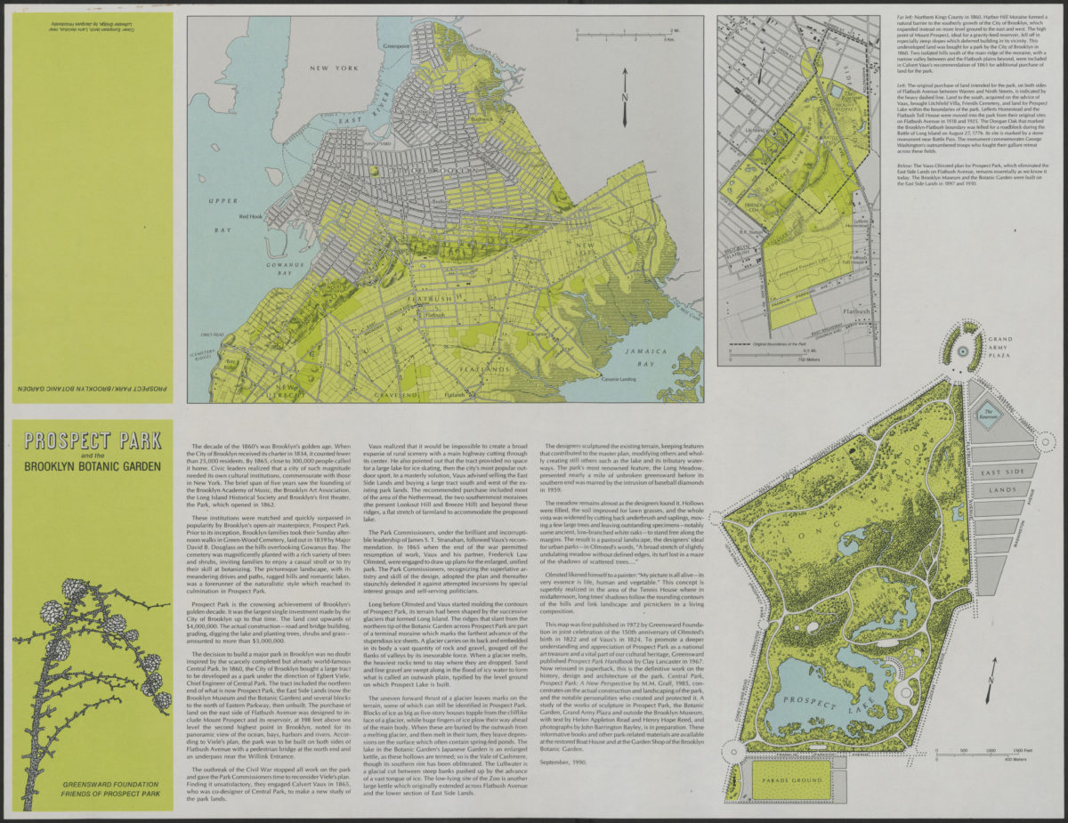
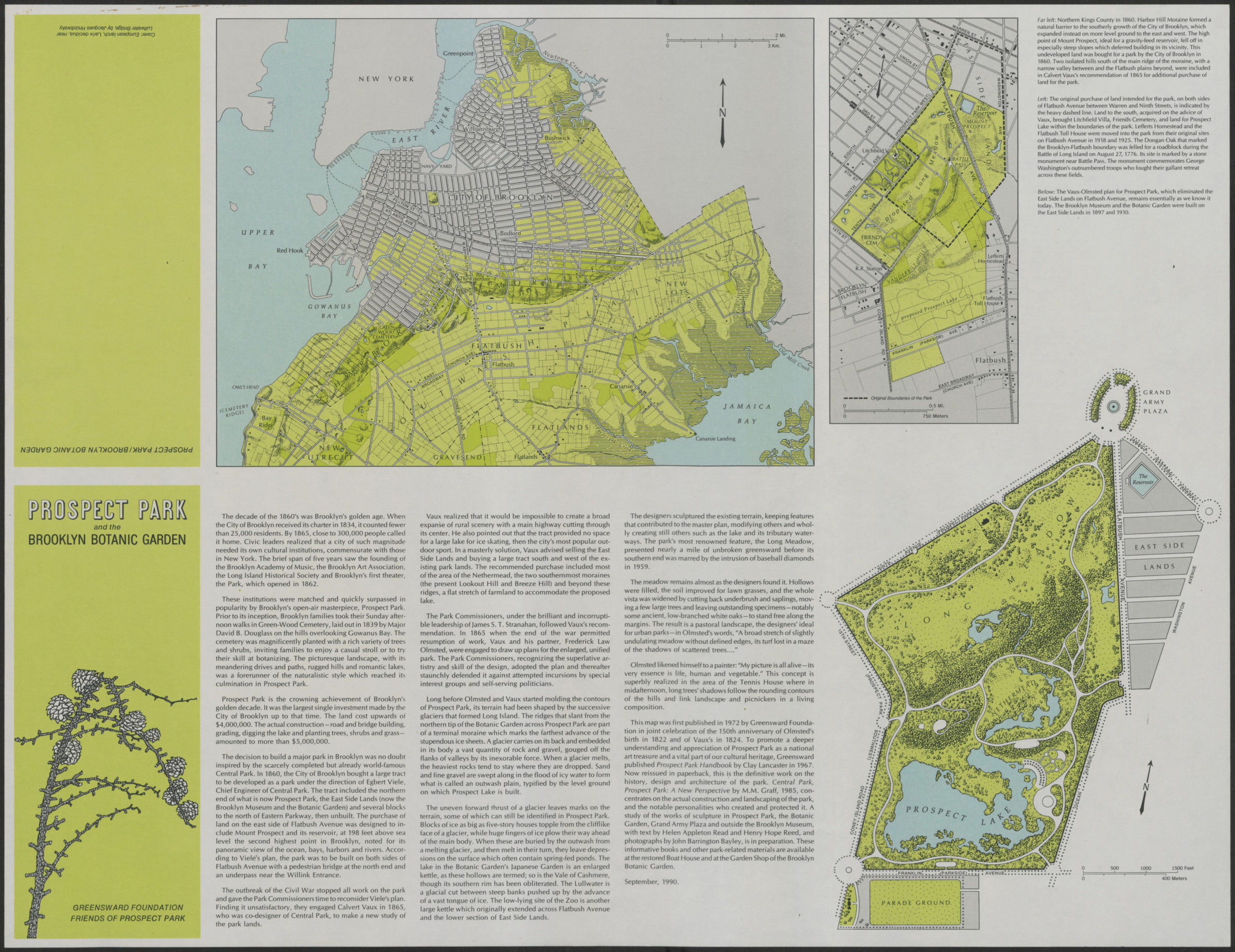
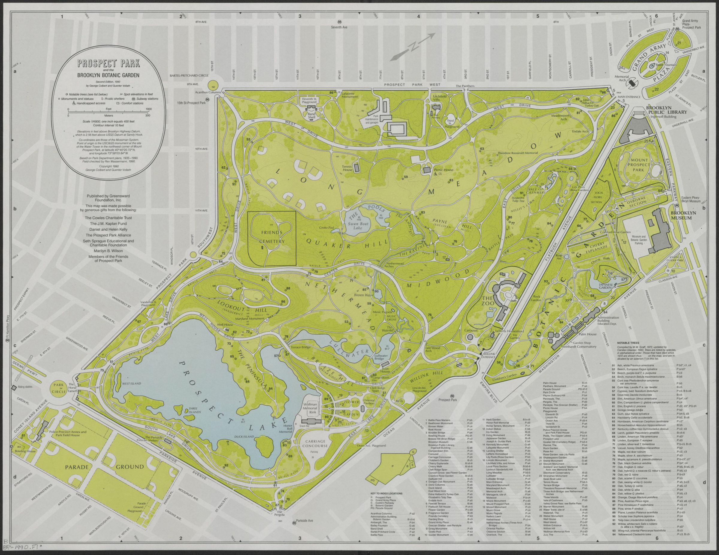
Shows monuments and statues, subway entrances, playgrounds, shelters, comfort stations, important trees, surrounding streets. Relief shown by contours and spot heights. “Based on Park Department plans, 1935-1990. Field checked by Rex Wassermann, 1990.” “Coordinates are those of the Mossman System.” Published by Greensward Foundation, Inc. for the friends of Prospect Park. Includes tree list compiled by M.M. Graff updated by Carsten Glaeser. On verso: text, ill., and ancillary maps: Northern Kings County in 1860, Land intended for Prospect Park, and the Vaux-Olmsted plan of 1866. BHS copy 2 originally part of the collection of Everett and Evelyn Ortner papers and photographs (ARC.306).
Map area shown
Genre
Thematic mapsRelation
Full catalog recordSize
42 × 55 cmDownload
Low Resolution Image
Creator
Colbert, George,Publisher
Brooklyn Historical SocietyCitation
Prospect Park and the Brooklyn Botanic Garden: by George Corbert and Guenter Vollath; [ca. 1990], Map Collection, B PP-1990.Fl c.2;B PP-1990.Fl; Brooklyn Historical Society.Scale
Scale 1:4,800. 1 in to 40Loading zoom image...