Prospect Park and the Brooklyn Botanic Garden [1990; 1990]
Map No. B PP-1990a.Fl
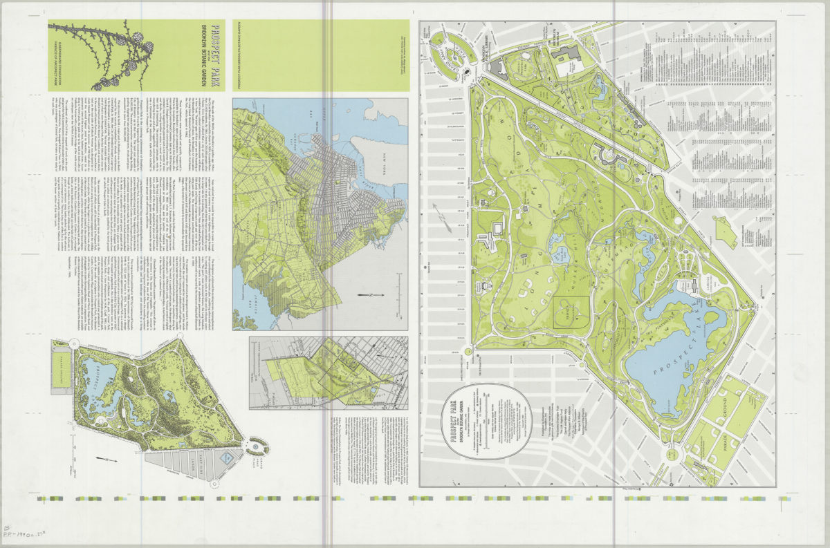
Panel title. Prospect Park map shows monuments and statues, subway entrances, playgrounds, shelters, comfort stations, important trees, surrounding streets. Relief shown by contours and spot heights. Map attributed to George Colbert and Guenter Vollath. Published by Greensward Foundation, Inc. for the friends of Prospect Park. Printer’s proof of the published map, 1990. Includes text, illustrations, index and tree list compiled by M. M. Graff updated by Carsten Glaeser. Prospect Park and the Brooklyn Botanic Garden — Northern Kings County in 1860 — Land intended for Prospect Park — The Vaux-Olmsted plan of 1866.
Map area shown
Genre
Thematic mapsRelation
Full catalog recordSize
97 × 64 cmDownload
Low Resolution Image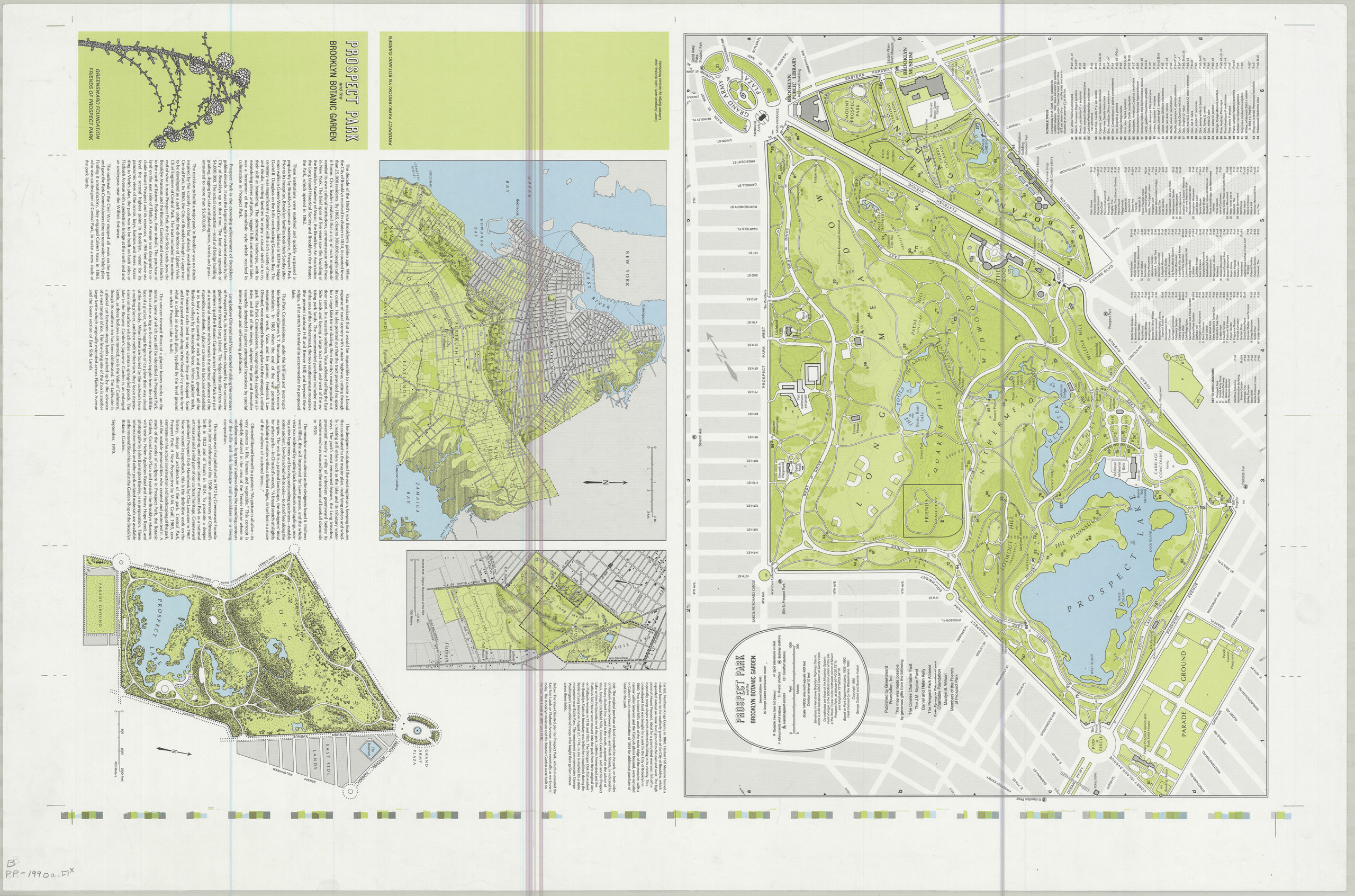
Creator
Colbert, George,Publisher
Brooklyn Historical SocietyCitation
Prospect Park and the Brooklyn Botanic Garden; [1990; 1990], Map Collection, B PP-1990a.Fl; Brooklyn Historical Society.Scale
Scales differLoading zoom image...