Prospect Park map 2005
Map No. B PP-2005.Fl
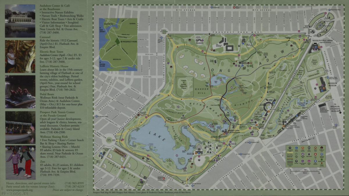
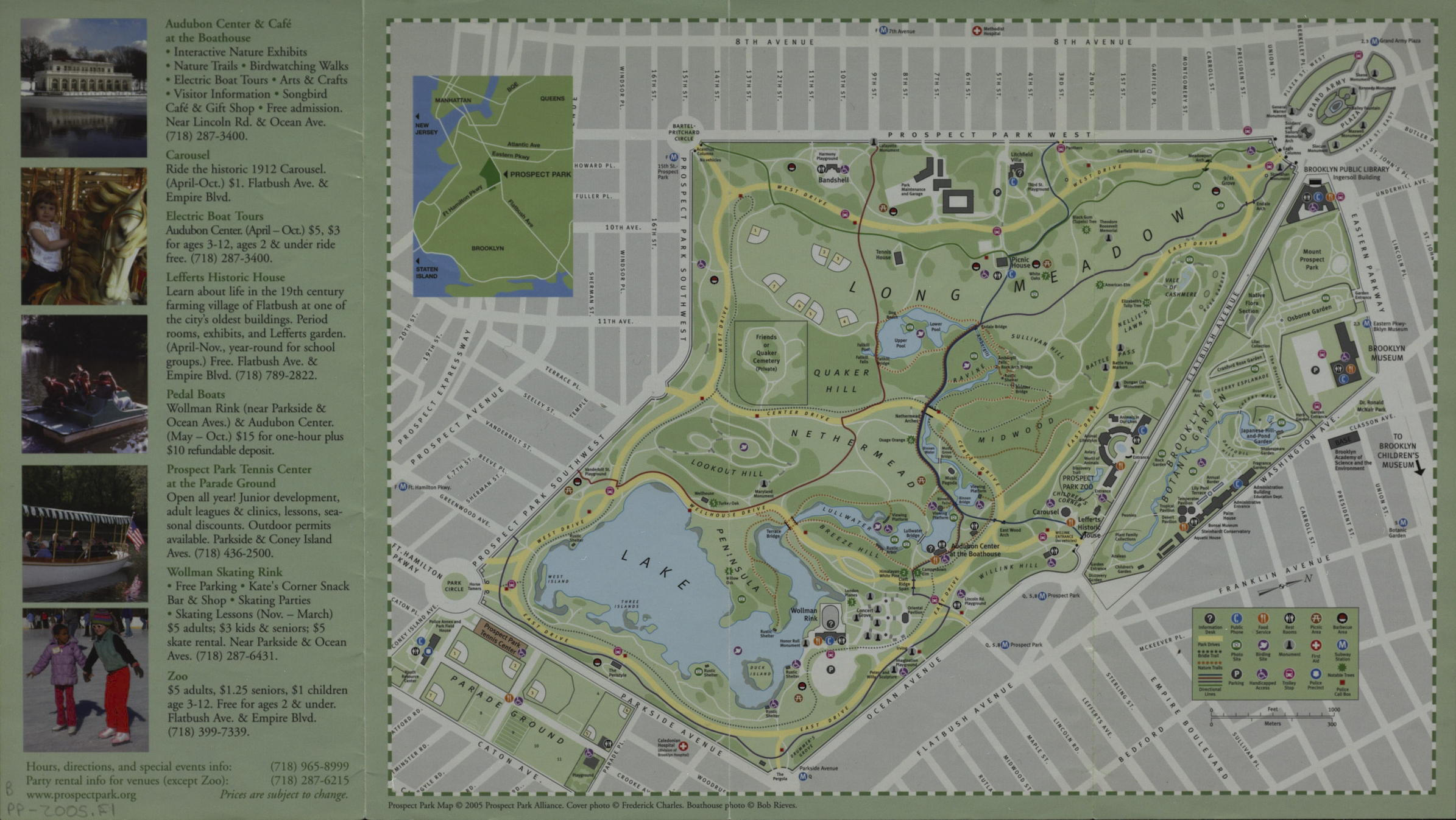
Map shows roads, paths, lakes, ponds, location of public buildings, and amenities in Prospect Park. Title from panel. Includes text, color illustrations, directory of buildings, and inset location map. On verso: illustrations, lists of annual park events, notable trees, and community sponsors of the park.
Map area shown
Genre
Tourist mapsRelation
Full catalog recordSize
23 × 41 cmDownload
Low Resolution ImageCreator
Prospect Park Alliance,Publisher
Brooklyn Historical SocietyCitation
Prospect Park map; 2005, Map Collection, B PP-2005.Fl; Brooklyn Historical Society.Scale
Scale not givenLoading zoom image...