
Railroad terminal map of New York Harbor [ca. 1933]
Map No. NYC-1933.Fl.O
Covers 5 boroughs of New York City and portion of northern New Jersey. Shows commercial and passenger rail lines, railroad terminals and waterfront commercial terminals.
Map area shown
Genre
Transportation mapsRelation
Full catalog recordSize
110 × 92 cmDownload
Low Resolution Image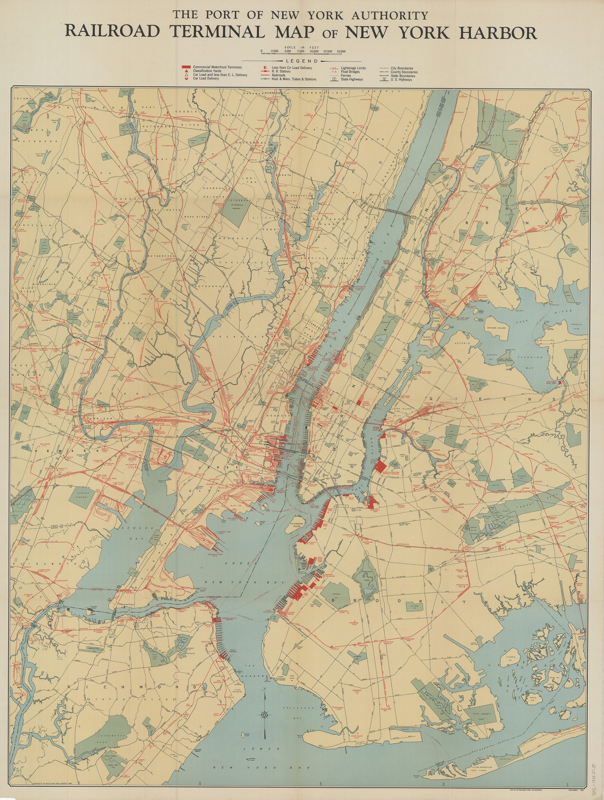
Creator
Port of New York Authority,Publisher
Brooklyn Historical SocietyCitation
Railroad terminal map of New York Harbor; [ca. 1933], Map Collection, NYC-1933.Fl.O; Brooklyn Historical Society.Scale
Scale [ca. 1:36,000]Loading zoom image... 