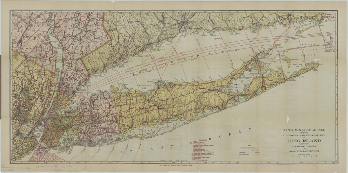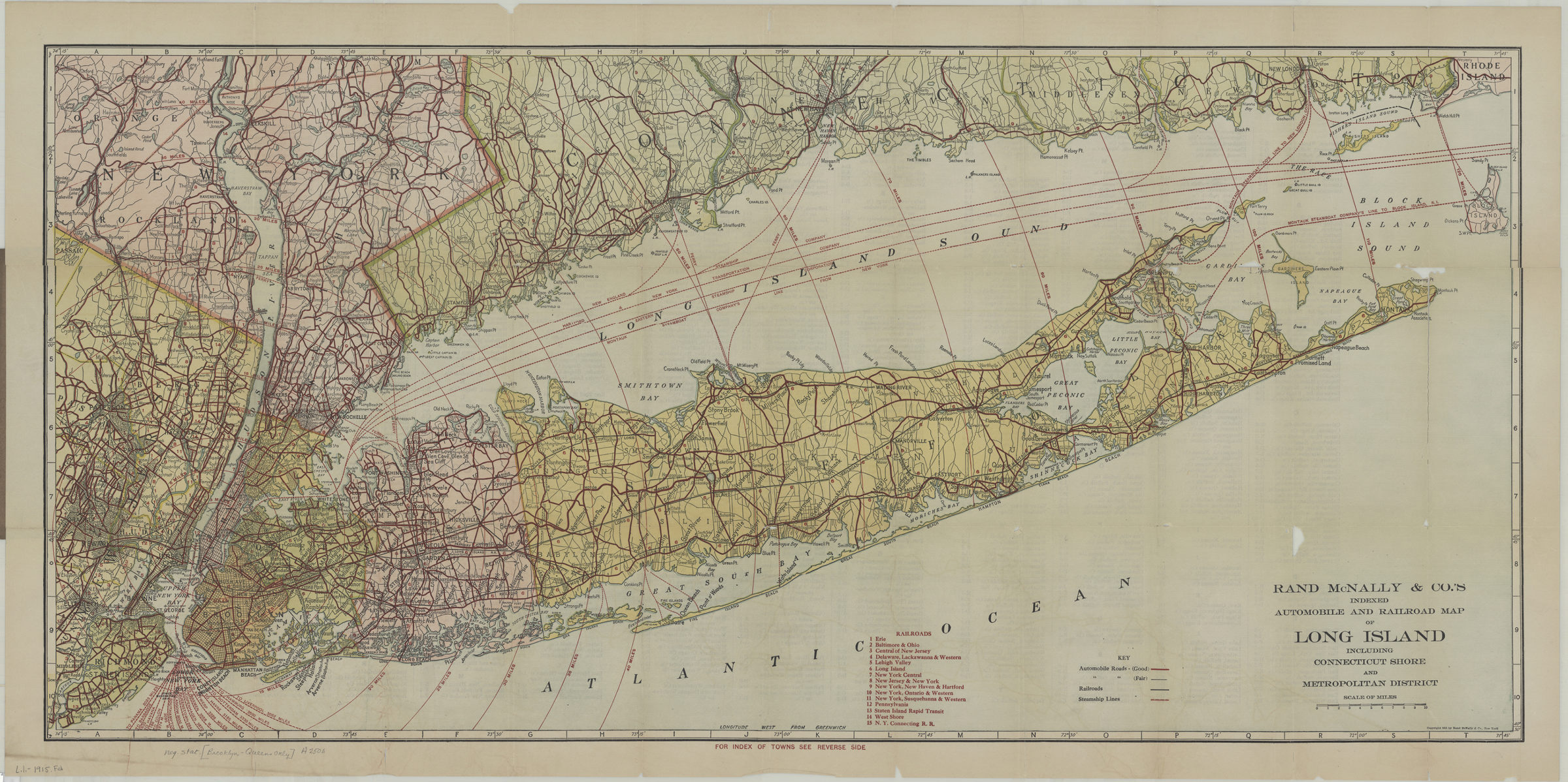
Rand McNally indexed automobile and railroad pocket map of Long Island including Connecticut shore and Metropolitan district [1915; 1915]
Map No. L.I.-1915.Fl
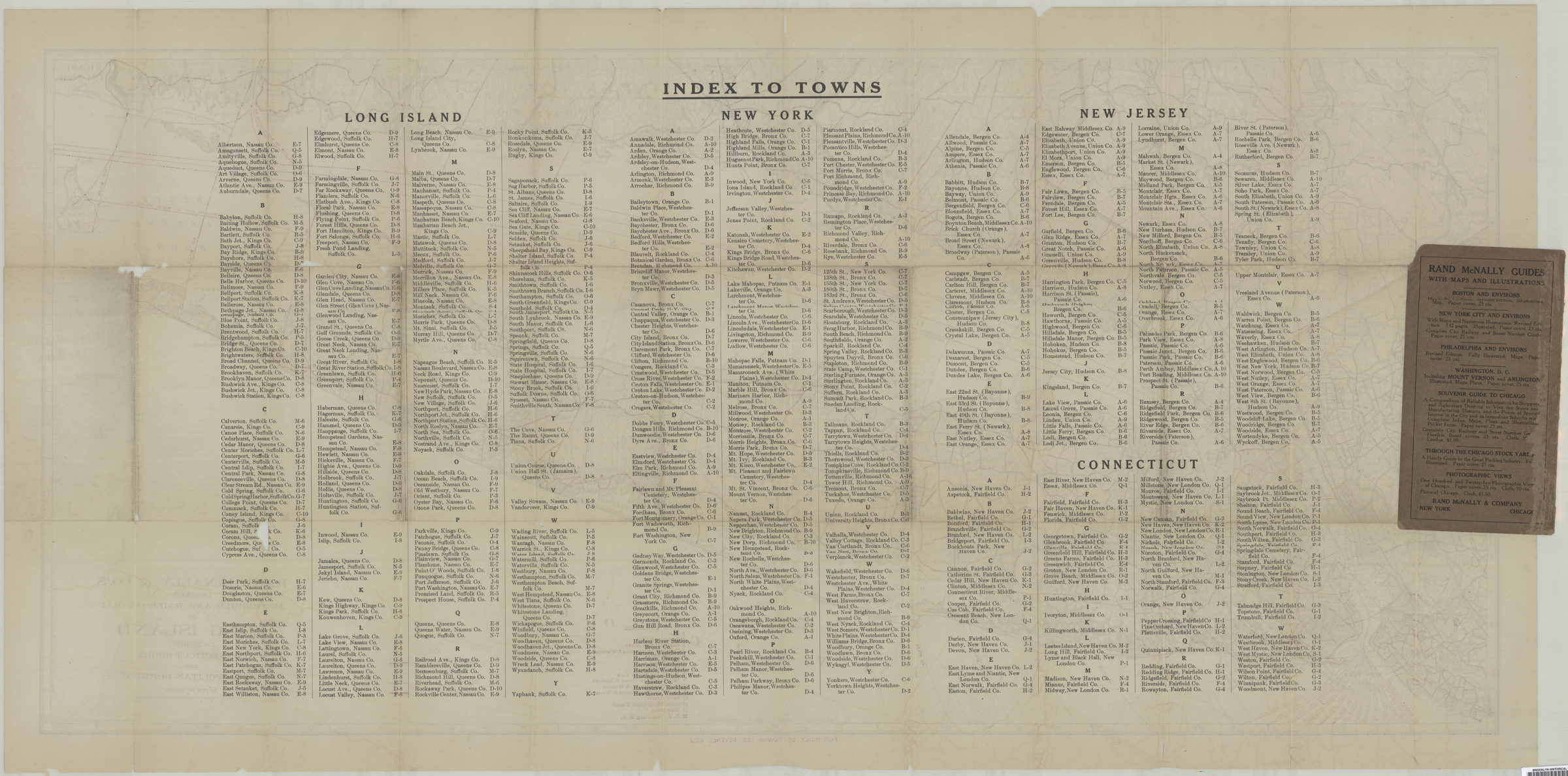
Also shows steamship lines in Long Island Sound. “Corrected to date 1915.” Includes index to railroad lines. On verso: index of towns.
Map area shown
Relation
Full catalog recordSize
50 × 106 cmDownload
Low Resolution Image
Creator
Rand McNally and Company,Publisher
Brooklyn Historical SocietyCitation
Rand McNally indexed automobile and railroad pocket map of Long Island including Connecticut shore and Metropolitan district; [1915; 1915], Map Collection, L.I.-1915.Fl; Brooklyn Historical Society.Scale
Scale approximately 1:204Loading zoom image...