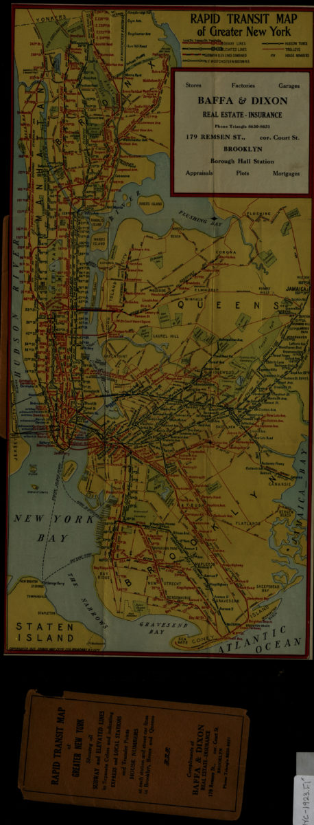
Rapid transit map of greater New York: Ohman Map Co 1923
Map No. NYC-1923.Fl
Shows subway, elevated, and trolley lines in Manhattan, Brooklyn, Queens, and the Bronx. Center point longitude: -73.9181. Center point latitude: 40.769.
Map area shown
Genre
Transportation mapsRelation
Full catalog recordSize
46 × 22 cmDownload
Low Resolution Image
Creator
Ohman Map Co.,Publisher
Brooklyn Historical SocietyCitation
Rapid transit map of greater New York: Ohman Map Co; 1923, Map Collection, NYC-1923.Fl; Brooklyn Historical Society.Scale
Scale not givenLoading zoom image...