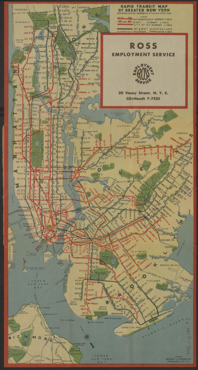
Rapid transit map of greater New York: showing house numbers at each station [193?]
Map No. NYC-[193-?].Fl
Subway map covers the south Bronx, Manhattan, Queens, Brooklyn, and northern Staten Island. Shows subways, railroads, tunnels, and ferries. Includes street address guide for Manhattan on back cover. “Compliments of: Ross Employment Services.”
Map area shown
Genre
Transportation mapsRelation
Full catalog recordSize
45 × 23 cmDownload
Low Resolution Image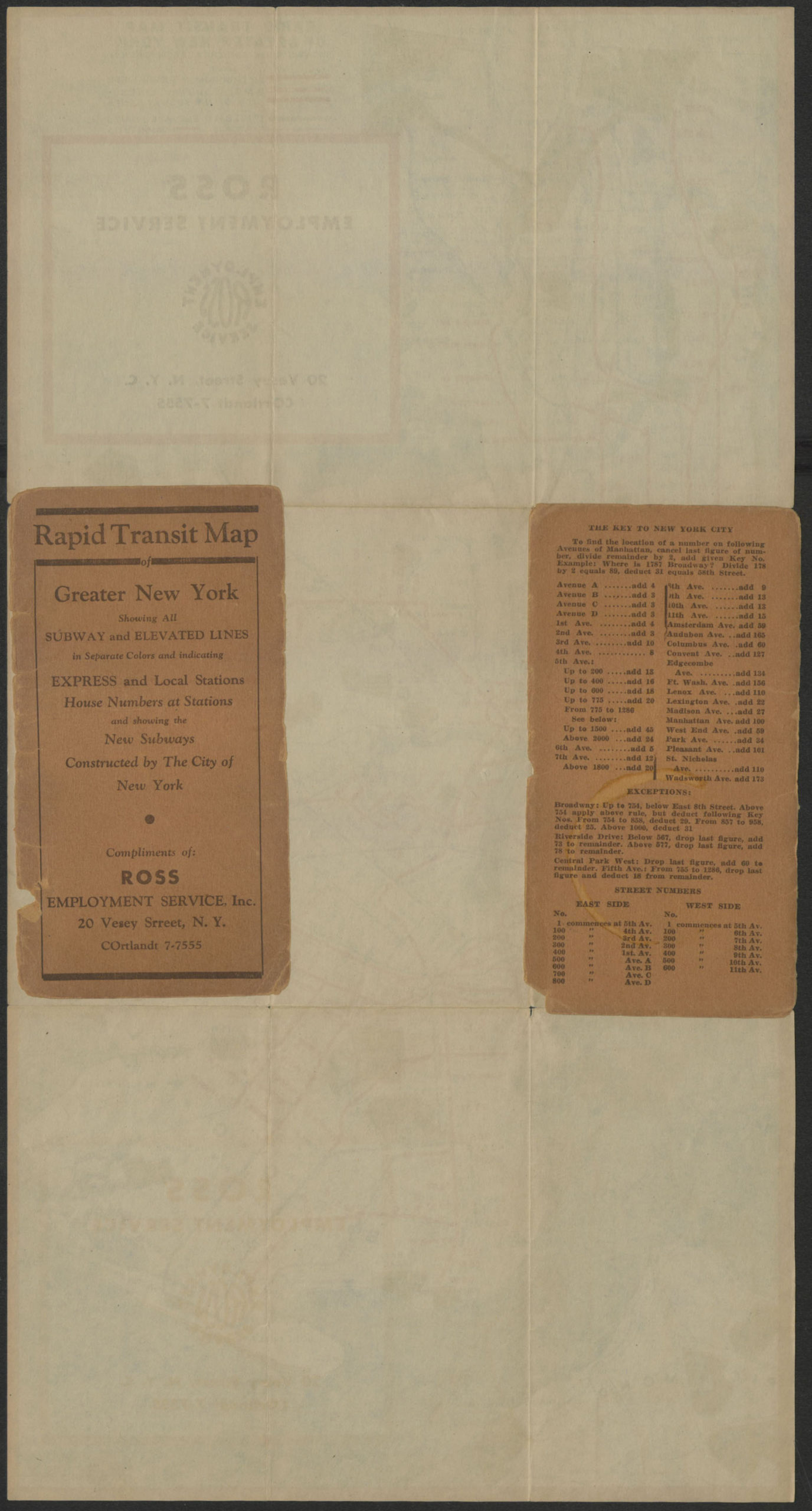
Creator
Nostrand, George J.,Publisher
Brooklyn Historical SocietyCitation
Rapid transit map of greater New York: showing house numbers at each station; [193?], Map Collection, NYC-[193-?].Fl; Brooklyn Historical Society.Scale
Scale not givenLoading zoom image...