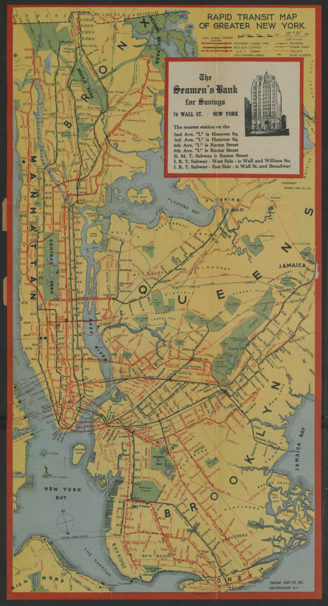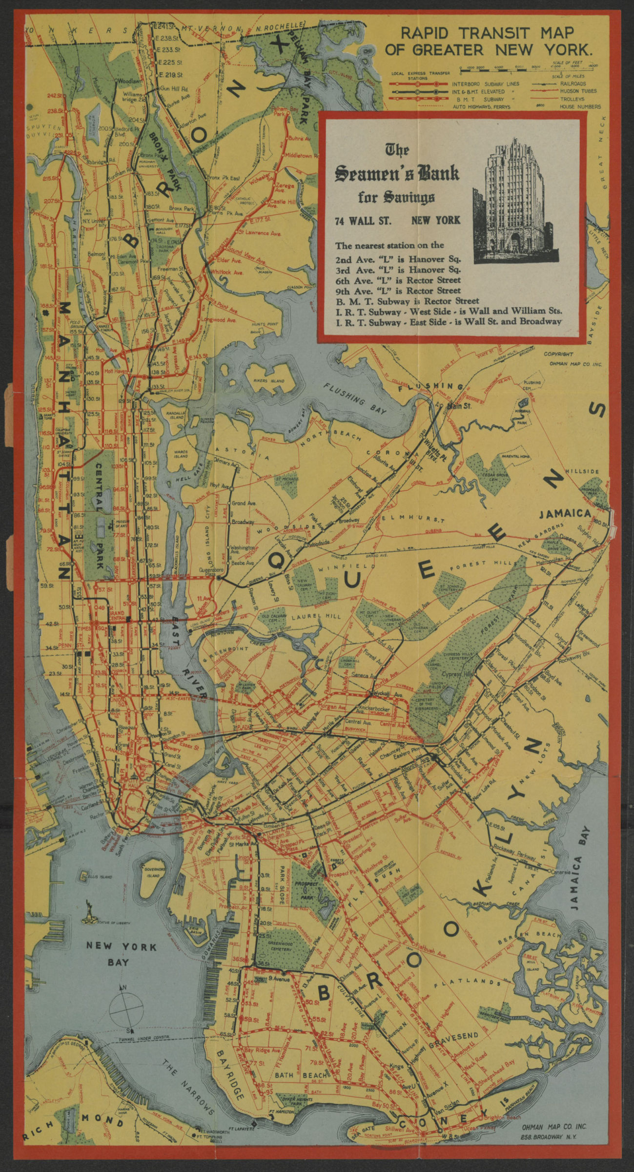
Rapid transit map of greater New York: shows house numbers at each station [1929]
Map No. NYC-[1929?].Fl
Subway map covers the south Bronx, Manhattan, Queens, Brooklyn, and northern Staten Island. Shows subways, railroads, trolleys, tunnels, and ferries. “Compliments of The Seamen’s Bank for Savings.”
Map area shown
Genre
Transportation mapsRelation
Full catalog recordSize
45 × 23 cmDownload
Low Resolution Image
Creator
Ohman Map Co.,Publisher
Brooklyn Historical SocietyCitation
Rapid transit map of greater New York: shows house numbers at each station; [1929], Map Collection, NYC-[1929?].Fl; Brooklyn Historical Society.Scale
Scale not givenLoading zoom image...