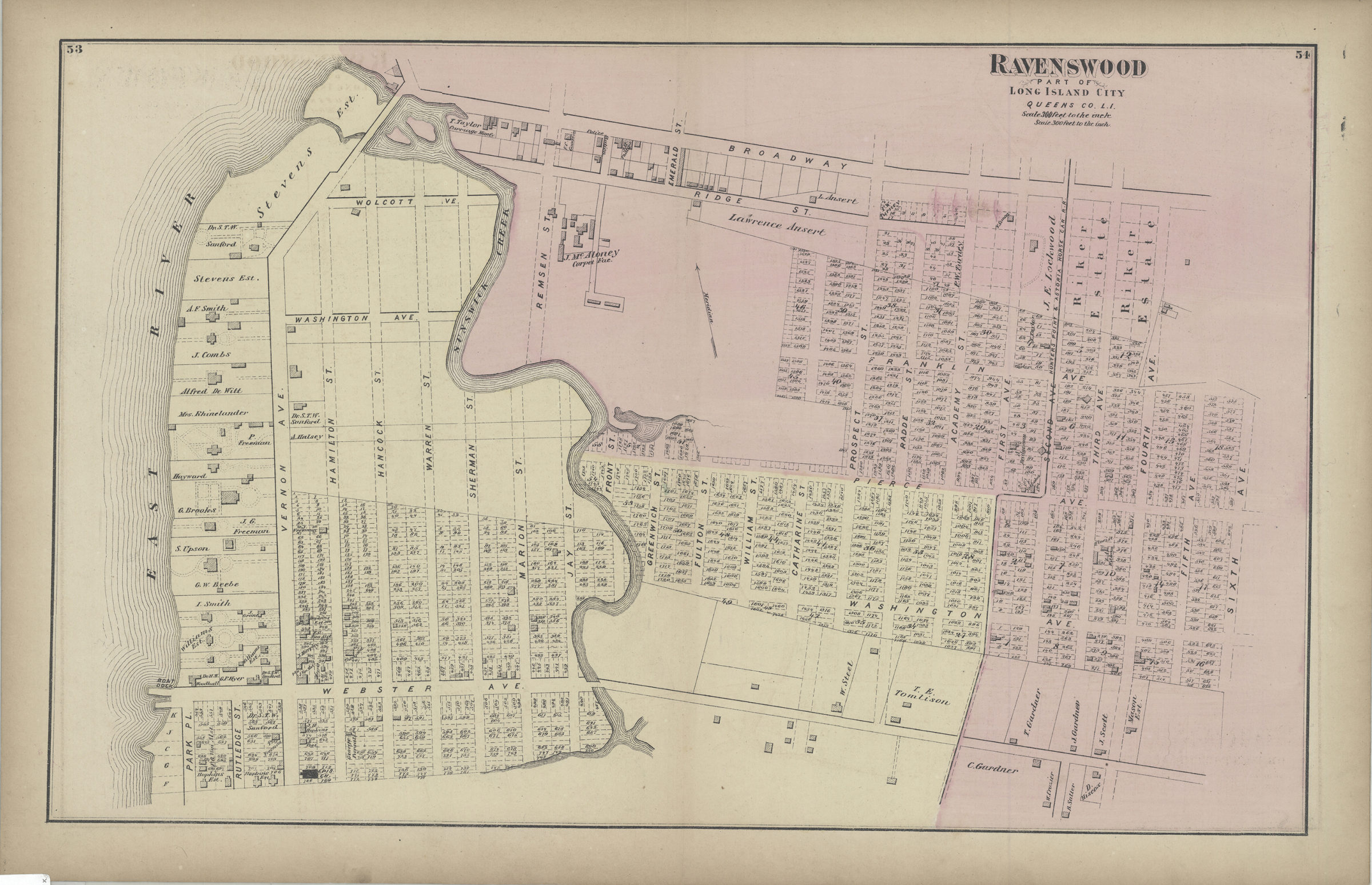
Ravenswood, part of Long Island City [1873]
Map No. Q-[1873]b.Fl
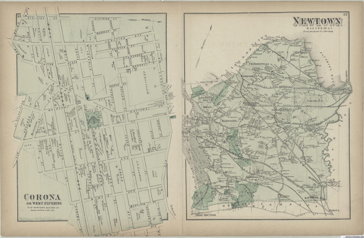
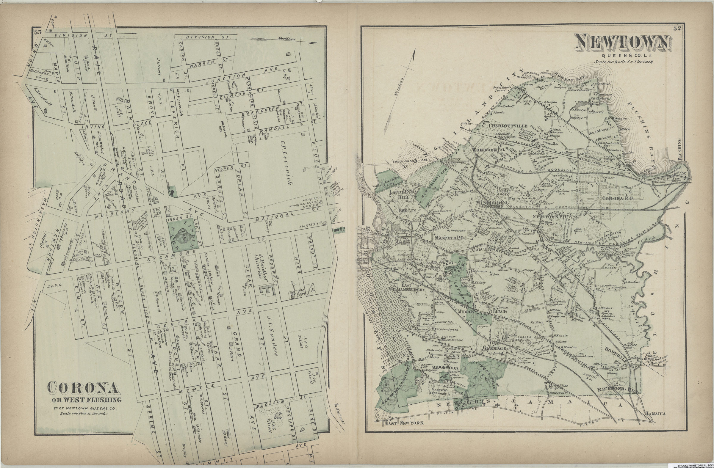
Cadastral map. Covers area north from approximately Webster Ave. to Broadway and east from the East River to 6th Ave. Shows property (including lot numbers and buildings), names of landowners, and railroads. Extracted from: Atlas of Long Island, New York. New York : Beers, Comstock & Cline, 1873, p. 52-55. On verso: 2 ancillary maps. Ancillary maps: Corona or West Flushing, tn. of Newtown, Queens Co. (Scale [1:4,800]. 400 ft. to the in.) — Newtown, Queens Co., L.I. (Scale [1:31,680]. 160 rods to the in.).
Subjects
Places
Map area shown
Genre
Cadastral mapsRelation
Full catalog recordSize
35 × 56 cmDownload
Low Resolution Image
Creator
Beers, F. W.; Beers, Comstock & Cline,Publisher
Brooklyn Historical SocietyCitation
Ravenswood, part of Long Island City; [1873], Map Collection, Q-[1873]b.Fl; Brooklyn Historical Society.Scale
Scale [1:3,600] 1 in to 3Loading zoom image...