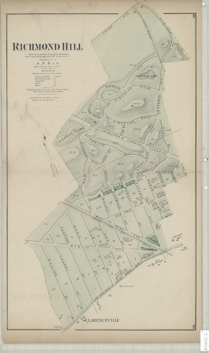
Richmond Hill: laid out expressly for private residences and against all nuisances : property of A.P. Man [1873]
Map No. Q-[1873]i.Fl
Cadastral map. Shows property (including lots and buildings), names of landowners, and railroads. Relief shown by hachures and spot heigths. Extracted from: Atlas of Long Island, New York. New York : Beers, Comstock & Cline, 1873, p. 164-165. Includes notes.
Map area shown
Genre
Cadastral mapsRelation
Full catalog recordSize
60 × 34 cmDownload
Low Resolution Image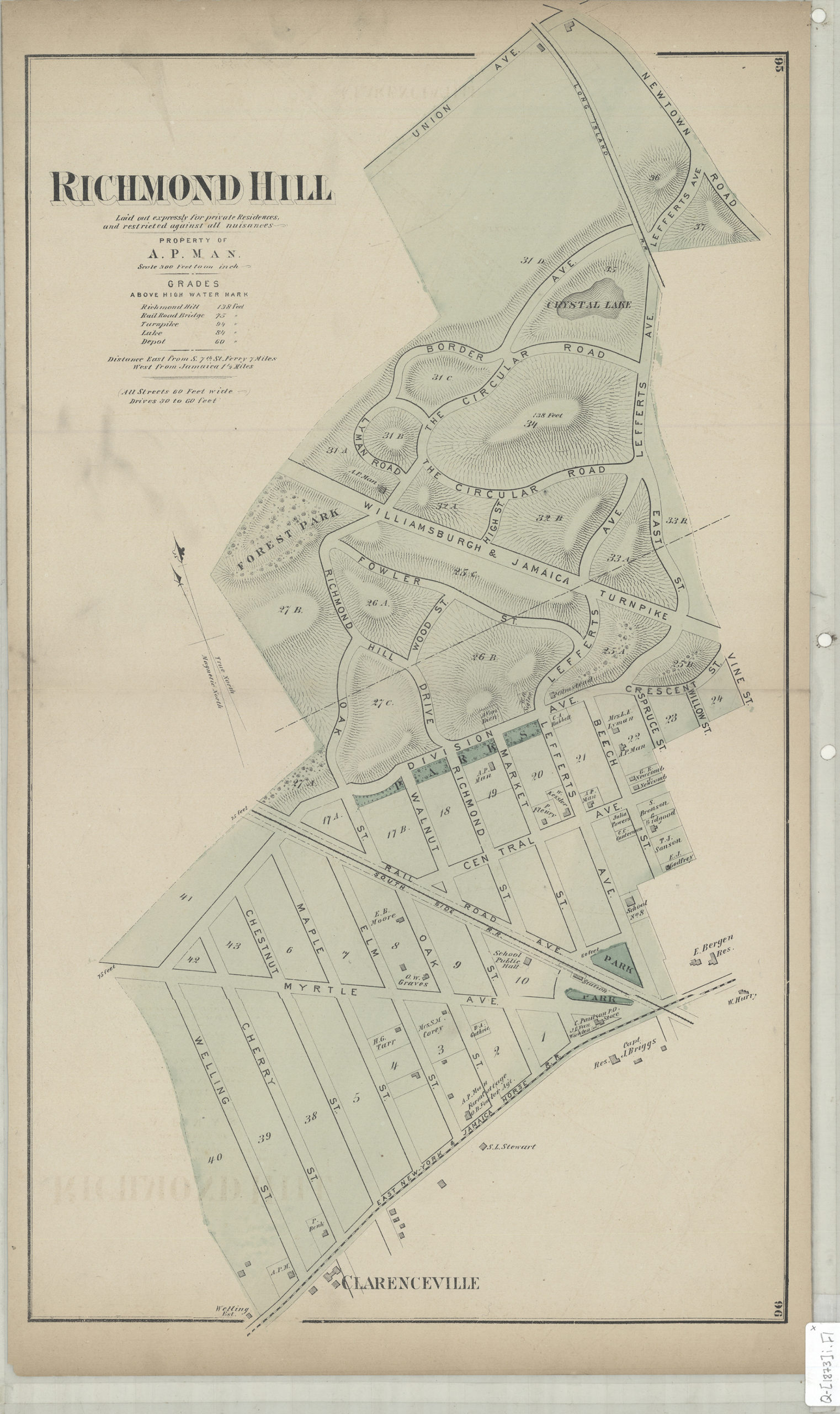
Creator
Beers, F. W.; Beers, Comstock & Cline,Publisher
Brooklyn Historical SocietyCitation
Richmond Hill: laid out expressly for private residences and against all nuisances : property of A.P. Man; [1873], Map Collection, Q-[1873]i.Fl; Brooklyn Historical Society.Scale
Scale [1:3,600] 1 in to 3Loading zoom image...