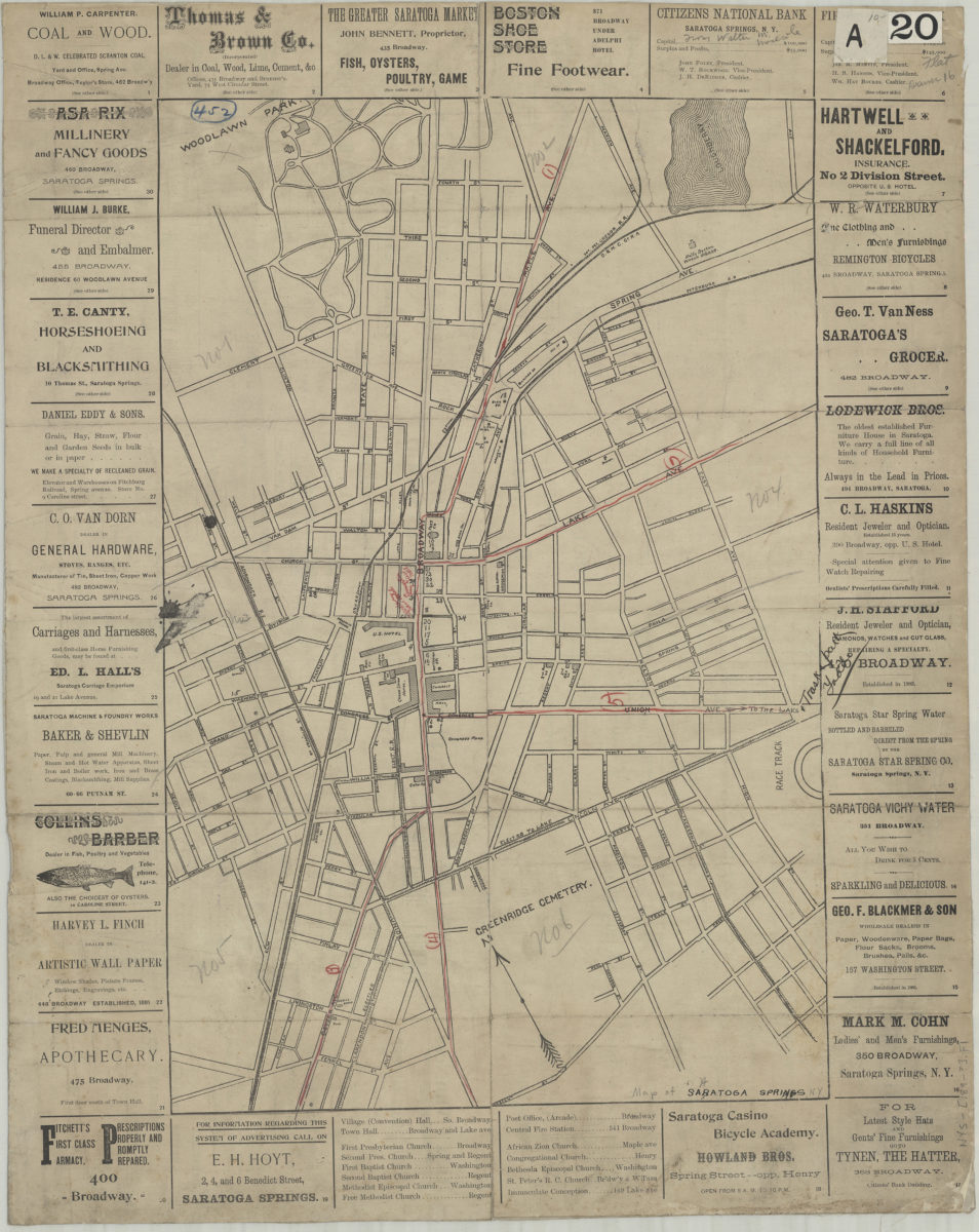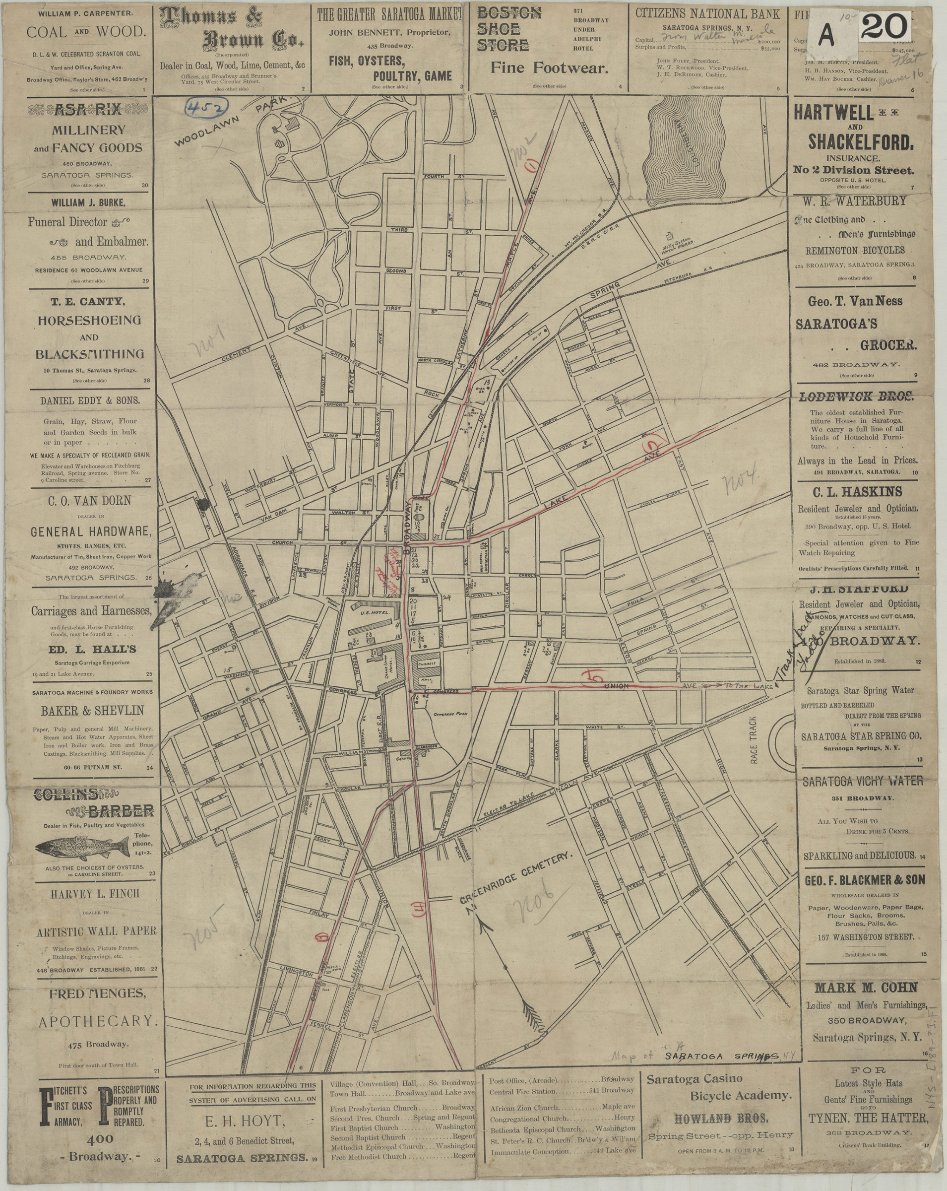
Saratoga Springs [189?]
Map No. NYS-[189-?].Fl
Shows railroads, hotels, churches, and public buildings. Oriented with north to the upper left. Bordered by advertisements (indexed). On verso: Advertisements (not indexed). BHS copy annotated in red pencil.
Places
Map area shown
Genre
MapRelation
Full catalog recordSize
51 × 34 cmDownload
Low Resolution Image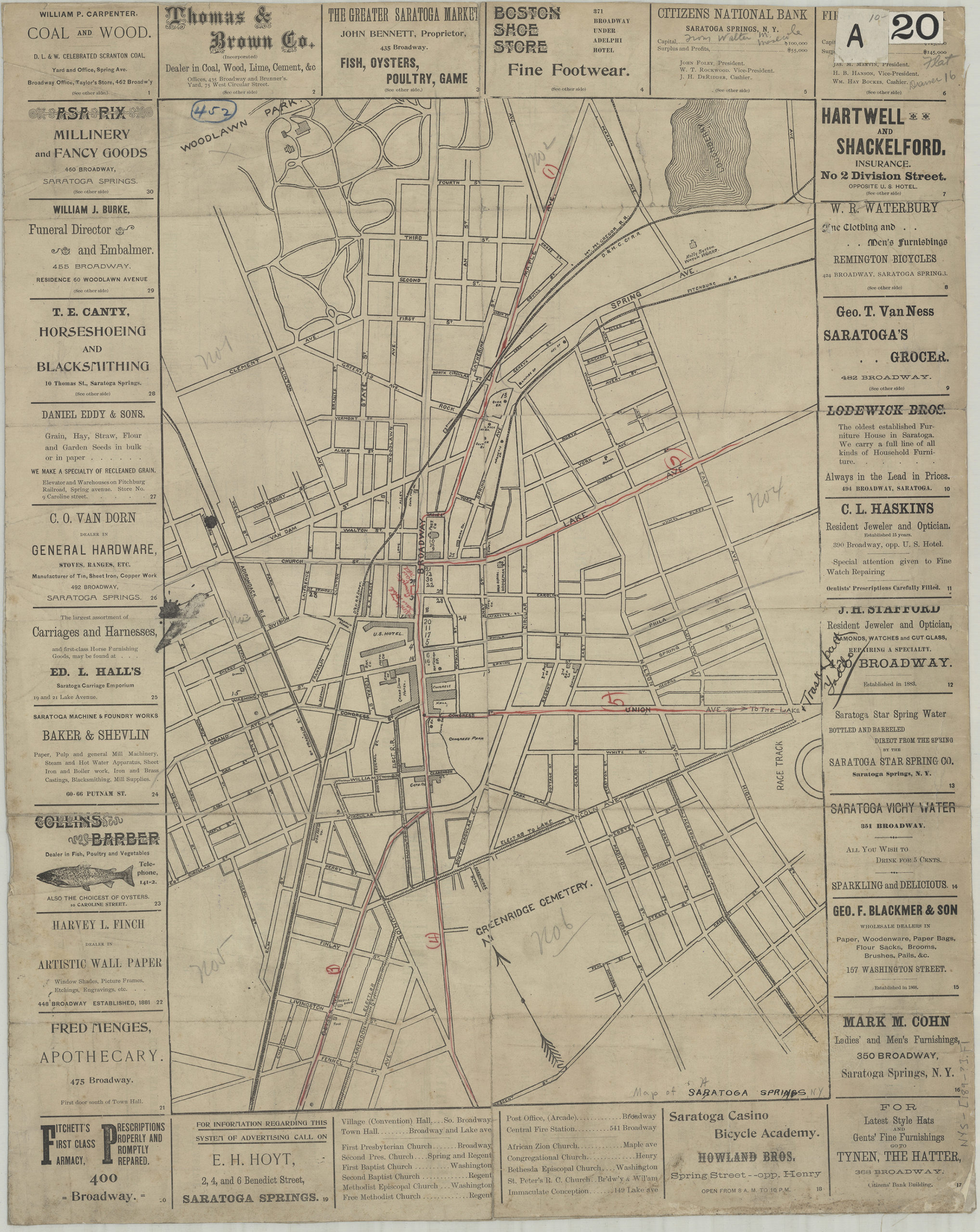
Creator
Publisher
Brooklyn Historical SocietyCitation
Saratoga Springs; [189?], Map Collection, NYS-[189-?].Fl; Brooklyn Historical Society.Scale
Scale not givenLoading zoom image...