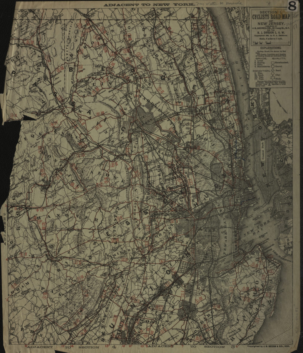
Section 1, cyclists’ road map of New Jersey [ca. 1890]
Map No. N.J. 1890.Fl
Covers New Jersey north from New Dover to Orangeburg and east to Mosstown. Also covers part of New York City. Shows roads by grade, condition, and quality. Relief shown by hachures. Likely extracted from: Benedict, Henry A. The cyclists’ road book of New Jersey : containing eight sectional maps of New Jersey and a map of Westchester county, N.Y. … / compiled for the New Jersey division of the League of American Wheelmen, by Henry A. Benedict. [N.Y. : J.B. Beers & Co.], 1890. Oriented with north to the upper left. “Copyrighted 1890, by H.A. Benedict.” “Copyrighted by J.B. Beers & Co., 1890.” Includes key. “Section 1”–Verso.
Map area shown
Genre
Road mapsRelation
Full catalog recordSize
48 × 41 cmDownload
Low Resolution Image
Creator
J.B. Beers & Co.,Publisher
Brooklyn Historical SocietyCitation
Section 1, cyclists’ road map of New Jersey; [ca. 1890], Map Collection, N.J. 1890.Fl; Brooklyn Historical Society.Scale
Scale [1:126,720] 1 in toLoading zoom image...