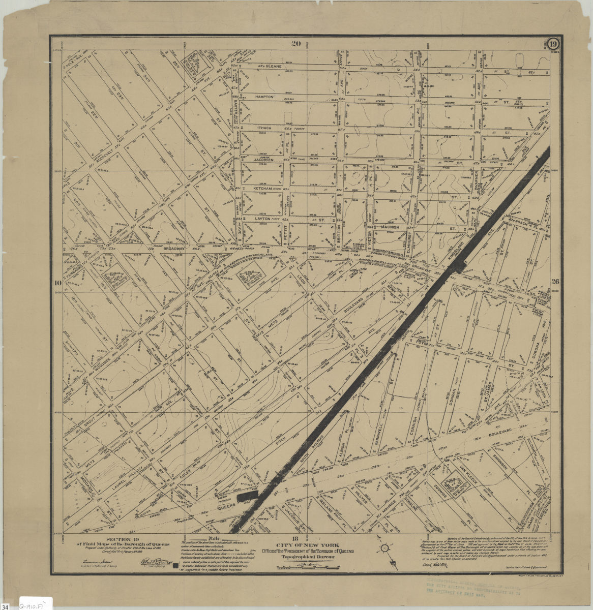
Section 19 of Final maps of the Borough of Queens: City of New York, Borough of Queens, Office of the President, Topographical Bureau 1910
Map No. Q-1910.Fl
Shows existing and proposed streets in modern-day Elmhurst. Relief shown by contours. “Prepared under authority of Chapter 466 of the Laws of 1901. Dated: New York, February 10th, 1910.” Oriented with north toward upper left. 1 sheet from Final maps of the Borough of Queens (New York : Topographical Bureau, 1909-1932).
Map area shown
Genre
Topographic mapsRelation
Full catalog recordSize
56 × 54 cmDownload
Low Resolution Image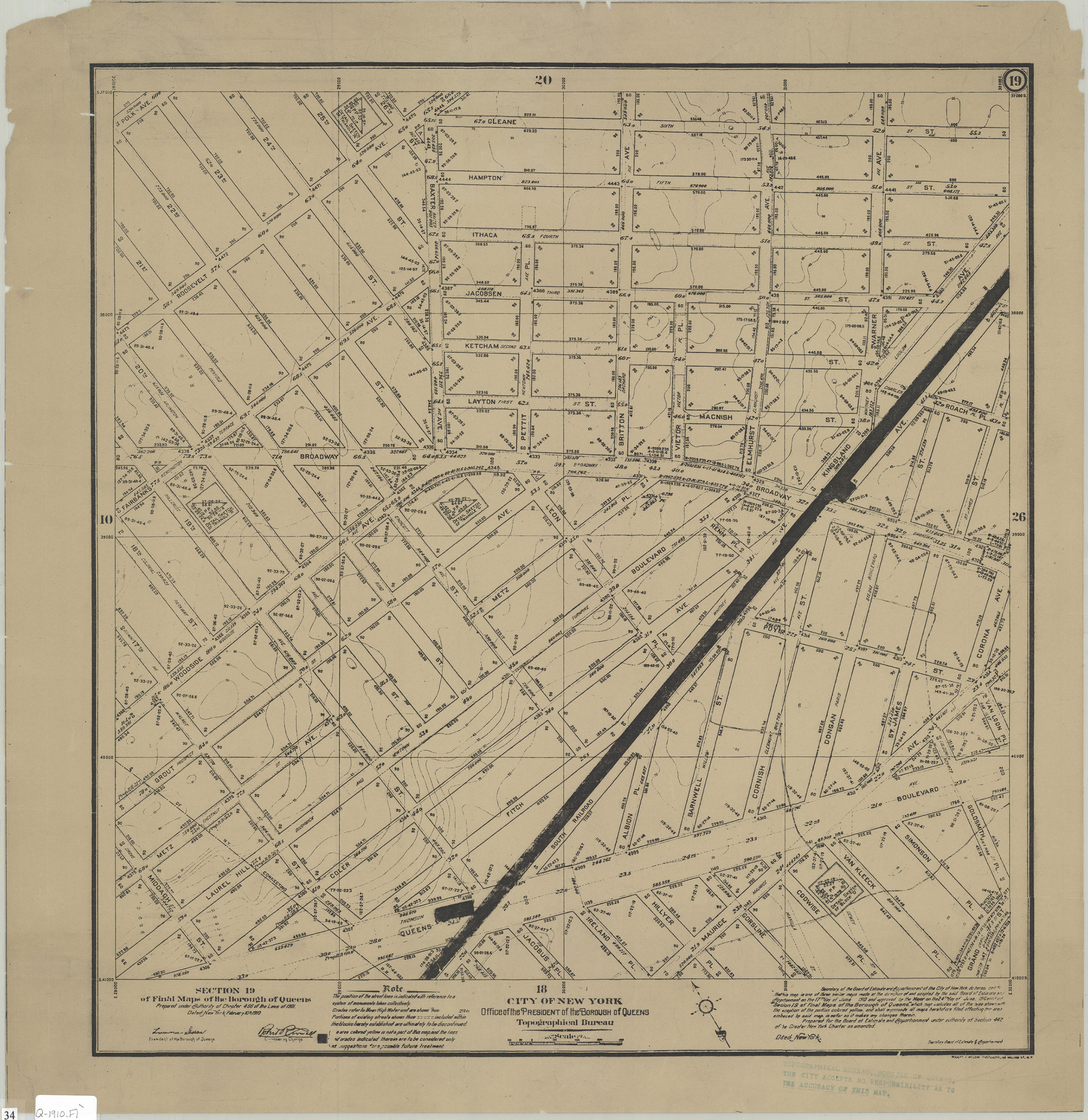
Creator
Queens (New York, N.Y.).; Office of Queens Borough President,Publisher
Brooklyn Historical SocietyCitation
Section 19 of Final maps of the Borough of Queens: City of New York, Borough of Queens, Office of the President, Topographical Bureau; 1910, Map Collection, Q-1910.Fl; Brooklyn Historical Society.Scale
Scale approximately 1:234Loading zoom image...