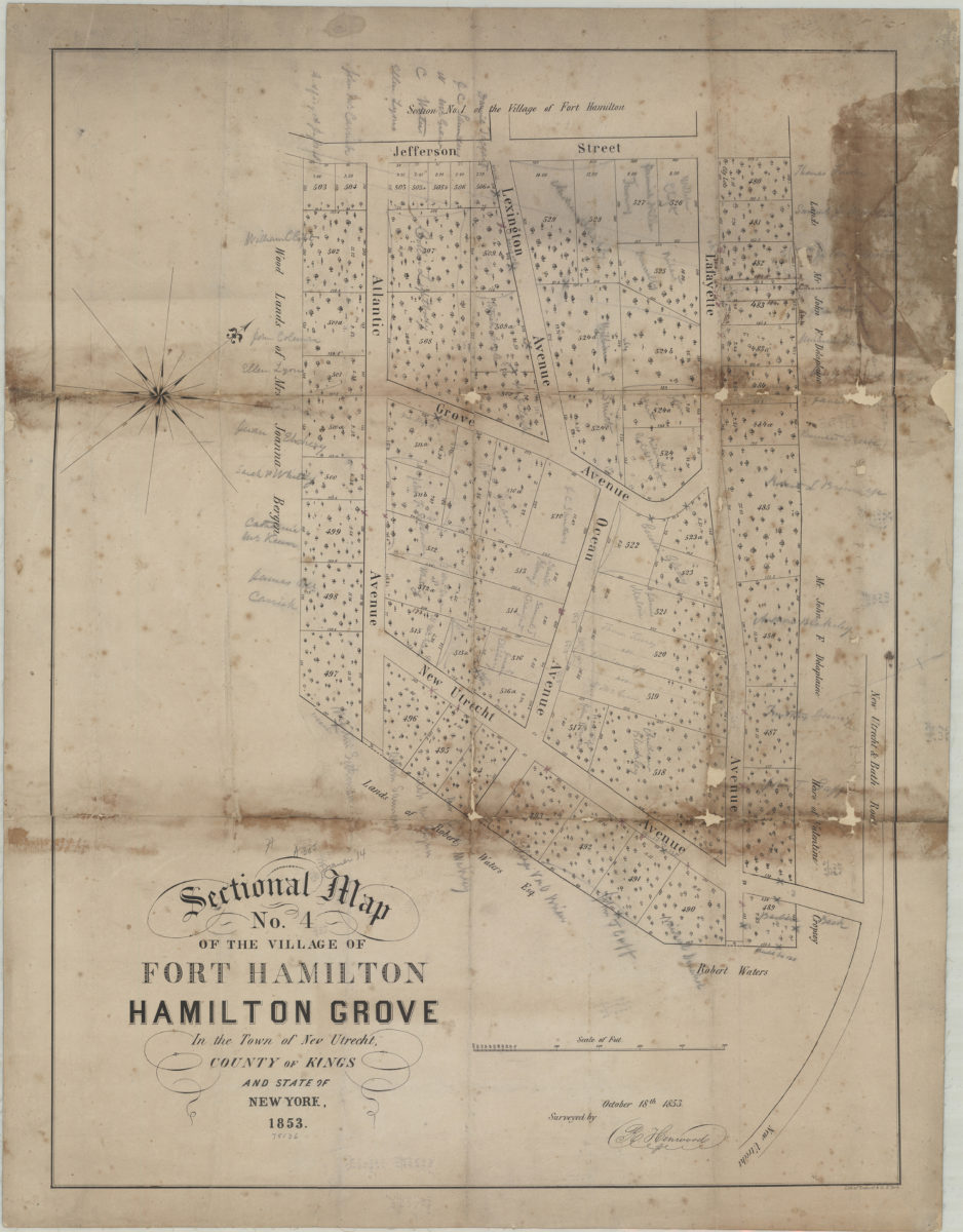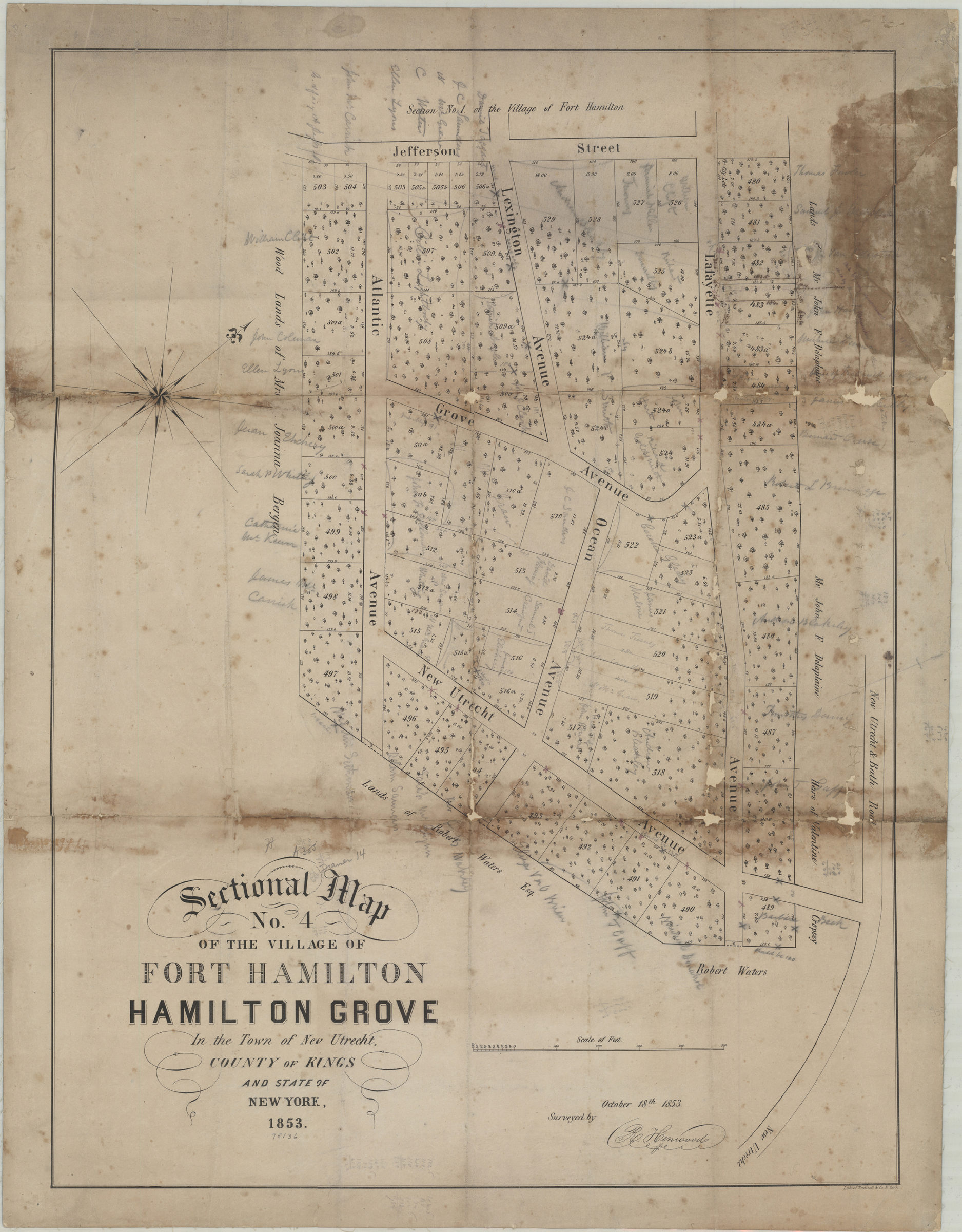
Sectional map no. 4 of the village of Fort Hamilton, Hamilton Grove in the town of New Utrecht and state of New York, 1853: surveyed by R. Henwood, October 18th, 1853 [1853]
Map No. B A-[1853].Fl
Cadastral map covering a portion of Fort Hamilton bounded by the following streets: New Utrecht & Bath Rd., New Utrecht Ave., Atlantic Ave., and Jefferson St. Shows lot numbers, lot divisions, and names of property owners. Relief shown pictorially. Oriented with north to the upper right. BHS copy annotated in pencil and red ink.
Map area shown
Genre
Cadastral mapsRelation
Full catalog recordSize
68 × 51 cmDownload
Low Resolution Image
Creator
Henwood, R.,Publisher
Brooklyn Historical SocietyCitation
Sectional map no. 4 of the village of Fort Hamilton, Hamilton Grove in the town of New Utrecht and state of New York, 1853: surveyed by R. Henwood, October 18th, 1853; [1853], Map Collection, B A-[1853].Fl; Brooklyn Historical Society.Scale
Scale [ca. 1:1,215]Loading zoom image...