Sewer connection, May 1, 1916 1916
Map No. Bergen-1916.Fl
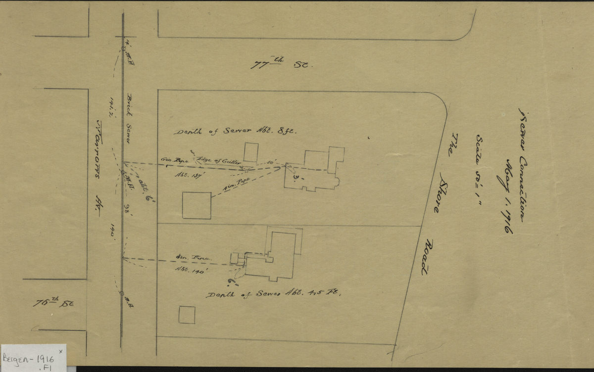
Map covering area between 76th Street and 77th Street, from Narrows Avenue to Shore Road in modern-day Bay Ridge. Shows property lines, structures, and sewer lines running from structures to street (including depth). Attributed to Van Brunt Bergen, based on handwriting on piece.
Map area shown
Relation
Full catalog recordSize
36 × 22 cmDownload
Low Resolution Image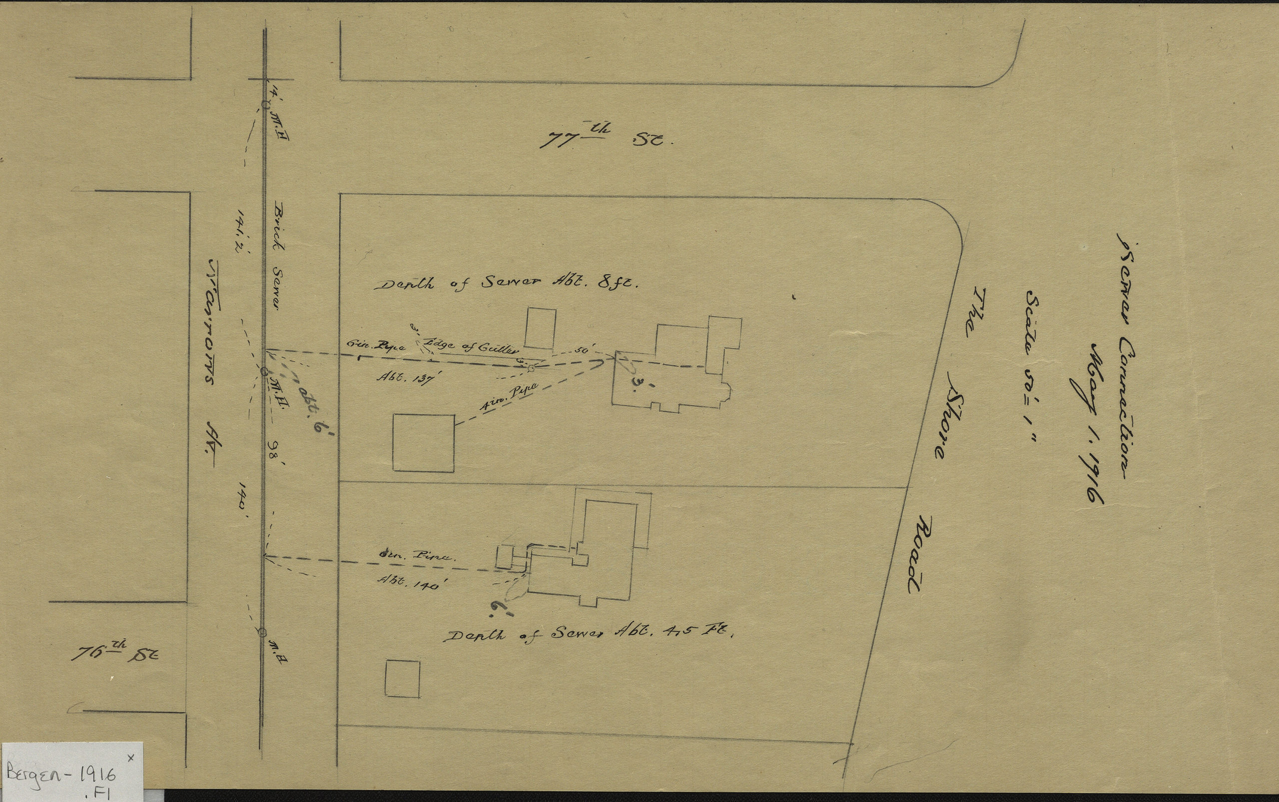
Creator
Bergen, Van Brunt,Publisher
Brooklyn Historical SocietyCitation
Sewer connection, May 1, 1916; 1916, Map Collection, Bergen-1916.Fl; Brooklyn Historical Society.Scale
Scale [1: 12] 1 in to 50Loading zoom image...