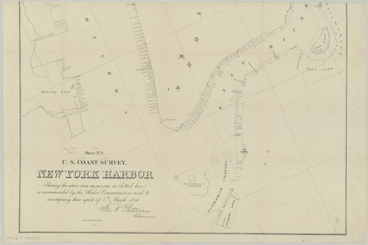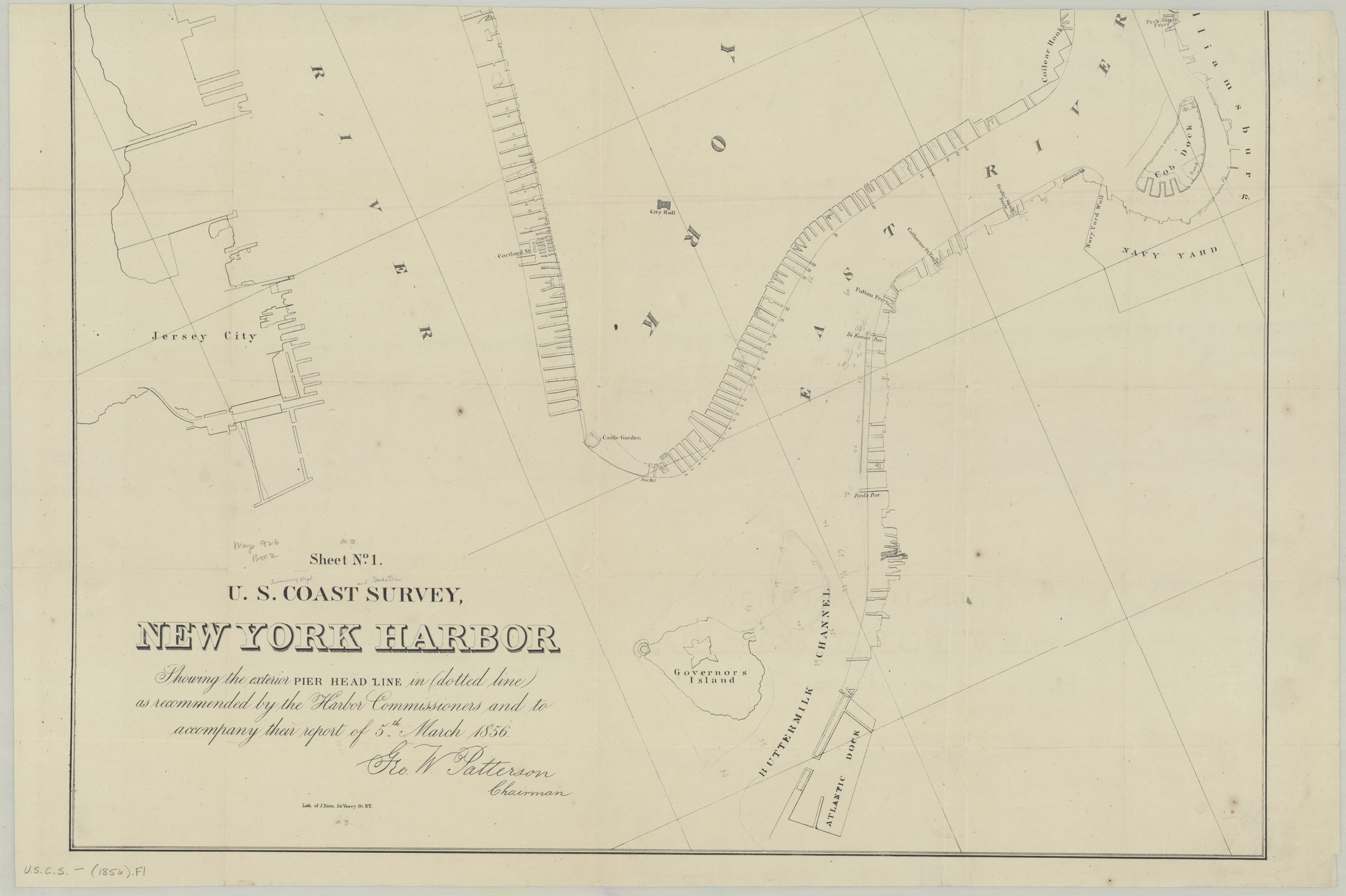
Sheet no. 1, U.S. Coast Survey, New York Harbor: showing the exterior pier head line in dotted line as recommended by the Harbor Commissioners and to accompany their report of 5th March 1856 [1856]
Map No. U.S.C.S.-[1856].Fl
Also covers Brooklyn north from the Buttermilk Channel to the Navy Yard, Governors Island, and portions of Lower Manhattan and Jersey City. Shows piers and ferry landings. “Geo. W. Patterson Chairman.” BHS copy annotated in gray pencil.
Map area shown
Relation
Full catalog recordSize
47 × 66 cmDownload
Low Resolution Image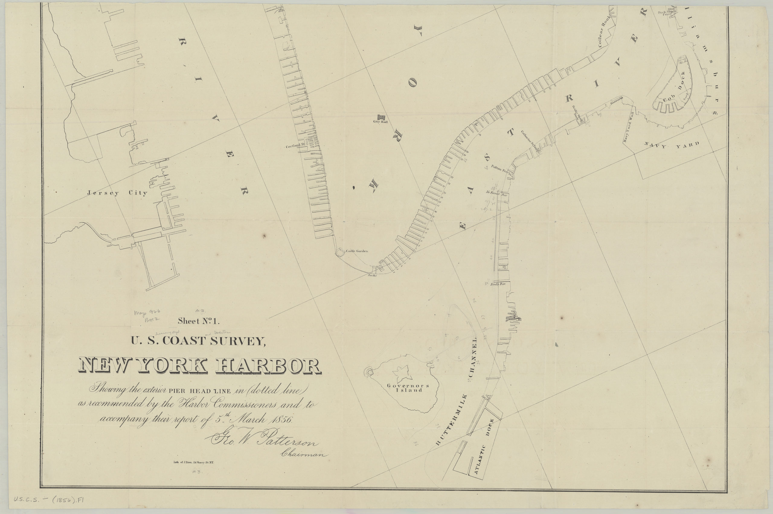
Creator
United States Coast Survey,Publisher
Brooklyn Historical SocietyCitation
Sheet no. 1, U.S. Coast Survey, New York Harbor: showing the exterior pier head line in dotted line as recommended by the Harbor Commissioners and to accompany their report of 5th March 1856; [1856], Map Collection, U.S.C.S.-[1856].Fl; Brooklyn Historical Society.Scale
Scale not givenLoading zoom image...