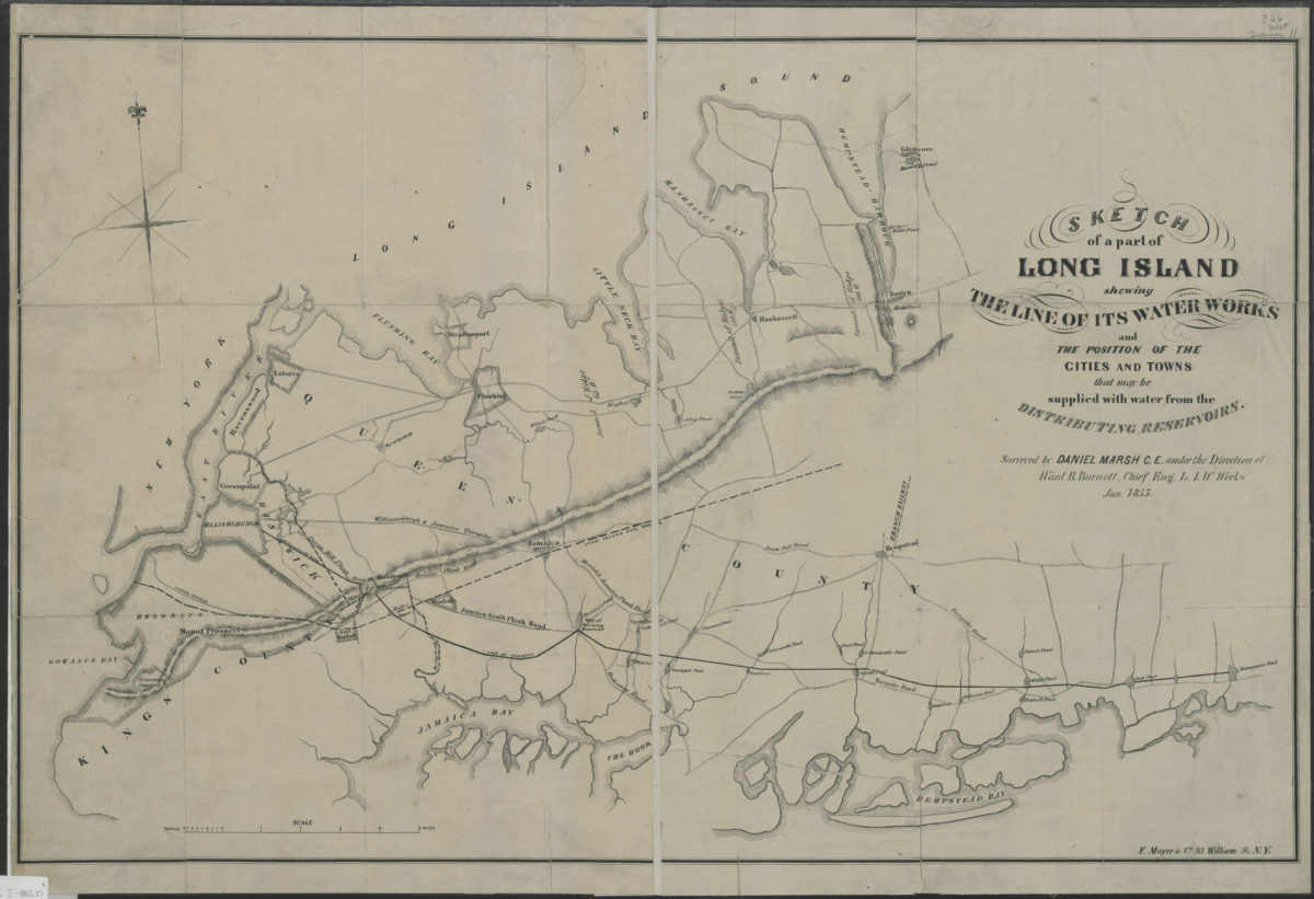
Sketch of a part of Long Island shewing the line of its water works and the position of the cities and towns that may be supplied with water from the distributing reservoirs: surveyed by Daniel Marsh … under the direction of Ward B. Burnett January 1853
Map No. L.I.-1853.Fl
Water utility map. Covers the western end of Long Island–Brooklyn and Queens, New York (N.Y.) and Nassau County, New York, as far east as Glen Cove and Massapequa. Shows streams and ponds, “line of conduit” and reservoirs. Also shows roads, towns, railroads. Shows relief by hachures. Printed by “F. Mayer & Co. 93 William St. N.Y.” N-YHS copy (F128K TD225.B67 C43 1855) is bound with 24 bound pamphlets, come numbered in ink, in a volume with binder’s title Brooklyn Water Documents. NYHS copy split along creased, lightly soiled. Probably detached from a bound book of which one page remains–pasted to upper left verso. M006814
Subjects
Places
Map area shown
Genre
Thematic mapsRelation
Full catalog recordSize
53 × 82 cmDownload
Low Resolution Image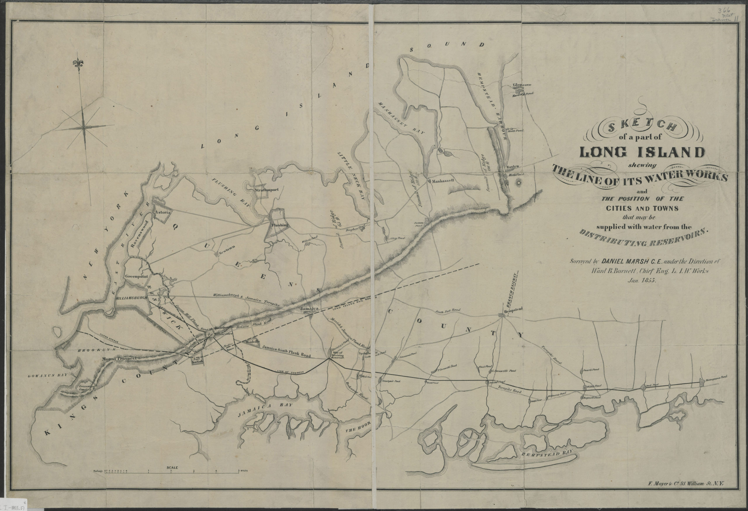
Creator
Burnett, Ward B.,Publisher
Brooklyn Historical SocietyCitation
Sketch of a part of Long Island shewing the line of its water works and the position of the cities and towns that may be supplied with water from the distributing reservoirs: surveyed by Daniel Marsh … under the direction of Ward B. Burnett; January 1853, Map Collection, L.I.-1853.Fl; Brooklyn Historical Society.Scale
Scale [ca. 1:65,000]Loading zoom image...