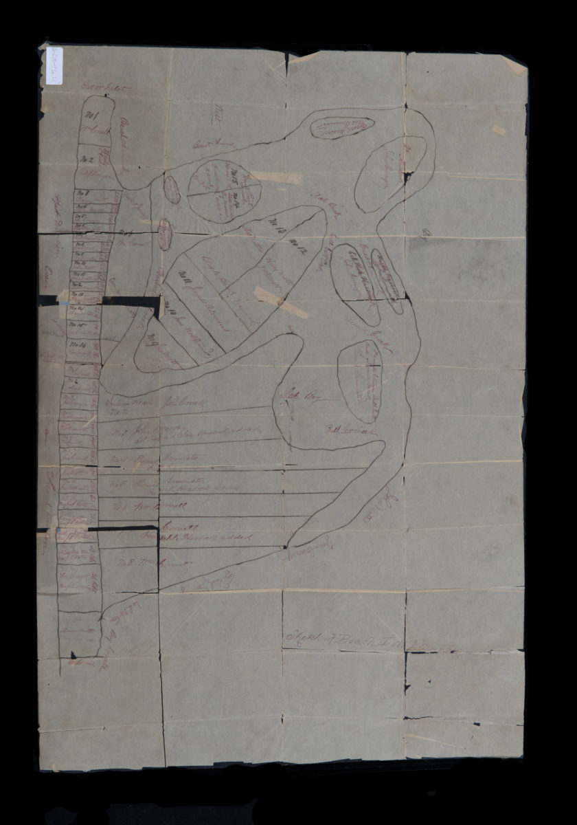
Sketch of beach lots & marsh [18??]
Map No. Q-[18--?]a.Fl
Cadastral map. Shows property (including lots and dimensions), and names of landowners. Likely covers part of Rockaway Beach, Queens. Cataloger unable to verify geographic coverage. Oriented with north to the right.
Map area shown
Relation
Full catalog recordSize
75 × 51 cmDownload
Low Resolution Image
Creator
Publisher
Brooklyn Historical SocietyCitation
Sketch of beach lots & marsh; [18??], Map Collection, Q-[18--?]a.Fl; Brooklyn Historical Society.Scale
Scale not givenLoading zoom image...